
Korgan | |
|---|---|
District and municipality | |
 | |
 Map showing Korgan District in Ordu Province | |
 Korgan Location in Turkey | |
| Coordinates: 40°49′29″N 37°20′48″E / 40.82472°N 37.34667°E | |
| Country | Turkey |
| Province | Ordu |
| Government | |
| • Mayor | Tuncay Kiraz (AKP) |
| Area | 254 km2 (98 sq mi) |
| Elevation | 764 m (2,507 ft) |
| Population (2022)[1] | 27,349 |
| • Density | 110/km2 (280/sq mi) |
| Time zone | TRT (UTC+3) |
| Postal code | 52700 |
| Area code | 0452 |
| Climate | Csb |
| Website | www |
Korgan is a municipality and district of Ordu Province, Turkey.[2] Its area is 254 km2,[3] and its population is 27,349 (2022).[1] The town lies at an elevation of 764 m (2,507 ft).[4]
YouTube Encyclopedic
-
1/5Views:4 3561 9447 1421 0172 672
-
korgan tanıtım filmi
-
Korgan Yaylaları ve Orman Gülleri
-
Korgan tanitim filmi
-
KORGAN BELEDİYESİ MAHALLELER VİDEO
-
Grant Korgan: The Push (Trailer)
Transcription
History
The district of Korgan has been a source of iron ore since the reign of Mithridates, King of Pontus, and even before that the area was occupied by Persians in the reign of Darius I in the 6th century BC, as part of the Satrapy of Pontus and Cappadocia. The Persian presence was erased by the armies of Alexander the Great in 331BC, and the area eventually became part of the Kingdom of Pontus and then the Roman Empire. This era ended in 1083 when Korgan was conquered by the Turkish armies of Danishmend Gazi. Subsequently a number of Turkish tribes ruled here until 1398 when Bayezid I brought the area, then known as Keşdere after a tributary of the River Bolaman, into the Ottoman Empire.
Composition
There are 29 neighbourhoods in Korgan District:[5]
- Aşağıkozpınar
- Aşağıyaylacık
- Belalan
- Beypınarı
- Büyükakçakese
- Çamlı
- Çayırkent
- Çiftlik
- Çitlice
- Dip
- Durali
- Karakışla
- Karakoyunlu
- Koççığaz
- Sarıaliç
- Soğukpınar
- Tatarcık
- Tepe
- Tepealan
- Terzili
- Yazıcı
- Yazlık
- Yeniköy
- Yenipınar
- Yeşilalan
- Yeşildere
- Yeşilyurt
- Yukarıkozpınar
- Yukarıyaylacık
References
- ^ a b "Address-based population registration system (ADNKS) results dated 31 December 2022, Favorite Reports" (XLS). TÜİK. Retrieved 19 September 2023.
- ^ Büyükşehir İlçe Belediyesi, Turkey Civil Administration Departments Inventory. Retrieved 19 September 2023.
- ^ "İl ve İlçe Yüz ölçümleri". General Directorate of Mapping. Retrieved 19 September 2023.
- ^ Falling Rain Genomics, Inc. "Geographical information on Korgan, Turkey". Retrieved 9 October 2023.
- ^ Mahalle, Turkey Civil Administration Departments Inventory. Retrieved 19 September 2023.
External links
- District municipality's official website (in Turkish)
- Road map of Korgan and environs
- Various images of Korgan, Ordu
- Korgan Dünü ve Bugünü
Korgan in Ordu Province of Turkey | |||||||||||||||||||||||||||
|---|---|---|---|---|---|---|---|---|---|---|---|---|---|---|---|---|---|---|---|---|---|---|---|---|---|---|---|
| Districts |  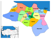 | ||||||||||||||||||||||||||
|
Metropolitan municipalities are bolded. | |||||||||||||||||||||||||||
This article about a Black Sea Region of Turkey location is a stub. You can help Wikipedia by expanding it. |