
Košická Belá | |
|---|---|
Municipality | |
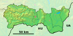 Košická Belá Location of Košická Belá in the Košice Region  Košická Belá Location of Košická Belá in Slovakia | |
| Coordinates: 48°48′N 21°07′E / 48.800°N 21.117°E | |
| Country | |
| Region | Košice |
| District | Košice-okolie |
| First mentioned | 1297 |
| Area | |
| • Total | 39.575 km2 (15.280 sq mi) |
| Elevation | 380 m (1,250 ft) |
| Population | |
| • Total | 982 |
| • Density | 25/km2 (64/sq mi) |
| Time zone | UTC+1 (CET) |
| • Summer (DST) | UTC+2 (CEST) |
| Postal code | 044 65 |
| Area code | +421-57 |
| Car plate | KS |
| Website | www |
Košická Belá (1297 flimen Bela, 1397 villa Johannis, 1440 Janussffalwa, 1580 Hansdorff, 1650 Bela) (German: Hansdorf; Hungarian: Kassabéla) is a village and large municipality in Košice-okolie District in the Košice Region of eastern Slovakia.
YouTube Encyclopedic
-
1/3Views:1 9521 036317
-
Košická Belá
-
DIA KONCENTRAK KOSICKA BELA 2008
-
RA Zlatnik - AbandonedHotels.EU
Transcription
History
Historically, the first written mention of the village was in 1297 as Villa Johannis when German settlers came here. To the municipality also belonged the villages of Košické Hámre, Malý Folkmar and Ružín, which were flooded when the water reservoir Ružín was filled in 1969.
The name of the village is derived from the stream Belá that flows through it.
Geography
The village lies in the eastern Slovak Ore Mountains at an altitude of 380 metres and covers an area of 39.575 km2. It has a population of 982 people.
Genealogical resources
The records for genealogical research are available at the state archive "Statny Archiv in Levoca, Slovakia"
- Roman Catholic church records (births/marriages/deaths): 1750-1896 (parish A)
- Greek Catholic church records (births/marriages/deaths): 1727-1896 (parish B)
- Lutheran church records (births/marriages/deaths): 1783-1896 (parish B)
See also
External links
 Media related to Košická Belá at Wikimedia Commons
- Official website

- [1]
- http://www.cassovia.sk/obce/kbela/
- Surnames of living people in Kosicka Bela
This Košice-okolie District geography article is a stub. You can help Wikipedia by expanding it. |