
| Griebnitz Canal | |
|---|---|
 The Alsen bridge on the Griebnitz Canal | |
| Specifications | |
| Length | 3.9 km (2.4 miles) |
| Minimum boat draft | 1.3 metres (4.3 ft) |
| Minimum boat air draft | 5 metres (16 ft) |
| Geography | |
| Start point | Griebnitzsee |
| End point | Großer Wannsee |
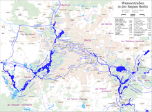
The Griebnitz Canal (German: Griebnitzkanal, pronounced [ˈɡʁiːpnɪts.kaˌnaːl] ⓘ), formerly known as the Prinz-Friedrich-Leopold-Kanal, is a canal in the western suburbs of Berlin, the capital city of Germany. It consists of a chain of small lakes: the Stölpchensee (German: [ˈʃtœlpçn̩ˌzeː] ⓘ), Pohlesee (IPA: [ˈpoːləˌzeː]), and Kleiner Wannsee (IPA: [ˈklaɪnɐ ˈvanˌzeː] ⓘ), together with artificial channels linking them together.[1]
The canal connects the Griebnitzsee, a lake on the course of the Teltow Canal, with the Großer Wannsee, a lake on the course of the River Havel. Including the three intermediate lakes, it has a length of 3.9 kilometres (2.4 mi) and is navigable by boats with a draught of up to 1.3 metres (4 ft 3 in). It has no locks, but is crossed by three bridges, with a maximum clearance of 5 metres (16 ft).[1]
References
- ^ a b Sheffield, Barry (1995). Inland Waterways of Germany. St Ives: Imray Laurie Norie & Wilson. p. 118. ISBN 0-85288-283-1.
External links
![]() Media related to Griebnitzkanal at Wikimedia Commons
Media related to Griebnitzkanal at Wikimedia Commons
52°24′37″N 13°08′44″E / 52.410273°N 13.145657°E
This Berlin location article is a stub. You can help Wikipedia by expanding it. |
This article related to water transport is a stub. You can help Wikipedia by expanding it. |