
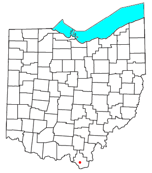
Kitts Hill is an unincorporated community in western Lawrence Township, Lawrence County, Ohio, United States.[1] It has a post office with the ZIP code 45645.[2] It lies along State Route 141 northeast of the city of Ironton, the county seat of Lawrence County. It has a community center that was previously Deering Local School District in the area. The majority of Pre-K through 12th grade education is provided by the Rock Hill Local School District, although very small portions of the area are served by the Dawson-Bryant Local School District.
Kitts Hill is named for the family of farmer Charles Edward Kitts, who was born in Belmont, and died at Kitts Hill in 1875. His son, Edward Franklin Kitts and wife Mary Ann nee-Farson, followed. Their daughter Louisa Esther married Willis Crowe, whose family controlled the farm for much of the 20th century.[3]
YouTube Encyclopedic
-
1/3Views:4481 329798 237
-
HighRock, Ohio
-
Lawrence County, Ohio
-
Marvia Providence - Inspirational Medley
Transcription
References
- ^ U.S. Geological Survey Geographic Names Information System: Kitts Hill
- ^ "Free ZIP Code Lookup with area code, county, geocode, MSA/PMSA, population". Zipinfo.com. Archived from the original on August 12, 2016. Retrieved June 17, 2016.
- ^ [1][dead link]
Municipalities and communities of Lawrence County, Ohio, United States | ||
|---|---|---|
| City |  | |
| Villages | ||
| Townships | ||
| CDPs | ||
| Other communities | ||
| Footnotes | ‡This populated place also has portions in an adjacent county or counties | |
38°33′41″N 82°34′39″W / 38.56139°N 82.57750°W
This Lawrence County, Ohio state location article is a stub. You can help Wikipedia by expanding it. |