
Kinmundy Township | |
|---|---|
 | |
 Location of Illinois in the United States | |
| Coordinates: 38°47′N 88°52′W / 38.783°N 88.867°W | |
| Country | United States |
| State | Illinois |
| County | Marion |
| Settled | November 4, 1873 |
| Area | |
| • Total | 36.98 sq mi (95.8 km2) |
| • Land | 36.65 sq mi (94.9 km2) |
| • Water | 0.33 sq mi (0.9 km2) |
| Elevation | 584 ft (178 m) |
| Population (2010) | |
| • Estimate (2016)[1] | 1,151 |
| • Density | 32.4/sq mi (12.5/km2) |
| Time zone | UTC-6 (CST) |
| • Summer (DST) | UTC-5 (CDT) |
| FIPS code | 17-121-40130 |
Kinmundy Township is located in Marion County, Illinois, USA. At the 2010 census, its population was 1,186 and it contained 542 housing units.[2]
Kinmundy is believed to be named after a place in Scotland.[3]
Geography
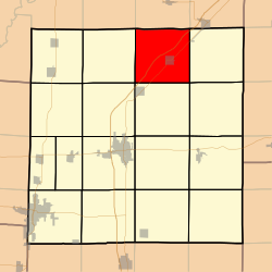
Kinmundy Township (T4N R3E) is centered at 38°47'N 88°51'W (38.778, -88.983). It is traversed northeast–southwest by Interstate Route 57, State Route 37 and the East Fork of the Kaskaskia River. The city of Kinmundy is located near the center of the township. According to the 2010 census, the township has a total area of 36.98 square miles (95.8 km2), of which 36.65 square miles (94.9 km2) (or 99.11%) is land and 0.33 square miles (0.85 km2) (or 0.89%) is water.[2]
Demographics
| Census | Pop. | Note | %± |
|---|---|---|---|
| 2016 (est.) | 1,151 | [1] | |
| U.S. Decennial Census[4] | |||
Adjacent townships
- Lone Grove Township, Fayette County (north)
- LaClede Township, Fayette County (northeast)
- Meacham Township (east)
- Omega Township (southeast)
- Alma Township (south)
- Tonti Township (southwest)
- Foster Township (west)
- Wilberton Township, Fayette County (northwest)
References
- ^ a b "Population and Housing Unit Estimates". Retrieved June 9, 2017.
- ^ a b "Population, Housing Units, Area, and Density: 2010 - County -- County Subdivision and Place -- 2010 Census Summary File 1". United States Census. Archived from the original on February 12, 2020. Retrieved May 28, 2013.
- ^ Gannett, Henry (1905). The Origin of Certain Place Names in the United States. Govt. Print. Off. pp. 176.
- ^ "Census of Population and Housing". Census.gov. Retrieved June 4, 2016.
External links
Municipalities and communities of Marion County, Illinois, United States | ||
|---|---|---|
| Cities |  | |
| Villages | ||
| Townships | ||
| Unincorporated communities | ||
| Footnotes | ‡This populated place also has portions in an adjacent county or counties | |
This Marion County, Illinois location article is a stub. You can help Wikipedia by expanding it. |