
| Karns City Area School District | |
|---|---|
 Map of Butler County Pennsylvania School Districts | |
| Address | |
1446 Kittanning Pike
, Butler County, Armstrong County, Pennsylvania, 16041United States | |
| District information | |
| Type | Public |
| Grades | K–12 |
| Students and staff | |
| District mascot | Gremlin |
| Colors | Purple, gold, and white |
| Other information | |
| Website | www |
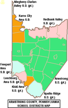

Karn City Area School District is a public school district in Butler County, Clarion County, and Armstrong County, Pennsylvania. The district serves the boroughs of Chicora, Fairview, Karns City, Petrolia, and Bruin, and the townships of Parker, Fairview, and Donegal in Butler County, the townships of Perry, Sugarcreek, and Bradys Bend in Armstrong County, and the borough of East Brady and Brady Township in Clarion County. There are two K–6 elementary schools- Chicora and Sugarcreek Elementaries, as well as Karns City Area Junior/Senior High School. The district encompasses approximately 125 square miles (320 km2). According to 2000 federal census data, it serves a resident population of 10,720.
YouTube Encyclopedic
-
1/2Views:8402 479
-
Karns City winning shot.
-
Welcome to Brookville Area Schools
Transcription
Schools
- Chicora Elementary School
- Sugarcreek Elementary School
- Karns City Area Junior/Senior High School
References
External links
40°59′16″N 79°43′34″W / 40.98772°N 79.72600°W