
Kapilvastu District
कपिलवस्तु जिल्ला | |
|---|---|
 Tilaurakot, Kapilvastu Ancient Shakya Capital | |
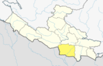
 Location of Kapilvastu (dark yellow) in Lumbini Province | |
| Country | |
| Province | Lumbini Province |
| Government | |
| • Type | Coordination committee |
| • Body | DCC, Kapilvastu |
| Area | |
| • Total | 1,738 km2 (671 sq mi) |
| Population (2021) | |
| • Total | 686,739 |
| • Density | 400/km2 (1,000/sq mi) |
| Time zone | UTC+05:45 (NPT) |
| Telephone Code | 076 |
| Main Language(s) | Awadhi, Tharu, Nepali |
| Website | www |
Kapilvastu District (Nepali: कपिलवस्तु जिल्ला [ˈkʌpilbʌstu] ⓘ), often Kapilbastu, Birth Place of GAUTAM BUDDHA is one of the districts of Lumbini Province, Nepal. The district, with Kapilbastu municipality as its district headquarters, covers an area of 1,738 square kilometres (671 sq mi) and in 2001 had a population of 481,976, which increased to 571,936 in 2011 and later according 2021 census it further increased to 686,739 Kapilvastu district has 3 number of seats for central whereas 6 seats for state level elections.
YouTube Encyclopedic
-
1/5Views:21 3872 1183871 005477
-
Top 5 Places To Visit In Kapilvastu || Nepal || Rangin Parda Nepal
-
JAGDISHPUR TAAL KAPILVASTU || VLOG
-
Lumbini Siddartha Birth Place & India Kapilvastu exploring || This video about Lumbini & Kapilvastu
-
A local ceremony before marriage in Kapilvastu | बिबाह अगाडिको यो कार्य #FiranteATraveller
-
SINGAPOREAN PILGRIM NEPAL KAPILVASTU BUDDHIST HOLY PLACE .
Transcription
Geography and climate
The district is situated at a height of 93 to 1,491 metres (305 to 4,892 ft) above sea level.[1] Geographically, the district can be divided into the low land plains of Terai and the low Chure hills.
Kapilvastu is bounded by Rupandehi District to the east, Dang District to the northwest, Arghakhanchi District to the north, Balrampur district, Awadh region, Uttar Pradesh, India to the west and Siddharthnagar district, Purvanchal region, Uttar Pradesh to the south.
| Climate zone[2] | Elevation range | % of area |
|---|---|---|
| Lower Tropical | below 300 meters (1,000 ft) | 86.8% |
| Upper Tropical | 300 to 1,000 meters 1,000 to 3,300 ft. |
12.0% |
| Subtropical | 1,000 to 2,000 meters 3,300 to 6,600 ft. |
1.2% |
The summer is hot with temperature above 40 °C and winter temperature remains below 15 °C. Due to extremely hot and cold climatic conditions, the people suffer from viral fever, dengue, malaria etc. and cold and diarrohea respectively.
Demographics
| Census year | Pop. | ±% p.a. |
|---|---|---|
| 1981 | 270,045 | — |
| 1991 | 371,778 | +3.25% |
| 2001 | 481,976 | +2.63% |
| 2011 | 571,936 | +1.73% |
| 2021 | 686,739 | +1.85% |
| Source: Citypopulation[3] | ||
At the time of the 2011 Nepal census, Kapilvastu District had a population of 571,936.
As their first language, 49.9% spoke Awadhi, 17.8% Urdu, 17.0% Nepali, 11.3% Tharu, 1.7% Magar, 0.9% Maithili, 0.4% Hindi, 0.2% Bhojpuri, 0.2% Newar, 0.1% Doteli, 0.1% Gurung, 0.1% Kham and 0.1% other languages.[4]
Ethnicity/caste: 18.2% were Musalman, 12.3% Tharu, 10.2% Yadav, 8.5% Hill Brahmin, 6.3% Kurmi, 4.0% Chhetri, 3.8% Dusadh/Pasawan/Pasi, 3.7% Chamar/Harijan/Ram, 3.5% Magar, 3.1% Kahar, 2.1% Dhobi, 2.1% Kewat, 1.9% Teli, 1.8% Kami, 1.6% Kathabaniyan, 1.3% Kori, 1.3% other Terai, 1.2% Terai Brahmin, 1.1% Badhaee, 1.1% Baraee, 1.1% Hajam/Thakur, 0.9% Kalwar, 0.7% other Dalit, 0.7% Mallaha, 0.7% Sanyasi/Dasnami, 0.6% Damai/Dholi, 0.6% Halwai, 0.6% Lohar, 0.5% Gaderi/Bhedidar, 0.5% Thakuri, 0.4% Lodh, 0.3% Bengali, 0.3% Kayastha, 0.3% Koiri/Kushwaha, 0.3% Marwadi, 0.3% Newar, 0.2% Dhunia, 0.2% Gurung, 0.2% Kumal, 0.2% Sarki, 0.1% Badi, 0.1% Dhandi, 0.1% Dhanuk, 0.1% Kanu, 0.1% Kumhar, 0.1% Majhi, 0.1% Mali, 0.1% Natuwa, 0.1% Pattharkatta/Kushwadiya, 0.1% Sonar, 0.1% Sudhi and 0.1% others.[5]
Religion: 80.6% were Hindu, 18.2% Muslim, 0.9% Buddhist, 0.2% Christian and 0.1% others.[6]
Literacy: 54.7% could read and write, 3.6% could only read and 41.5% could neither read nor write.[7]
Administration
The district consists of ten municipalities, out of which six are urban municipalities and four are rural municipalities. These are as follows:[8]
- Kapilvastu Municipality
- Banganga Municipality
- Buddhabhumi Municipality
- Shivaraj Municipality
- Krishnanagar Municipality
- Maharajgunj Municipality
- Mayadevi Rural Municipality
- Yashodhara Rural Municipality
- Suddhodhan Rural Municipality
- Bijaynagar Rural Municipality
Economy
Most of the population of the district is dependent on agriculture. Paddy rice is a major crop of the district. A number of youths rely on foreign employment while sugarcane is an important cash crop.
| Crop | Production in metric tonnes |
|---|---|
| Paddy | > 150,000 |
| Wheat | 25,000-35,000 |
| Sugarcane | > 175,000 |
| Oil seed | 1,000-5,000 |
Population
In 2021 National population and Housing census 2021 was reported that total population of kapilvastu district was 686,739 . Male=337,604 and Female=348604 and number of total household was 101,321 Data source: central bureau of statistics, kathmandu government of Nepal .
Culture
Awadhi people are the major inhabitants of this region, which is very rich in their culture. Awadhi cuisine is well known. Most people of the district follow Sanatana culture and majority of the population is Hindu. Therefore, festivals such as Vijaya Dashami, Deepawali, Holi, Ram Navami and Naag Panchami are very popular. Shivaratri and the month of Shrawana attract huge crowds in the district capital Taulihawa where ancient Tauleshwar Nath Temple exists. Since Kapilvastu was the kingdom of Bhagwan Buddha, Vaishak Purnima is also celebrated in a grand way. The local population including Tharu celebrate Makar Sankranti (Maghi) with festivity. Tharus live in the northern part of the district.
Places of interest
World Marsh Region
A region with biodiversity, cultural, archaeological and historical monuments that has been proposed to be enlisted in the list of World Cultural Heritage of UNESCO.
Archaeological sites
More than 138 historical sites related to Buddha have already been identified within the boundary to the east of Banganga, west of Kothi, north to Indian border and south to Mahendra highway. The forest of the district stands as a natural park. The land is irrigated by the rivers like Banganga, Koili, Surai, Chirai, Bhutera and others.[1] The latest archaeological excavation carried out under the aegis of the Department of Archaeology (DoA) has discovered that Kapilvastu has the highest number of archaeological sites in the country. The department has identified 136 archaeological sites in the district.[9][10][11][12]
See also
- People's Progressive Party
- Jagdishpur Lake, Kapilvastu
- Bikuli, Kapilvastu
- Lumbini Province
- Buddha
References
- ^ a b "कपिलवस्तु जि.स.स". Retrieved October 7, 2008.[dead link]
- ^ The Map of Potential Vegetation of Nepal - a forestry/agroecological/biodiversity classification system (PDF), Forest & Landscape Development and Environment Series 2-2005 and CFC-TIS Document Series No.110., 2005, ISBN 87-7903-210-9, retrieved November 22, 2013
- ^ "NEPAL: Administrative Division". www.citypopulation.de.
- ^ NepalMap Language [1]
- ^ NepalMap Caste [2]
- ^ NepalMap Religion [3]
- ^ NepalMap Literacy [4]
- ^ "स्थानिय तह" (in Nepali). Ministry of Federal Affairs and General Administration. Archived from the original on 31 August 2018. Retrieved 1 October 2018.
- ^ "Country's largest number of archaeological sites in Kapilvastu". The Himalayan Times. 2018-02-23. Retrieved 2019-07-04.
- ^ "136 archaeological sites found". The Himalayan Times. 2018-02-24. Retrieved 2019-07-04.
- ^ "136 archaeological spots uncovered in Kapilvastu". My Republica. Retrieved 2019-07-04.
- ^ "Kapilvastu home to 136 archaeological sites – NepalTourNews". Retrieved 2019-07-04.
External links
- "Districts of Nepal". Statoids.
 Kapilvastu travel guide from Wikivoyage
27°32′N 83°3′E / 27.533°N 83.050°E
| International | |
|---|---|
| National | |