
Kankakee Township | |
|---|---|
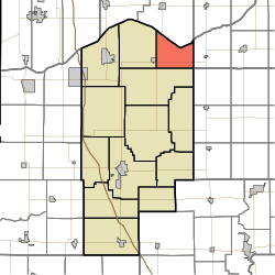 Location in Jasper County | |
| Coordinates: 41°12′18″N 86°59′52″W / 41.20500°N 86.99778°W | |
| Country | United States |
| State | Indiana |
| County | Jasper |
| Government | |
| • Type | Indiana township |
| Area | |
| • Total | 25.97 sq mi (67.3 km2) |
| • Land | 25.27 sq mi (65.4 km2) |
| • Water | 0.7 sq mi (2 km2) 2.70% |
| Elevation | 663 ft (202 m) |
| Population | |
| • Total | 913 |
| • Density | 39.1/sq mi (15.1/km2) |
| GNIS feature ID | 0453520 |
Kankakee Township is one of thirteen townships in Jasper County, Indiana, United States. As of the 2020 census, its population was 913 (down from 988 at 2010[2]) and it contained 354 housing units.
Kankakee Township was established in 1856.[3]
Geography
According to the 2010 census, the township has a total area of 25.97 square miles (67.3 km2), of which 25.27 square miles (65.4 km2) (or 97.30%) is land and 0.7 square miles (1.8 km2) (or 2.70%) is water.[2]
Unincorporated towns
Adjacent townships
- Pleasant Township, Porter County (north)
- Dewey Township, LaPorte County (northeast)
- Railroad Township, Starke County (east)
- Cass Township, Pulaski County (southeast)
- Walker Township (southwest)
- Wheatfield Township (west)
Major highways
Education
Kankakee Township residents are eligible to obtain a free library card from the Jasper County Public Library.[4]
References
- "Kankakee Township, Jasper County, Indiana". Geographic Names Information System. United States Geological Survey, United States Department of the Interior. Retrieved September 24, 2009.
- United States Census Bureau cartographic boundary files
- ^ "Census Bureau profile: Kankakee Township, Jasper County, Indiana". United States Census Bureau. May 2023. Retrieved April 4, 2024.
- ^ a b "Population, Housing Units, Area, and Density: 2010 - County -- County Subdivision and Place -- 2010 Census Summary File 1". United States Census. Archived from the original on February 12, 2020. Retrieved May 10, 2013.
- ^ A standard history of Jasper and Newton counties, Indiana. Lewis Publishing Company. 1916. p. 51.
- ^ "How do I get a library card?". Jasper County Public Library. Retrieved March 8, 2018.
External links
Municipalities and communities of Jasper County, Indiana, United States | ||
|---|---|---|
| City |  | |
| Towns | ||
| Townships | ||
| CDPs | ||
| Other communities | ||
| Footnotes | ‡This populated place also has portions in an adjacent county or counties | |