
Kakani
ककनी | |
|---|---|
| [[File:Kakani.jpg language = tamang gurung neawar and nepali|250px]] | |
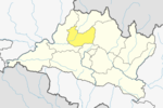
 Kakani Location in Nepal | |
| Coordinates: 27°49′N 85°16′E / 27.817°N 85.267°E | |
| Country | |
| Zone | Bagmati Province |
| District | Nuwakot District |
| Elevation | 2,030 m (6,660 ft) |
| Population (1991) | |
| • Total | 7,816 |
| Time zone | UTC+5:45 (Nepal Time) |
| Website | http://kakanimun.gov.np/ |

Kakani is a Gaunpalika and former village development committee in Nuwakot District in Bagmati Province of central Nepal. At the time of the 1991 Nepal census, the Kakani village development committee administered a population of 7816 living in 1343 individual households.[1]
As one of the most accessible settlements from Kathmandu over 2000 meters, this hill station hosts a British Gurkhas welfare bungalow[2] and a number of hotels. The village is also home to a memorial park to the victims of Thai Airways International Flight 311.
A notable local industry is strawberry farming. With the assistance of a United Nations Development Programme project, a local farmers' cooperative now produces close to 250 000 kg of the fruit per year.[3]
YouTube Encyclopedic
-
1/1Views:17 613
-
Kathmandu to Kakani Nuwakot | Kakani Memorial Park | Awesome Place
Transcription
Ward office of Kakani
For the easiness of local people Nepal Government have formed a Kakani Rural Municipality by collapsing the former Village development committee. The Rural municipality has 8 Ward and each ward has an elected body to serve the people. Here are the list of ward and their office.
Ward No 1: Okharpauwa
Ward No 2: Okharpauwa
Ward No 3: Chauthe
Ward No 4: Kakani
Ward No 5: Kakani
Ward No 6: Madanpur, Nuwakot
Ward No 7: Chaturale
Ward No 8: Thansing
Climate
| Climate data for Kakani (elevation 2,064 m (6,772 ft), 1976–2005 normals) | |||||||||||||
|---|---|---|---|---|---|---|---|---|---|---|---|---|---|
| Month | Jan | Feb | Mar | Apr | May | Jun | Jul | Aug | Sep | Oct | Nov | Dec | Year |
| Mean daily maximum °C (°F) | 13.6 (56.5) |
15.4 (59.7) |
19.6 (67.3) |
22.6 (72.7) |
22.8 (73.0) |
22.7 (72.9) |
22.3 (72.1) |
22.6 (72.7) |
22.0 (71.6) |
20.8 (69.4) |
18.0 (64.4) |
14.9 (58.8) |
19.8 (67.6) |
| Mean daily minimum °C (°F) | 3.0 (37.4) |
4.7 (40.5) |
8.3 (46.9) |
11.4 (52.5) |
13.5 (56.3) |
15.4 (59.7) |
16.0 (60.8) |
15.8 (60.4) |
14.9 (58.8) |
11.7 (53.1) |
8.0 (46.4) |
4.8 (40.6) |
10.6 (51.1) |
| Average precipitation mm (inches) | 19.5 (0.77) |
25.6 (1.01) |
41.3 (1.63) |
68.7 (2.70) |
202.1 (7.96) |
483.8 (19.05) |
737.5 (29.04) |
753.2 (29.65) |
400.7 (15.78) |
80.4 (3.17) |
9.0 (0.35) |
18.1 (0.71) |
2,864.9 (112.79) |
| Source: Agricultural Extension in South Asia[4] | |||||||||||||
Road to Kakani
The Pasang-Lhamu Highway goes through Kakani. It starts from Kathmandu and reaches up to Kerung at the border of China. The road is now under construction because they are upgrading the road and making it wider. This video shows some display about the road condition to Kakani
See also
- Sisdol landfill- the biggest landfill site of Nepal located in Kakani
References
- ^ "Nepal Census 2001", Nepal's Village Development Committees, Digital Himalaya, archived from the original on 12 October 2008, retrieved 15 November 2009.
- ^ British Gurkhas Nepal Guide to Preparation and Arrival British Army 1 Feb 2010
- ^ New morning in Kakani! Archived 2011-07-24 at the Wayback Machine UNDP Micro-Enterprise Development Programme 05-01-2010
- ^ "TEMPORAL AND SPATIAL VARIABILITY OF CLIMATE CHANGE OVER NEPAL (1976-2005)" (PDF). Agricultural Extension in South Asia. Archived from the original (PDF) on 13 October 2023. Retrieved 14 October 2023.
External links
| International | |
|---|---|
| National | |
This article about a location in Nuwakot District, Nepal is a stub. You can help Wikipedia by expanding it. |