
Kailali District | |
|---|---|
 Ghodaghodi Tal, Kailali | |
 Location of Kailali District | |
| Coordinates: 28°41′N 80°52′E / 28.683°N 80.867°E | |
| Country | |
| Province | Sudurpashchim Province |
| Admin HQ. | Dhangadhi |
| Government | |
| • Type | Coordination committee |
| • Body | DCC, Kailali |
| Area | |
| • Total | 3,235 km2 (1,249 sq mi) |
| Population (2021) | |
| • Total | 911,155 |
| • Density | 281.7/km2 (730/sq mi) |
| Time zone | UTC+05:45 (NPT) |
| Postal Codes | 10900 |
| Area code | 91 |
| Main Language(s) | Tharu, Nepali language, Doteli |
| Website | ddckailali |
Kailali District (Nepali: कैलाली जिल्लाⓘ), a part of Sudurpashchim Province in Terai plain, is one of the 77 districts of Nepal. The district, with Dhangadhi as its district headquarters, covers an area of 3,235 square kilometres (1,249 sq mi) and has a population 911,155 (2021 census) and (775,709 in 2011 census), (616,697 in 2001 census).
Before the reunification of Nepal by Gorkha King Prithvi Narayan Shah, this district was the part of Doti Kingdom. Nepal lost it to the East India Company after the Anglo-Nepalese war (1814-1816) between the then Kingdom of Nepal and the East India Company followed by territorial concessions of Sugauli Treaty. Later on after the treaty of 1860, Nepal recovered this land along with Kanchanpur, Banke and Bardiya.
YouTube Encyclopedic
-
1/5Views:1 56132 7753673113 986
-
TOP 10 place to visit in Kailali District
-
नेपालको जनसंख्या_कुन जिल्लामा कुन जाति पहिलो |Highest populous castes in District |NEPAL UPDATE
-
दाङ देखि धनगढी Day 2, Rammapur Bardiya to Dhangadhi, Karnali Bridge, Ghodaghodi, Attariya Kailali.
-
CHISAPANI A SUMMER DESTINATION | FAR-WEST NEPAL | AWESOME SUNDAYs | VLOG ||
-
Tikapur Vlogs | Kailali | Ghoda Ghodi Lake | Tikapur Park
Transcription
Geography and climate
| Climate zone[1] | Elevation range | % of area |
|---|---|---|
| Lower Tropical | below 300 meters (1,000 ft) | 59.3% |
| Upper Tropical | 300 to 1,000 meters 1,000 to 3,300 ft. |
25.9% |
| Subtropical | 1,000 to 2,000 meters 3,300 to 6,600 ft. |
13.8% |
Demographics
| Census year | Pop. | ±% p.a. |
|---|---|---|
| 1981 | 257,905 | — |
| 1991 | 417,891 | +4.94% |
| 2001 | 616,697 | +3.97% |
| 2011 | 775,709 | +2.32% |
| 2021 | 911,155 | +1.62% |
| Source: Citypopulation[2] | ||
At the time of the 2011 Nepal census, Kailali District had a population of 775,709.
As their first language, 41.5% spoke Tharu, 27.3% Nepali, 18.7% Doteli, 6.3% Achhami, 1.4% Magar, 0.9% Maithili, 0.8% Hindi, 0.5% Bajureli, 0.4% Bajhangi, 0.3% Baitadeli, 0.3% Dailekhi, 0.2% Kham, 0.2% Raji, 0.2% Tamang, 0.2% Urdu, 0.1% Bhojpuri, 0.1% Darchuleli, 0.1% Gurung, 0.1% Jumli, 0.1% Newar and 0.1% other languages as their first language.[3]
Ethnicity/caste: 41.9% were Tharu, 20.8% Chhetri, 12.4% Hill Brahmin, 8.4% Kami, 3.9% Thakuri, 3.8% Magar, 2.2% Damai/Dholi, 1.1% other Dalit, 0.9% Sarki, 0.6% Musalman, 0.5% Lohar, 0.5% Sanyasi/Dasnami, 0.4% Badi, 0.4% Newar, 0.3% Raji, 0.3% Tamang, 0.2% Gurung, 0.2% other Terai, 0.1% Terai Brahmin, 0.1% Halwai, 0.1% Kathabaniyan, 0.1% Rai, 0.1% Yadav and 0.1% others.[5]
Religion: 94.9% were Hindu, 2.0% Buddhist, 1.9% Christian, 0.6% Muslim, 0.2% Prakriti and 0.3% others.[6]
Literacy: 65.9% could read and write, 2.7% could only read and 31.4% could neither read nor write.[7]
Administration
The district consists of 13 Local Levels, of which one is a sub-metropolitan city, six are urban municipalities and six are rural municipalities. These are as follows:[8]
- Dhangadhi Sub-Metropolitan City
- Lamki Chuha Municipality
- Tikapur Municipality
- Ghodaghodi Municipality
- Bhajani Municipality
- Godawari Municipality
- Gauriganga Municipality
- Janaki Rural Municipality
- Bardagoriya Rural Municipality
- Mohanyal Rural Municipality
- Kailari Rural Municipality
- Joshipur Rural Municipality
- Chure Rural Municipality
See also
References
- ^ The Map of Potential Vegetation of Nepal - a forestry/agroecological/biodiversity classification system (PDF), . Forest & Landscape Development and Environment Series 2-2005 and CFC-TIS Document Series No.110., 2005, ISBN 87-7903-210-9, retrieved Nov 22, 2013
- ^ "NEPAL: Administrative Division". www.citypopulation.de.
- ^ NepalMap Language
- ^ 2011 Nepal Census, Social Characteristics Tables
- ^ NepalMap Caste
- ^ NepalMap Religion
- ^ NepalMap Literacy
- ^ "स्थानिय तह" (in Nepali). Ministry of Federal Affairs and General Administration. Archived from the original on 31 August 2018. Retrieved 1 September 2018.
| |||||||||
External links
Headquarters: Dhangadhi | ||
| Sub-metropolitan cities | 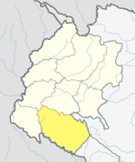 | |
| Municipalities | ||
| Rural municipalities | ||
| Former VDCs | ||
List of municipalities and rural municipalities of Nepal | ||
- "Districts of Nepal". Statoids.
Places adjacent to Kailali District | |
|---|---|
Headquarters: Dhangadhi | ||
| Sub-metropolitan cities | | |
| Municipalities | ||
| Rural municipalities | ||
| Former VDCs | ||
List of municipalities and rural municipalities of Nepal | ||