
Kōhoku
江北町 | |
|---|---|
 View of Kōhoku Town | |
 Flag  Emblem | |
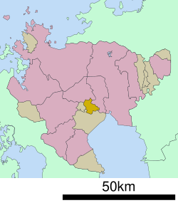
 Location of Kōhoku in Saga Prefecture | |
 | |
 Kōhoku Location in Japan | |
| Coordinates: 33°13′14″N 130°9′26″E / 33.22056°N 130.15722°E | |
| Country | Japan |
| Region | Kyushu |
| Prefecture | Saga |
| District | Kishima |
| Government | |
| • Mayor | Kenichi Tanaka |
| Area | |
| • Total | 24.88 km2 (9.61 sq mi) |
| Population (May 31, 2024) | |
| • Total | 9,586 |
| • Density | 390/km2 (1,000/sq mi) |
| Time zone | UTC+09:00 (JST) |
| City hall address | 1651-1 Ōaza Yamaguchi, Kōhoku-chō, Kishima-gun, Saga-ken 849-0592 |
| Website | Official website |
| Symbols | |
| Flower | Narcissus |
| Tree | Ilex integra |

Kōhoku (江北町, Kōhoku-machi) is a town located in Kishima District, Saga Prefecture, Japan.[1][2] It is known as a crossroads for railways and national highways, and as such has dubbed itself "the navel of Saga". As of 31 May 2024[update], the town had an estimated population of 9586 in 3715 households, and a population density of 750 persons per km².[3] The total area of the town is 24.88 km2 (9.61 sq mi)
Geography
- Mountains: The northern part of the city is gradually mountainous.
- Rivers: Rokkaku River, Ushizu River
Adjoining Municipalities
Saga Prefecture
Climate
Kōhoku has a humid subtropical climate (Köppen Cfa) characterized by warm summers and cool winters with light to no snowfall. The average annual temperature in Kōhoku is 16.6 °C. The average annual rainfall is 1902 mm with September as the wettest month. The temperatures are highest on average in August, at around 27.4 °C, and lowest in January, at around 6.5 °C.[4]
Demographics
Per Japanese census data, the population of Kōhoku is as shown below. [5]
| Year | Pop. | ±% |
|---|---|---|
| 1960 | 16,379 | — |
| 1970 | 10,546 | −35.6% |
| 1980 | 9,732 | −7.7% |
| 1990 | 9,483 | −2.6% |
| 2000 | 9,584 | +1.1% |
| 2010 | 9,515 | −0.7% |
| 2020 | 9,566 | +0.5% |
History
The area of Kōhoku is part of ancient Hizen Province. During the Edo period it was part of the holdings of Saga Domain until the Meiji restoration. The village of Oda, Yamaguchi and Sarushi were established on April 1, 1889 with the creation of the modern municipalities system. The three villages merged on April 1, 1932 to form the village of Kōhoku. Kōhoku gained town status on April 1,1952. On September 30, 1956 part of the village of Teisen (砥川村) from Ogi District merges with Kōhoku
Government
Kōhoku has a mayor-council form of government with a directly elected mayor and a unicameral town council of 10 members. Kōhoku, together with the other municipalities in Kishima District contributes two members to the Saga Prefectural Assembly. In terms of national politics, the town is part of the Saga 2nd district of the lower house of the Diet of Japan.
Economy
The local economy is overwhelming based on agriculture and livestock raising.
Education
Kōhoku has one public elementary school and one public junior high schools operated by the town government. The town does not have a high school.
Transportation
Railway
![]() JR Kyushu - Nagasaki Main Line / Sasebo Line
JR Kyushu - Nagasaki Main Line / Sasebo Line
- JH Kōhoku
Highways
References
- ^ 江北町(佐賀県) (1982). 江北町史. 江北町. OCLC 673756253.
- ^ 日本放送協会. "江北町でNHKのど自慢 18組の出場者が熱唱|NHK 佐賀県のニュース". NHK NEWS WEB. Retrieved 2022-10-21.
- ^ "Kōhoku Town official statistics" (in Japanese). Japan.
- ^ Kōhoku climate: Average Temperature, weather by month
- ^ Saga Prefecture population by municipality
External links
 Media related to Kōhoku, Saga at Wikimedia Commons
- Kōhoku official website (in Japanese)
| Special city | ||
|---|---|---|
| Cities | ||
| Districts | ||
| International | |
|---|---|
| National | |
This Saga Prefecture location article is a stub. You can help Wikipedia by expanding it. |