
Johnston | |
|---|---|
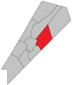 Location within Queens County, New Brunswick. | |
| Coordinates: 45°50′N 64°35′W / 45.84°N 64.59°W | |
| Country | |
| Province | |
| County | Queens County |
| Erected | 1839 |
| Area | |
| • Land | 360.87 km2 (139.33 sq mi) |
| Population (2021)[1] | |
| • Total | 638 |
| • Density | 1.8/km2 (5/sq mi) |
| • Change 2016-2021 | |
| • Dwellings | 384 |
| Time zone | UTC-4 (AST) |
| • Summer (DST) | UTC-3 (ADT) |
| Figures do not include portion within the village of Cambridge-Narrows | |
Johnston Parish is a geographic parish in Queens County, New Brunswick, Canada.[2]
Prior to the 2023 governance reform, for governance purposes it was divided between the village of Cambridge-Narrows and the local service district of the parish of Johnston,[3] both of which were members of Kings Regional Service Commission (RSC8).[4]
YouTube Encyclopedic
-
1/4Views:2 4851 536 1134 538 7353 957
-
Woodstock - New Brunswick - Canada - 4K Downtown Drive
-
10 Places in Ohio You Should NEVER Move To
-
15 Strangest Things Recently Discovered In Thailand
-
Snapshots from the National Statuary Hall at the U. S. Capitol - Gerald Ford and Jefferson Davis
Transcription
Origin of name
The parish was named in honour of Hugh Johnston Jr., MLA for Queens County and member of the Executive Council at the time.[5] Johnston's father Hugh preceded him as MLA from Saint John County and died there in 1829.
History
Johnston was erected in 1839 from Wickham Parish.[6]
In 1852 part of Johnston was included in the newly erected Cambridge Parish.[7]
In 1856 the boundary with Cambridge Parish was altered.[8]
Boundaries
Johnston Parish is bounded:[2][9][10][11]
- on the east by a line running north-northwesterly from north of the end of Chittick Road in Marrtown, crossing the Canaan River east of Phillips Brook and striking the Waterborough Parish line about 2 kilometres northwest of Parks Lake;
- on the southeast by the Kings County line;
- on the west by a line running north from the Kings County line along Route 695 and Watson Road to Washademoak Lake, then upstream through the middle of the lake to a point about three hundred metres southwest of Fowlers Cove, then northeasterly to Route 715, then northwesterly along the highway and Fowler Road to the Waterborough Parish line about 1.5 kilometres past the junction of Fowler Road with Route 715;
- on the northwest by a line running north 54º east[a] from a point on the Saint John River about 1.8 kilometres southwest of the Route 715 bridge over McAlpines Brook.
Communities
Communities at least partly within the parish.[9][10][11]
- Annidale
- Bagdad
- Cambridge-Narrows
- Hammtown
- Canaan Rapids
- Chambres Corner
- Codys
- Coles Island
- Goshen
- Highfield
- Long Creek
- Partridge Valley
- Phillipstown
- Salmon Creek
- Smith Corner
- Thornetown
- Washademoak
- Waterloo Corner
- Youngs Cove Road
Bodies of water
Bodies of water[b] at least partly within the parish.[9][10][11]
- Canaan River
- Long Creek
- Salmon Creek
- Washademoak Lake
Islands
Islands at least partly within the parish.[9][10][11]
- Coles Island
Other notable places
Parks, historic sites, and other noteworthy places at least partly within the parish.[9][10][11][13]
- Partridge Valley East Protected Natural Area
- Phillipstown Protected Natural Area
Demographics
Parish population total does not include portion within Cambridge-Narrows
Population
|
LanguageMother tongue (2016)[16]
|
Access Routes
Highways and numbered routes that run through the parish, including external routes that start or finish at the parish limits:[17]
|
|
|
See also
Notes
- ^ By the magnet of 1786, when declination at the starting point was a bit more than 14º west of north.[12]
- ^ Not including brooks, ponds or coves.
References
- ^ a b "Census Profile". Statistics Canada. 26 October 2022. Retrieved 29 October 2022.
- ^ a b "Chapter T-3 Territorial Division Act". Government of New Brunswick. Retrieved 13 November 2020.
- ^ "New Brunswick Regulation 84-168 under the Municipalities Act (O.C. 84-582)". Government of New Brunswick. Retrieved 19 July 2020.
- ^ "Communities in each of the 12 Regional Service Commissions (RSC) / Les communautés dans chacune des 12 Commissions de services régionaux (CSR)" (PDF), Government of New Brunswick, July 2017, retrieved 2 February 2021
- ^ Ganong, William F. (1896). A Monograph of the Place-Nomenclature of the Province of New Brunswick. Royal Society of Canada. p. 242. Retrieved 17 March 2021.
- ^ "2 Vic. c. 21 An Act to erect a part of the Parish of Wickham, in Queen's County into a separate and distinct Town or Parish.". Acts of the General Assembly of Her Majesty's Province of New Brunswick, Passed in the Year 1839. Fredericton: Government of New Brunswick. 1839. pp. 65–66. Retrieved 27 March 2021.
- ^ "15 Vic. c. 36 An Act for the erection of a new Parish in Queen's County.". Acts of the General Assembly of Her Majesty's Province of New Brunswick, Passed in the Year 1852. Fredericton: Government of New Brunswick. 1852. pp. 55–56. Retrieved 27 March 2021.
- ^ "19 Vic. c. 5 An Act to alter the Division Line of the Parish of Cambridge, in Queen's County.". Acts of the General Assembly of Her Majesty's Province of New Brunswick, Passed in the Months of March, April, and May 1856. Fredericton: Government of New Brunswick. 1856. pp. 4–5. Retrieved 27 March 2021.
- ^ a b c d e "No. 117". Provincial Archives of New Brunswick. Department of Natural Resources and Energy Development. Retrieved 19 June 2021. Remainder of parish on maps 128, 129, 139, and 140 at same site.
- ^ a b c d e "353" (PDF). Transportation and Infrastructure. Government of New Brunswick. Retrieved 19 June 2021. Remainder of parish on mapbooks 354, 374, 375, 394, 395, 413, and 414 at same site.
- ^ a b c d e "Search the Canadian Geographical Names Database (CGNDB)". Government of Canada. Retrieved 19 June 2021.
- ^ "Historical Magnetic Declination". National Oceanic and Atmospheric Administration. Retrieved 26 April 2021.
- ^ "Explore New Brunswick's Protected Natural Areas". GeoNB. Retrieved 2 July 2021.
- ^ Statistics Canada: 2001, 2006 census
- ^ 2011 Statistics Canada Census Profile: Johnston Parish, New Brunswick
- ^ a b "Census Profile, 2016 Census Johnston, Parish [Census subdivision], New Brunswick". Statistics Canada. Retrieved 27 September 2019.
- ^ Atlantic Canada Back Road Atlas ISBN 978-1-55368-618-7
Places adjacent to Johnston Parish, New Brunswick | |
|---|---|
Subdivisions of New Brunswick | |
|---|---|
| Cities | |
| Towns |
|
| Villages | |
| Regional municipality | |
| Rural communities | |
| Rural districts |
|
| Other administrative divisions | |
45°52′31″N 65°47′43″W / 45.87519°N 65.795403°W