
| Jirishanca | |
|---|---|
 Jirishanca, West Face, July 2010 | |
| Highest point | |
| Elevation | 6,125 m (20,095 ft) |
| Prominence | 484 m (1,588 ft)[1] |
| Parent peak | Yerupaja |
| Coordinates | 10°14′12″S 76°54′18″W / 10.236593°S 76.905052°W |
| Geography | |
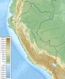 Jirishanca Peru | |
| Location | Ancash Region, Peru |
| Parent range | Andes, Huayhuash |
| Climbing | |
| First ascent | 12 July 1957 - Toni Egger and Siegfried Jungmeir (Austria)[2][3] - Toni Egger and Siegfried Jungmeir (Austria)[2][3] |
Jirishanca[4][5][6][7][8] is a 6,094-metre-high (19,993 ft)[4][5][6][7] mountain in the Huayhuash mountain range in west central Peru, part of the Andes. Other sources cite a height of 6,125 metres (20,095 ft).[8] It is the tenth highest peak in Peru and the third in the Huayhuash range (after Yerupajá and Siula Grande).[citation needed] Jirishanca translates as "hummingbird bill peak".[6]
YouTube Encyclopedic
-
1/3Views:1 315462860
-
Peru, Cordillera Huayhuash. Janca area, approaching Jirishanca
-
Cordillera Huayhuash y Laguna Carhuacocha - Lauricocha - Huánuco
-
Kay Rush Huayhuash Peru 2008
Transcription
Ascents

The mountain is notoriously difficult and has seen very few successful ascents. The first ascent in July 1957 by the Austrian mountaineers Toni Egger and Siegfried Jungmair over the (north)east face[9] has been called "one of the boldest climbing feats ever performed in the Cordillera".[10] Their route has only been repeated once.[11] In 1964 Gary Colliver and Glen Denny of an American expedition climbed the north ridge to the slightly lower north summit, but a traverse over the "cockscomb of ice" connecting to the main summit has so far not been attempted.[10] On July 6, 1969, an Italian team led by the 60-year-old Riccardo Cassin forged the first route through the West face.[12] On July 31, 1971 the Americans Dean Caldwell and Jon Bowlin first climbed the southwest face in two days. Leaving their expedition below, Bowlin and Caldwell forged their own route and reached the peak on August 1, and were back at base camp by August 2.[13] In 1973, a Japanese team led by Masayuki Shinohara succeeded in climbing the south east face for the first time, though it took them 49 days.[10]
Climbing
It is one of the hardest 6000 meter mountains of the Andes. The easier route to the summit is quoted TD but more difficult routes exist,[6] many on them on vertical ice and with overhanging section of mixed terrain such as the Cassin route (70° ice and a pitch rated UIAA IV+).
Elevation
The altitude of 6125 isn't likely as other data from available digital elevation models show lower elevations: SRTM yields 6028 metres[14] and TanDEM-X 5734 metres.[15] The height of the nearest key col is 5610 meters, leading to a topographic prominence of 484 meters.[16] Jirishanca is considered a Mountain according to the Dominance System [17] and its dominance is 7.94%. Its parent peak is Yerupaja and the Topographic isolation is 3.5 kilometers.[16]
References
- ^ "Jirishanca". Andes Specialists. Retrieved 2020-04-12.
- ^ a b Jeremy Frimer. Jirishanca, A Climbing History of the Humming bird Peak's Southeast Face, Peru.
- ^ a b "AAJ (American Alpine Journal)". AAJ (American Alpine Journal): 48. 2004.
- ^ a b Peru 1:100 000, Yanahuanca (21-j). IGN (Instituto Geográfico Nacional - Perú).
- ^ a b Alpenvereinskarte 0/3c. Cordillera Huayhuash (Peru). 1:50 000. Oesterreichischer Alpenverein. 2008. ISBN 9783937530079.
- ^ a b c d Biggar, John (2020). The Andes: A Guide for Climbers and Skiers. Andes. p. 110. ISBN 9780953608768.
- ^ a b "Jirishanca, Peru". Peakbagger.com. Retrieved 2014-04-27.
- ^ a b Neate, Jill (1994). "Peru". Mountaineering in the Andes (PDF). RGS-IBG Expedition Advisory Centre. p. 23. ISBN 0-907649-64-5. Archived from the original (PDF) on 2016-03-04. Retrieved 2016-08-10.
- ^ Description of the expedition, The American Alpine Journal, vol 11, p. 106 (1958)
- ^ a b c Jeremy Frimer, Jirishanca, A Climbing History of the Hummingbird Peak's Southeast Face, Peru, AAC Publications December 2004
- ^ By another Austrian expedition in 1969
- ^ Riccardo Cassin, Jirishanca's West Face, The Alpine Journal, 1970
- ^ Dean Caldwell, The South Face of Jirishanca, AAC Publications December 1972
- ^ NASA, Jet Propulsion Laboratory. "Shuttle Radar Topographic Mission - Filled Data V2". Retrieved 12 April 2020.
- ^ TanDEM-X, TerraSAR-X. "Copernicus Space Component Data Access". Archived from the original on 12 April 2020. Retrieved 12 April 2020.
- ^ a b "Jirishanca". Andes Specialists. Retrieved 2020-04-12.
- ^ "Dominance - Page 2". www.8000ers.com. Retrieved 2020-04-12.