
Jhalokati
ঝালকাঠি | |
|---|---|
    From top: Jhalokati Sadar Road, Kirtipasha Zamindar Bari Ruins and Jhalokathi N S Kamil Madrasah Complex | |
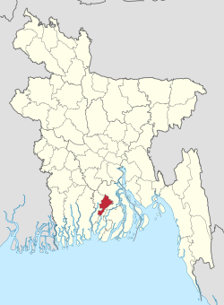 Location of Jhalokati in Bangladesh | |
 Expandable map of Jhalokati District | |
| Coordinates: 22°34′N 90°09′E / 22.567°N 90.150°E | |
| Country | |
| Division | Barisal |
| Headquarters | Jhalokati |
| Government | |
| • Deputy Commissioner | Md. Johar Ali |
| Area | |
| • Total | 706.76 km2 (272.88 sq mi) |
| Population | |
| • Total | 661,160 |
| • Density | 940/km2 (2,400/sq mi) |
| Time zone | UTC+06:00 (BST) |
| HDI (2018) | 0.672[2] medium · 2nd of 21 |
| Website | www |
Jhalokati, also spelled Jhalokathi, (Bengali: ঝালকাঠি) is a district in southern Bangladesh.[3] It is located in the Barisal Division and covers an area of 758.06 km2 It is bounded by Barisal district to the north and east, Barguna district and the Bishkhali river in the south, and Pirojpur district to the west. Annual average temperatures: maximum 33.3 °C, minimum 12.1 °C; annual rainfall 2506 mm. The main rivers in this district are the Bishkhali, Dhanshiri, Gabkhan, Sugandha, Jangalia, Bamanda and Bajitpur. "পেয়ারা আর শীতলপাটি, এই নিয়ে ঝালকাঠি" "(Jhalokathi, The land of tasty Guava and Shitolpati)" is the official moto of the district.[4]
YouTube Encyclopedic
-
1/1Views:10 713
-
Basic information of Jhalakathi district. ঝালকাঠি জেলার তথ্য। General knowledge.
Transcription
History
The 2021 Bangladesh ferry fire occurred on the Sugandha River near the town.[5]
Subdivisions
The district is administratively subdivided into 4 upazilas, these are:
Administration
Zilla Parishad Chairman/Administrator: Khan Saifullah Panir (খান সাইফুল্লাহ পনির) [6]
Deputy Commissioner (DC): Md. Johar Ali [7][8]
Transportation
- Roads & Highways:
- Rural communications: Water transport is a major attraction in Jhalokati district. People can travel at a cheap cost by boats and various types of engine boats. Jhalokati is famous for its beautiful rivers and canals. Tourists can find it enjoyable to travel through boats.
Population
| Year | Pop. | ±% p.a. |
|---|---|---|
| 1974 | 496,791 | — |
| 1981 | 583,102 | +2.31% |
| 1991 | 666,139 | +1.34% |
| 2001 | 694,231 | +0.41% |
| 2011 | 682,669 | −0.17% |
| 2022 | 661,160 | −0.29% |
| Sources:[1][9] | ||
According to the 2022 Census of Bangladesh, Jhalokati District had 162,401 households and a population of 661,160. 121,894 (18.44%) were under 10 years of age. The population density was 935 people per km2. Jhalokati district had a literacy rate (age 7 and over) of 83.21%, compared to the national average of 74.80%, and a sex ratio of 1088 females per 1000 males. 27.85% of the population lived in urban areas.[1]
Religion
| Religion | Population (1941)[10]: 100–101 | Percentage (1941) | Population (2022)[1] | Percentage (2022) |
|---|---|---|---|---|
| Islam |
252,292 | 64.09% | 599,593 | 90.69% |
| Hinduism |
141,259 | 35.89% | 61,352 | 9.28% |
| Others [b] | 82 | 0.02% | 215 | 0.03% |
| Total Population | 393,633 | 100% | 661,160 | 100% |
A large majority of the district population is Muslim. It has 2475 mosques, 46 Hindu temples and five Buddhist pagodas. The percentage share of minority Hindus and Christians has seen a decline in absolute numbers since the 1981 census.
Most people of this district speaks Barisali dialect of Bengali which is the dialect of nearby Barisal city.
Media
- Prothom Alo (National)
- Kaler kantho (National)
- Samakal (National)
- The Daily Star (National)
- Akash dth.
Notable personalities
- Maqsudullah, Islamic scholar and first Pir of Talgachhia
- Nachiketa Chakraborty, famous Tollywood singer's family hails from Chechri Rampur village in Kathalia Upazila[11]
- Kabir Ahmed, former international footballer who played for the Pakistan
See also
Notes
- ^ Nalchiti, Jhalokati, Rajapur and Kathalia thanas of Bakerganj district
- ^ Including Jainism, Christianity, Buddhism, Zoroastrianism, Judaism, Ad-Dharmis, or not stated
References
- ^ a b c d e Population and Housing Census 2022 National Report (PDF). Vol. 1. Bangladesh Bureau of Statistics. November 2023.
- ^ "Sub-national HDI - Area Database - Global Data Lab". hdi.globaldatalab.org. Retrieved 18 March 2020.
- ^ a b Rahman, Humayun (2012). "Jhalokati District". In Islam, Sirajul; Jamal, Ahmed A. (eds.). Banglapedia: National Encyclopedia of Bangladesh (Second ed.). Asiatic Society of Bangladesh.
- ^ ছবিতে জেলা ব্র্যান্ডিং [District Branding]. Jhalokati District (in Bengali).
- ^ "Bangladesh: Death toll rises to 41 in ferry fire on Sugandha River". Free Press Journal. Retrieved 30 December 2021.
- ^ "ভোট ছাড়াই চেয়ারম্যান হচ্ছেন ১৯ জন". Jugantor. 16 September 2022.
- ^ "List of Deputy Commissioners". Ministry of Public Administration.
- ^ "Officers: Deputy Commissioner's Office".
- ^ "Bangladesh Population and Housing Census 2011 Zila Report – Jhalokati" (PDF). bbs.gov.bd. Bangladesh Bureau of Statistics.
- ^ "Census of India, 1941 Volume VI Bengal Province" (PDF). Retrieved 13 August 2022.
- ^ "Shekorer taane Nachiketa ghure gelen Nachiketa". amaderbarisal.com. 18 November 2014. Retrieved 22 September 2019.
Capital: Jhalokati | ||
| Upazilas | ||
| Constituencies | ||
| Inhabited areas | ||
| History | ||
| Sites | ||
| Barisal Division |  | |
|---|---|---|
| Chittagong Division | ||
| Dhaka Division | ||
| Khulna Division | ||
| Mymensingh Division | ||
| Rajshahi Division | ||
| Rangpur Division | ||
| Sylhet Division | ||
| International | |
|---|---|
| National | |
This Barisal Division location article is a stub. You can help Wikipedia by expanding it. |