
Jainca
尖扎县 · གཅན་ཚ་རྫོང་། Chentsa, Jainzha | |
|---|---|
 Lijiaxia lake in Janica | |
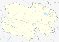
 Jainca County (light red) within Huangnan Prefecture (yellow) and Qinghai | |
 Jainca Location of the seat in Qinghai | |
| Coordinates: 35°56′18″N 102°02′00″E / 35.93833°N 102.03333°E | |
| Country | China |
| Province | Qinghai |
| Autonomous prefecture | Huangnan |
| County seat | Markhu Thang |
| Area | |
| • Total | 1,714 km2 (662 sq mi) |
| Elevation | 1,990 m (6,530 ft) |
| Population (2020)[1] | |
| • Total | 58,173 |
| • Density | 34/km2 (88/sq mi) |
| Time zone | UTC+8 (China Standard) |
| Postal code | 811200 |
| Area code | 0973 |
| Website | www |
| Jainca County | |||||||
|---|---|---|---|---|---|---|---|
| Chinese name | |||||||
| Simplified Chinese | 尖扎县 | ||||||
| Traditional Chinese | 尖扎縣 | ||||||
| |||||||
| Tibetan name | |||||||
| Tibetan | གཅན་ཚ་རྫོང་། | ||||||
| |||||||
Jainca County, Chentsa County or Jainzha County (Tibetan: གཅན་ཚ།, Wylie: gcan tsha; Chinese: 尖扎县; pinyin: Jiānzhā Xiàn) is a county in Huangnan Tibetan Autonomous Prefecture in Qinghai Province, China, to Tibetans in the area known as Malho Prefecture, part of Amdo. There are six townships, three towns and a total of 79 administrative villages in Chentsa county. The county has an area of 1714 square kilometres and a population of ~50,000 (2001), 67% Tibetan. The county seat is the town of Markhu Thang.
YouTube Encyclopedic
-
1/2Views:2 163458
-
Paradise resort, Inner Mongolia, Travel, to an autonomous region, of northern, China.
-
འཕགས་བསྟོད་འཆད་ཁྲིད། ཉིན་དང་པོ། འཆད་ཁྲིད་པ། དགེ་བཤེས་ལྷ་རམས་པ་རོང་པོ་བློ་བཟང་སྙན་གྲགས།
Transcription
Administrative divisions
Jainca County is made up of 3 towns and 6 townships:
| Name | Simplified Chinese | Hanyu Pinyin | Tibetan | Wylie | Administrative division code | |
|---|---|---|---|---|---|---|
| Towns | ||||||
| Markhu Thang Town (Markutang, Magitang, Maketang) |
马克堂镇 | Mǎkètáng Zhèn | མར་ཁུ་ཐང་གྲོང་བརྡལ། | mar khu thang grong brdal | 632322100 | |
| Kangyang Town (Dongna) |
康扬镇 | Kāngyáng Zhèn | གདོང་སྣ་གྲོང་བརྡལ། | gdong sna grong brdal | 632322101 | |
| Kamra Town (Kanbula) |
坎布拉镇 | Kǎnbùlā Zhèn | ཁམས་ར་གྲོང་རྡལ། | khams ra grong rdal | 632322102 | |
| Townships | ||||||
| Gya'gya Township (Jiajia) |
贾加乡 | Jiǎjiā Xiāng | སྐྱ་རྒྱ་ཞང་། | skya rgya zhang | 632322200 | |
| Cozhug Township (Cuozhou) |
措周乡 | Cuòzhōu Xiāng | ཚོ་དྲུག་ཞང་། | tsho drug zhang | 632322201 | |
| Nangra Township (Angla) |
昂拉乡 | Ánglā Xiāng | སྣང་ར་ཞང་། | snang ra zhang | 632322202 | |
| Nangkog Township (Nengke) |
能科乡 | Néngkē Xiāng | ནང་ཁོག་ཞང་། | nang khog zhang | 632322203 | |
| Dêngso Township (Dangshun) |
当顺乡 | Dàngshùn Xiāng | སྟེང་སོ་ཞང་། | steng so zhang | 632322204 | |
| Jaincatang Township (Jianzhatan) |
尖扎滩乡 | Jiānzhātān Xiāng | གཅན་ཚ་ཐང་ཞང་། | gcan tsha thang zhang | 632322205 | |
Climate
Jainca County has a cold semi-arid climate (Köppen BSk) and it set the record high temperature of Qinghai[citation needed], at 40.3 °C (104.5 °F), on July 24, 2000.
| Climate data for Jainca County (1991–2020 normals, extremes 1981–2010) | |||||||||||||
|---|---|---|---|---|---|---|---|---|---|---|---|---|---|
| Month | Jan | Feb | Mar | Apr | May | Jun | Jul | Aug | Sep | Oct | Nov | Dec | Year |
| Record high °C (°F) | 12.7 (54.9) |
18.2 (64.8) |
29.5 (85.1) |
34.5 (94.1) |
31.6 (88.9) |
33.1 (91.6) |
40.3 (104.5) |
36.0 (96.8) |
31.9 (89.4) |
26.0 (78.8) |
18.9 (66.0) |
12.8 (55.0) |
40.3 (104.5) |
| Mean daily maximum °C (°F) | 3.1 (37.6) |
7.2 (45.0) |
13.0 (55.4) |
18.9 (66.0) |
22.2 (72.0) |
25.2 (77.4) |
27.2 (81.0) |
26.3 (79.3) |
21.4 (70.5) |
16.2 (61.2) |
10.3 (50.5) |
4.5 (40.1) |
16.3 (61.3) |
| Daily mean °C (°F) | −4.7 (23.5) |
−0.6 (30.9) |
5.2 (41.4) |
11.1 (52.0) |
14.9 (58.8) |
18.2 (64.8) |
20.1 (68.2) |
19.3 (66.7) |
14.8 (58.6) |
8.9 (48.0) |
2.2 (36.0) |
−3.5 (25.7) |
8.8 (47.9) |
| Mean daily minimum °C (°F) | −10.5 (13.1) |
−6.6 (20.1) |
−0.8 (30.6) |
4.6 (40.3) |
8.6 (47.5) |
12.0 (53.6) |
14.2 (57.6) |
13.8 (56.8) |
10.0 (50.0) |
3.6 (38.5) |
−3.7 (25.3) |
−9.2 (15.4) |
3.0 (37.4) |
| Record low °C (°F) | −18.8 (−1.8) |
−16.4 (2.5) |
−13.7 (7.3) |
−6.8 (19.8) |
−1.5 (29.3) |
3.5 (38.3) |
5.6 (42.1) |
6.9 (44.4) |
1.2 (34.2) |
−7.5 (18.5) |
−14.0 (6.8) |
−18.7 (−1.7) |
−18.8 (−1.8) |
| Average precipitation mm (inches) | 0.8 (0.03) |
1.0 (0.04) |
4.4 (0.17) |
15.5 (0.61) |
46.5 (1.83) |
55.0 (2.17) |
74.7 (2.94) |
77.6 (3.06) |
59.2 (2.33) |
18.5 (0.73) |
1.3 (0.05) |
0.3 (0.01) |
354.8 (13.97) |
| Average precipitation days (≥ 0.1 mm) | 1.0 | 1.4 | 3.2 | 5.3 | 10.0 | 13.3 | 13.4 | 12.1 | 12.9 | 7.1 | 1.5 | 0.5 | 81.7 |
| Average snowy days | 2.1 | 2.8 | 3.9 | 1.3 | 0.1 | 0 | 0 | 0 | 0 | 0.7 | 2.1 | 1.6 | 14.6 |
| Average relative humidity (%) | 39 | 37 | 38 | 39 | 48 | 54 | 59 | 60 | 64 | 58 | 46 | 41 | 49 |
| Mean monthly sunshine hours | 205.4 | 203.9 | 233.3 | 243.5 | 246.4 | 230.1 | 239.0 | 229.2 | 186.8 | 210.4 | 213.0 | 207.7 | 2,648.7 |
| Percent possible sunshine | 66 | 66 | 62 | 62 | 56 | 53 | 54 | 56 | 51 | 61 | 70 | 69 | 61 |
| Source: China Meteorological Administration[2][3] | |||||||||||||
See also
References
- ^ "黄南州第七次全国人口普查公报(第二号)——县级常住人口情况" (in Chinese). Government of Huangnan Prefecture. 2021-07-01.
- ^ 中国气象数据网 – WeatherBk Data (in Simplified Chinese). China Meteorological Administration. Retrieved 27 August 2023.
- ^ 中国气象数据网 (in Simplified Chinese). China Meteorological Administration. Retrieved 27 August 2023.
External links
This Qinghai location article is a stub. You can help Wikipedia by expanding it. |