
Inquisivi | |
|---|---|
Province | |
 The village of Quime | |
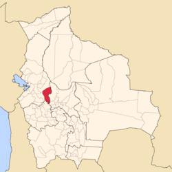 Map of Bolivia highlighting the province of Inquisivi within the La Paz Department. | |
 Provinces of the La Paz Department | |
| Coordinates: 16°50′S 67°10′W / 16.833°S 67.167°W | |
| Country | |
| Departament | La Paz |
| Municipalities | 6 |
| Founded | November 2, 1844 |
| Capital | Inquisivi |
| Area | |
| • Total | 6,430 km2 (2,480 sq mi) |
| Population (2012)[1] | |
| • Total | 66,346 |
| • Density | 10/km2 (27/sq mi) |
| • Ethnicities | Aymara Quechua |
| Time zone | UTC-4 (BOT) |
| Website | Official website |
Inquisivi is a province in the La Paz Department in Bolivia. During the presidency of José Ballivián it was created on November 2, 1844. The capital of the province is Inquisivi.
Geography
The Kimsa Cruz mountain range traverses the province. Some of the highest mountains of the province are listed below:[2][3][4][5][6][7]
- Apachita
- Chachakumani
- Chunkara
- Ch'amak Qullu
- Ch'iyar Jaqhi
- Inka Laqaya
- Iru Pata
- Iskayuni
- Jach'a Pukara
- Jach'a Warmi Qullu
- Jaqi Jiwata
- Janq'u Qullu
- Janq'u Quta
- Juqhuri
- Kimsa Llallawa
- Kimsa Q'awa
- Kimsa Willk'i
- Kuntur Samaña
- León Jiwata
- Pichaqani
- Pirwachani
- Pukara
- Pukara Qullu
- Qala Piwrani
- Qina Qina
- Qullqi Pata
- Q'uwa Qullu
- Tanka Tankani
- Turi Jaqhi
- Turini
- T'ula T'ulani
- Wankarani
- Wari Ikiña
- Warmi Qullu
- Wila Qullu
- Wisk'acha Punta
- Wisk'achani
Subdivision
Inquisivi Province is divided into six municipalities which are further subdivided into cantons.
| Municipality | Inhabitants (2001) [8] | Seat | Inhabitants (2001) |
|---|---|---|---|
| Inquisivi Municipality | 16,143 | Inquisivi | 581 |
| Quime Municipality | 7,338 | Quime | 2,439 |
| Cajuata Municipality | 7,757 | Cajuata | 875 |
| Colquiri Municipality | 18,351 | Colquiri | 4,004 |
| Ichoca Municipality | 6,839 | Ichoca | 517 |
| Licoma Pampa Municipality | 2,739 | Licoma | 1,036 |
See also
References
- ^ www.ine.gov.bo Archived 2009-11-13 at the Wayback Machine - Instituto Nacional de Estadística de Bolivia (in Spanish)
- ^ Evelio Echevarría, Cordillera Quimsa Cruz, Bolivia, see sketch map p. 153
- ^ Bolivian IGM map 1:100,000 Colquiri 3436
- ^ Bolivian IGM map 1:50,000 Estancia Choquetanga Chico 6143-IV
- ^ Bolivian IGM map 1:50,000 6142-IV 'Yaco'
- ^ Bolivian IGM map 1:50,000 Leque 6241-III
- ^ "Colquiri". INE, Bolivia. Archived from the original on March 28, 2016. Retrieved March 19, 2016.
- ^ Instituto Nacional de Estadística Archived 2009-11-13 at the Wayback Machine (Spanish)
External links

16°50′S 67°10′W / 16.833°S 67.167°W