
Inavale, Nebraska | |
|---|---|
 Blaine Street (U.S. Route 136) in Inavale, October 2013 | |
 Inavale, Nebraska Location within the state of Nebraska | |
| Coordinates: 40°05′32″N 98°38′54″W / 40.09222°N 98.64833°W | |
| Country | United States |
| State | Nebraska |
| County | Webster |
| Area | |
| • Total | 0.33 sq mi (0.86 km2) |
| • Land | 0.33 sq mi (0.86 km2) |
| • Water | 0.00 sq mi (0.00 km2) |
| Elevation | 1,739 ft (530 m) |
| Population (2020) | |
| • Total | 66 |
| • Density | 197.60/sq mi (76.32/km2) |
| Time zone | UTC-6 (Central (CST)) |
| • Summer (DST) | UTC-5 (CDT) |
| ZIP codes | 68952 |
| FIPS code | 31-23725 |
| GNIS feature ID | 2583882[2] |
Inavale is a census-designated place in western Webster County, Nebraska, United States.
YouTube Encyclopedic
-
1/3Views:46514 945470
-
My trip to Red Cloud & back
-
How to setup a VOIP phone - In just two steps!
-
UNK Homecoming Lip Sync 2013 - Mantor Hall
Transcription
Description
The community lies along U.S. Route 136, west of the city of Red Cloud, the county seat of Webster County.[3] Its elevation is 1,736 feet (529 m).[4]
A post office was established at Invale in 1873, and remained in operation until it was discontinued in 1994.[5] Inavale retains the ZIP code of 68952.[6] The town's name is descriptive, from its setting in a vale.[7]
Demographics
| Census | Pop. | Note | %± |
|---|---|---|---|
| 2020 | 66 | — | |
| U.S. Decennial Census[8] | |||
See also
References
- ^ "ArcGIS REST Services Directory". United States Census Bureau. Retrieved September 18, 2022.
- ^ a b U.S. Geological Survey Geographic Names Information System: Inavale, Nebraska
- ^ Rand McNally. The Road Atlas '08. Chicago: Rand McNally, 2008, p. 63.
- ^ U.S. Geological Survey Geographic Names Information System: Inavale, Nebraska, Geographic Names Information System, 1979-03-09. Accessed 2008-04-26.
- ^ "Webster County". Jim Forte Postal History. Retrieved August 24, 2014.
- ^ Zip Code Lookup
- ^ Fitzpatrick, Lillian L. (1960). Nebraska Place-Names. University of Nebraska Press. p. 145. ISBN 0-8032-5060-6. A 1925 edition is available for download at University of Nebraska—Lincoln Digital Commons.
- ^ "Census of Population and Housing". Census.gov. Retrieved June 4, 2016.
External links
![]() Media related to Inavale, Nebraska at Wikimedia Commons
Media related to Inavale, Nebraska at Wikimedia Commons
Municipalities and communities of Webster County, Nebraska, United States | ||
|---|---|---|
| Cities | 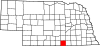 | |
| Villages | ||
| CDP | ||
| Unincorporated communities | ||
This Webster County, Nebraska state location article is a stub. You can help Wikipedia by expanding it. |