
João Batista Bos Filho Airport Aeroporto João Batista Bos Filho | |||||||||||
|---|---|---|---|---|---|---|---|---|---|---|---|
| Summary | |||||||||||
| Airport type | Public | ||||||||||
| Operator | DAP | ||||||||||
| Serves | Ijuí | ||||||||||
| Time zone | BRT (UTC−03:00) | ||||||||||
| Elevation AMSL | 365 m / 1,197 ft | ||||||||||
| Coordinates | 28°22′07″S 053°50′47″W / 28.36861°S 53.84639°W | ||||||||||
| Map | |||||||||||
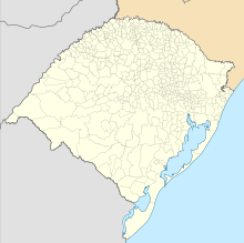 IJU Location in Brazil  IJU IJU (Brazil) | |||||||||||
| Runways | |||||||||||
| |||||||||||
João Batista Bos Filho Airport (IATA: IJU, ICAO: SSIJ) is the airport serving Ijuí, Brazil.
It is operated by DAP.
Airlines and destinations
No scheduled flights operate at this airport.
Access
The airport is located 8 km (5 mi) from downtown Ijuí.
See also
References
- ^ "Aeródromos". ANAC (in Portuguese). 29 June 2020. Retrieved 17 May 2021.
- ^ "Ijuí (SSIJ)". DECEA (in Portuguese). Retrieved 24 September 2023.
External links
- Airport information for SSIJ at Great Circle Mapper. Source: DAFIF (effective October 2006).
- Current weather for SSIJ at NOAA/NWS
- Accident history for IJU at Aviation Safety Network
Airports in Rio Grande do Sul | |
|---|---|