
A triple divide or triple watershed is a point on Earth's surface where three drainage basins meet. A triple divide results from the intersection of two drainage divides. Triple divides range from prominent mountain peaks to minor side peaks, down to simple slope changes on a ridge which are otherwise unremarkable. The elevation of a triple divide can be thousands of meters to barely above sea level. Triple divides are a common hydrographic feature of any terrain that has rivers, streams and/or lakes.
Topographic triple divides do not necessarily respect the underground path of water. Thus, depending on the infiltration and the different geological layers, the hydrologic triple divide is often offset from the topographic triple divide.
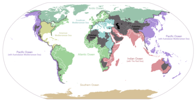
A hydrological apex is a triple divide whose waters flow into three different oceans. Triple Divide Peak in the U.S. state of Montana and, depending on definition, Snow Dome in Canada are the only such places on Earth.[notes 1]
YouTube Encyclopedic
-
1/5Views:1 6242 66640568 179845 257
-
Triple Divide | Fracking Documentary | Chapter 1
-
Triple Divide Peak Glacier National Park
-
VIDEO 2 Triple Divide
-
How to Simplify a Fraction over a Number and a Number over a Fraction
-
बड़ी संख्या का भाग कैसे करें // भाज्य, भाजक, भागफल क्या है//divisionforkids
Transcription
in pennsylvania water dominates the land 86,000 miles of rivers divide the landscape shaping life in every direction it controls the way we travel, the way we live our designs, and the type of energy we use carrying us on its back and keeping us on the go. But how often do we take time to think about where all this water comes from or how long will flow safe and to our glass to begin the day on a remote hilltop farm in north central Pennsylvania rain falls and flows to three separate sides of the North American continent these vast drainage basins are created where two continental divides come together to form a single peak this is the TRIPLE DIVIDE one of four triple continental divides in North America it's a phenomenon that forms headwaters for three major East Coast river systems giving birth to the Allegheny and Genesee rivers the Allegheny River begins its journey on the hilltop farm and crosses New York border before finding its way to the Ohio River in Pittsburgh where it then travels half the country before emptying into the gulf of mexico the Genesee River flows directly north into the Saint Lawrence River Basin at Lake Ontario TRIPLE DIVIDE headwaters also travel south east into the West Branch of the Susquehanna River where it flows to its end at the Chesapeake Bay for the TRIPLE DIVIDE Everything is Downstream
Africa
An unnamed hill on the border between the Central African Republic and South Sudan: the exact point is at 09°08′24″N 23°28′07″E / 9.14000°N 23.46861°E. Water from this point flows to the Atlantic Ocean via the Congo River, to the Mediterranean Sea via the Nile, or to endorheic Lake Chad. At this point meet the second, third and eighth largest drainage basins in the world, making it one of the most important triple divides on earth.[1]
Antarctica
Antarctica is completely circled by the Southern Ocean, and so it has no triple divides.
Older definitions of the oceans did not include the Southern Ocean, and instead had the Atlantic, Pacific and Indian Oceans touch the shores of Antarctica. Based on this outdated definition, Dome Argus is the highest point in the East Antarctic ice sheet and could be considered a triple divide if it is assumed that the ice forms a watershed. (80°22′S 77°21′E / 80.367°S 77.350°E)[2]
Asia
Asia is dominated by endorheic basins. There is a point in southern China where the Pacific Ocean, Indian Ocean, and endorheic basins meet and another point in northern China where the Pacific Ocean, endorheic and Arctic Ocean basins meet.[3]
Australia
Australia has two continental drainage divide tripoints, both close to each other along Queensland's Great Dividing Range. Both are named after two 1845 exploration party leaders who sought to solve the question of Australia's rivers, Thomas Mitchell and Edmund Kennedy.
- Mitchell Junction is in North Queensland, on Triple C Pastoral Station, near the White Mountains National Park. Water falling on the tripoint can flow either to the Pacific Ocean via the Burdekin River, to the Indian Ocean, via the Flinders River flowing to the Gulf Of Carpentaria and the Indonesian Throughflow and lastly to Lake Eyre via Cooper Creek. approximately 20°20′58″S 145°03′17″E / 20.349540608585798°S 145.05459085035665°E
- Kennedy Junction is in Central Queensland, on Caldervale Station, near Carnarvon National Park. Water falling on the tripoint can flow either to the Pacific Ocean via the Fitzroy River, to the Southern Ocean, via Murray/Darling River and to Lake Eyre via Cooper Creek. 24°55′22″S 146°49′27″E / 24.9227°S 146.8241°E[4]
Europe

| Landmark name | Coordinates | Location | Watersheds | Divides | Refs |
|---|---|---|---|---|---|
| Lunghin Pass | 46°24′48.71″N 9°39′48.53″E / 46.4135306°N 9.6634806°E | Piz Lunghin, Switzerland | |||
| Klepáč | 50°09′27.01″N 16°47′27″E / 50.1575028°N 16.79083°E | Králický Sněžník Mountains, Czech Republic and Poland |
|
[5] | |
| Unnamed point | 47°56′29.2″N 5°30′17.2″E / 47.941444°N 5.504778°E | Langres, France |
|
||
| Witenwasserenstock | 46°31′41.9″N 8°28′27.3″E / 46.528306°N 8.474250°E | Valais and Uri, Switzerland |
|
||
| Roundway Hill | 51°22′39.0″N 1°59′08.2″W / 51.377500°N 1.985611°W | Devizes, Wiltshire, United Kingdom |
|
[6] |
North America


North America has 3 triple divides in the United States which are intersections of continental divides, and a fourth one in British Columbia. Waters at these triple divides flow into three different oceans, seas or gulfs. Triple Divide Peak in Montana is considered the triple divide "hydrological apex" of North America, though Snow Dome on the Alberta-British Columbia border also has a claim depending on how the Arctic and Atlantic oceans are defined. North America is the only continent that has a triple point dividing basins draining into three different oceans.[7] Where the Continental Divide splits and joins to form the boundary of the Great Divide Basin, it forms two triple points.
Other points are often considered to be triple divides because they separate basins of continental rivers.
- Headwaters Hill in Saguache County, Colorado, near Chester (Arkansas River, Rio Grande River, Colorado River). This point has only a weak claim to being a continental triple divide because both the Rio Grande and Arkansas Rivers flow into the Gulf of Mexico. (38°20′52″N 106°15′11″W / 38.3477709°N 106.2530695°W)[19]
The highest elevation (4,040 m or 13,240 ft) significant triple divide in the lower 48 states of the United States, in Kings Canyon National Park in Fresno/Inyo counties, California, is a sub-peak of Mount Wallace of the central Sierra Nevada:
- Crumbly Spire or Mount Wallace South Peak, Fresno/Inyo counties, California (Tulare Lake via Kings River, Owens Lake via Owens River, Pacific Ocean via San Joaquin River) (37°08′28″N 118°39′15″W / 37.141188°N 118.654119°W)[20]
Numerous other triple divide points result from intersection of river basin divides, including:
- Young Lick Knob, Georgia (Savannah, Apalachicola, Mississippi) (34°49′22″N 83°39′09″W / 34.82278°N 83.65250°W)
South America

There are triple points in South America where the divide splits.
See also
Notes
- ^ a b c Sources disagree on whether Hudson Bay is part of the Atlantic Ocean or the Arctic Ocean. Snow Dome is a hydrological apex only if Hudson Bay is considered to be part of the Atlantic Ocean, but not if it is considered to be part of the Arctic Ocean.
- ^ a b Where the Continental Divide splits in New Mexico and joins in Chihuahua, Mexico, to form the boundary of Guzman Basin are two triple points.
References
- ^ Barbour, K.M. (1961). "A Geographical Analysis of Boundaries in Inter-Tropical Africa". Essays on African Population. Taylor & Francis. GGKEY:W5HTG750C3U. Retrieved 2013-05-04.
- ^ "Dome Argus". Peak Bagger. Retrieved December 28, 2021.
- ^ "Essentials of Endorheic Basins and Lakes: A Review in the Context of Current and Future Water Resource Management and Mitigation Activities in Central Asia, Figure 1, page 2" (PDF). Journal of Water. Retrieved December 28, 2021.
- ^ "Queensland Globe". State of Queensland. Retrieved 9 June 2019.
- ^ "Klepáč – Trójmorski Wierch (CZ/PL)". Sharing Water. Retrieved 2023-10-06.
- ^ "Catchment Data Explorer". Environment Agency. Retrieved 2024-01-03.
- ^ "Ocean Triple Divide Points". Peakbagger.com. Archived from the original on 2017-06-25. Retrieved 2017-07-01.
- ^ "Triple Divide Peak". USGS GNIS. Retrieved December 23, 2021.
- ^ "Canada National Parks Act (S.C. 2000, c. 32)" (PDF). Schedule 1 - National Parks of Canada. Government of Canada. Retrieved 2021-03-21.
- ^ "Triple Continental Divide". Uncovering Pennsylvania. 24 September 2018. Retrieved December 23, 2021.
- ^ "Triple Divide". USGS GNIS. Retrieved December 23, 2021.
- ^ "Hill of Three Waters or Triple Divide". Historical Markers Database. Retrieved December 22, 2021.
- ^ "Cresting the Continental Divide – In Florida?". GeoCaching. Retrieved December 23, 2021.
- ^ Francis, Julie. "The Great Divide and Green River Basins". Wyoming State Geological Survey. Retrieved December 30, 2021.
- ^ "Reeds Peak". USGS GNIS. Retrieved December 23, 2021.
- ^ "List". High Pointers. Retrieved December 23, 2021.
- ^ "Three Waters Mountain". Geographic Names Information System. United States Geological Survey, United States Department of the Interior. Retrieved August 25, 2013.
- ^ "Commissary Ridge Triple Point". Peak Bagger. Retrieved December 24, 2021.
- ^ "Headwaters Hill". USGS.
- ^ "Crumbly Spire". Peak Bagger. Retrieved December 24, 2021.
Citations
- Joseph A. DiPietro (2012-12-21). Landscape Evolution in the United States: An Introduction to the Geography, Geology, and Natural History. Newnes.