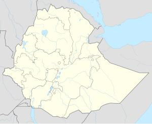
Hurso (Somali language: Huursoo) is a town in eastern Ethiopia. Located in the Shinile Zone of the Somali Region about 40 km west of Dire Dawa, it has a longitude and latitude of 9°36′N 41°38′E / 9.600°N 41.633°E and an altitude of 1130 meters above sea level. It is one of four towns in Erer woreda.
Hurso was served by a station on the Ethio-Djibouti Railways. South of the town is Camp Hurso, where members of the 294th Infantry Regiment, Guam Army National Guard, U.S. Army, spent a year training soldiers of the Ethiopian National Defense Force in 2006.[1]
Hurso was where the founding meeting of the Ethiopian Somali Democratic League was held, under the sponsorship of the Ethiopian People's Revolutionary Democratic Front and the leadership of the two Somali members of the federal cabinet, Federal Minister Abdul Mejid Hussein and Federal Vice-Minister Samsudin Ahmed.[2]
Demographics
The town's inhabitants belong to mainly Saad Musa , Wardiq subclan of the Issa Madoobe Dir who mostly speak Somali and some Oromo. As of recent, due to sever droughts in the region some of the neighbouring issa people have come to or near the town for farming or to graze their livestock. Based on figures from the Central Statistical Agency of Ethiopia published in 2005, Erer has an estimated total population of 3,318 of whom 1,695 are men and 1,623 women.[3] The 1997 census reported this town had a total population of 2,226 of whom 1,120 were men and 1,106 women. The three largest ethnic groups reported in this town were the Gurgura (Somali) (59.88%), the Oromo (22.46%), and the Amhara (11.99%); all other ethnic groups made up the remaining 5.67% of the residents.[4]
References
- ^ "U.S. Units Help Ethiopians Build Capacity", American Forces Press Service website, published 22 April 2006 (accessed 16 October 2009)
- ^ Sarah Vaughan, "Ethnicity and Power in Ethiopia" Archived 2011-08-13 at the Wayback Machine (University of Edinburgh: Ph.D. Thesis, 2003), p. 210 and nn. 214, 215
- ^ CSA 2005 National Statistics Archived 2009-11-13 at the Wayback Machine, Table B.4
- ^ 1994 Population and Housing Census of Ethiopia: Results for Somali Region, Vol. 1 Archived 2008-11-19 at the Wayback Machine Tables 2.4, 2.14 (accessed 10 January 2009). The results of the 1994 census in the Somali Region were not satisfactory, so the census was repeated in 1997.

