
Huimanguillo Municipality | |
|---|---|
 Municipal Palace | |
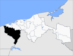 Location of the municipality in Tabasco. | |
| Country | |
| State | Tabasco |
| Time zone | UTC-6 (Central Standard Time) |
| • Summer (DST) | UTC-5 (Central Daylight Time) |
Huimanguillo Municipality is a municipality in the Mexican state of Tabasco in south-eastern Mexico.[1]
The city of Huimanguillo is the municipal seat and the largest city in the Chontalpa region, the Mexican state of Tabasco. It is located at a distance of 67 km from the city of Villahermosa, state capital.

YouTube Encyclopedic
-
1/1Views:9 917
-
HUIMANGUILLO
Transcription
Geography
Climate
| Climate data for Huimanguillo | |||||||||||||
|---|---|---|---|---|---|---|---|---|---|---|---|---|---|
| Month | Jan | Feb | Mar | Apr | May | Jun | Jul | Aug | Sep | Oct | Nov | Dec | Year |
| Mean daily maximum °C (°F) | 27.4 (81.3) |
28.8 (83.8) |
31.8 (89.2) |
34.1 (93.4) |
35.3 (95.5) |
34.3 (93.7) |
33.3 (91.9) |
33.4 (92.1) |
32.6 (90.7) |
30.8 (87.4) |
29.3 (84.7) |
27.4 (81.3) |
31.5 (88.7) |
| Mean daily minimum °C (°F) | 17.5 (63.5) |
18 (64) |
20 (68) |
21.9 (71.4) |
22.7 (72.9) |
23.0 (73.4) |
22.6 (72.7) |
22.7 (72.9) |
22.6 (72.7) |
21.6 (70.9) |
19.8 (67.6) |
18.1 (64.6) |
20.9 (69.6) |
| Average precipitation mm (inches) | 130 (5.1) |
89 (3.5) |
66 (2.6) |
64 (2.5) |
86 (3.4) |
260 (10.1) |
240 (9.5) |
300 (11.8) |
360 (14) |
330 (13.1) |
190 (7.4) |
140 (5.6) |
2,260 (88.8) |
| Source: Weatherbase [2] | |||||||||||||
References
- ^ "-". Enciclopedia de los Municipios de México. Instituto Nacional para el Federalismo y el Desarrollo Municipal. Archived from the original on March 2, 2007. Retrieved January 4, 2010.
- ^ "Weatherbase: Historical Weather for Huimanguillo, Tabasco". Weatherbase. 2011. Retrieved on November 24, 2011.
Villahermosa (capital) | ||
| Municipalities and (municipal seats) |
|  |
17°51′N 93°23′W / 17.850°N 93.383°W