
Town of Hudson | |
|---|---|
 The Hudson Town Hall. | |
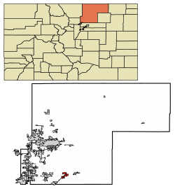 Location of Hudson in Weld County, Colorado. | |
| Coordinates: 40°4′21″N 104°38′24″W / 40.07250°N 104.64000°W | |
| Country | |
| State | |
| County[1] | Weld |
| Incorporated (town) | April 2, 1914[2] |
| Government | |
| • Type | Statutory Town[1] |
| Area | |
| • Total | 5.96 sq mi (15.43 km2) |
| • Land | 5.88 sq mi (15.23 km2) |
| • Water | 0.08 sq mi (0.20 km2) |
| Elevation | 5,000 ft (1,524 m) |
| Population | |
| • Total | 1,651 |
| • Density | 280/sq mi (110/km2) |
| Time zone | UTC-7 (MST) |
| • Summer (DST) | UTC-6 (MDT) |
| ZIP code[6] | 80642 |
| Area code | 303 |
| FIPS code | 08-37820 |
| GNIS feature ID | 0180861 |
| Website | Town of Hudson |
The Town of Hudson is a home rule municipality[7] in Weld County, Colorado, United States. The population was 1,651 at the 2020 census.[5]
A post office called Hudson has been in operation since 1883.[8] The town derives its name from the town company, Hudson City Land and Improvement Co.[9]
Geography
Hudson is located at 40°4′21″N 104°38′24″W / 40.07250°N 104.64000°W (40.072582, -104.639890).[10]
According to the United States Census Bureau, the town has a total area of 2.3 square miles (6.0 km2), of which, 2.3 square miles (6.0 km2) of it is land and 0.04 square miles (0.10 km2) of it (0.85%) is water.
Demographics
| Census | Pop. | Note | %± |
|---|---|---|---|
| 1920 | 322 | — | |
| 1930 | 346 | 7.5% | |
| 1940 | 295 | −14.7% | |
| 1950 | 365 | 23.7% | |
| 1960 | 430 | 17.8% | |
| 1970 | 518 | 20.5% | |
| 1980 | 698 | 34.7% | |
| 1990 | 918 | 31.5% | |
| 2000 | 1,565 | 70.5% | |
| 2010 | 2,356 | 50.5% | |
| 2020 | 1,651 | −29.9% |
References
- ^ a b "Active Colorado Municipalities". State of Colorado, Department of Local Affairs. Archived from the original on December 12, 2009. Retrieved September 1, 2007.
- ^ "Colorado Municipal Incorporations". State of Colorado, Department of Personnel & Administration, Colorado State Archives. December 1, 2004. Retrieved September 2, 2007.
- ^ "2019 U.S. Gazetteer Files". United States Census Bureau. Retrieved July 1, 2020.
- ^ "US Board on Geographic Names". United States Geological Survey. October 25, 2007. Retrieved January 31, 2008.
- ^ a b United States Census Bureau. "Hudson town, Colorado". Retrieved April 19, 2023.
- ^ "ZIP Code Lookup". United States Postal Service. Archived from the original (JavaScript/HTML) on November 4, 2010. Retrieved October 9, 2007.
- ^ "Town of Hudson Home Rule Charter". Retrieved June 2, 2019.
- ^ "Post offices". Jim Forte Postal History. Retrieved June 27, 2016.
- ^ Dawson, John Frank. Place names in Colorado: why 700 communities were so named, 150 of Spanish or Indian origin. Denver, CO: The J. Frank Dawson Publishing Co. p. 27.
- ^ "US Gazetteer files: 2010, 2000, and 1990". United States Census Bureau. February 12, 2011. Retrieved April 23, 2011.
External links
Municipalities and communities of Weld County, Colorado, United States | ||
|---|---|---|
| Cities |  | |
| Towns | ||
| CDPs | ||
| Unincorporated communities | ||
| Ghost towns | ||
| Trading posts | ||
| Footnotes | ‡This populated place also has portions in an adjacent county or counties | |
| International | |
|---|---|
| National | |