
| Hotokegaura | |
|---|---|
 typical rock formations at Hotokegaura | |
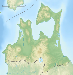 Location of Hotokegaura  Hotoke-ga-ura (Japan) | |
| Location | Sai, Shimokita, Aomori Prefecture, Japan |
| Coordinates | 41°18′43.9″N 140°48′18.4″E / 41.312194°N 140.805111°E |
| Length | 1.5 km (0.93 mi) |
| Established | April 23, 1941 |
Hotokegaura (仏ヶ浦 also 仏宇多, Hotoke-ga-ura) is a series of rock formations along the sea cliffs on the west coast of Shimokita Peninsula at the entrance to Mutsu Bay in far northern Japan. These rock formations were designed a Natural Monument of Aomori Prefecture in 1934, and became further protected from April 23, 1941 as a nationally designated Place of Scenic Beauty and Natural Monument,[1][2] From 1968, the rock formations were also located within the borders of the Shimokita Hantō Quasi-National Park. In 1975, the surrounding waters were designated as Hotokegaura Marine Park.
YouTube Encyclopedic
-
1/3Views:58836 2409 064
-
にーはんと旅に出よう 青森編 第一部中編
-
青木慈雲 7 東北鎮魂の旅 空飛ぶ慈雲、ついに霊界の入口を発見!
-
Golden Buddha Beach Resort
Transcription
Overview
These natural wave-eroded formations are made from green volcanic tuff, with a height of approximately 90 metres (300 ft) and extend for a 1.5 kilometres (0.93 mi) stretch of coastline in the village of Sai, Aomori Prefecture. Individual features have been named for figures in Buddhist theology, and were popularised by the poet and mountaineer Omachi Keigetsu (1869-1925) after his visit in September 1922, although the area had been well-known since the Edo period at part of the pilgrimage route to Mount Osore.
The area is difficult to reach overland despite its proximity to Japan National Route 338, and tourist boats depart from the village of Sai or the city of Mutsu from April through October. In 1991, a small jetty was constructed for the purpose of berthing a sightseeing boat
See also
Gallery
-

Panorama
-

Rock formations
-

Monument to Omachi Keigetsu
References
- Teikoku's Complete Atlas of Japan, Teikoku-Shoin Co., Ltd. Tokyo 1990, ISBN 4-8071-0004-1
External links
- Hotokegaura homepage (in Japanese)
- Aomori Prefectural home page
- Japan National Tourism Organization home page
- Sai Village Tourism Association
Notes
- ^ "仏宇多(仏ヶ浦". Agency for Cultural Affairs. Retrieved 1 May 2020.
- ^ "Hotokegaura". Aomori Prefecture. Retrieved 10 February 2012.
This Aomori Prefecture location article is a stub. You can help Wikipedia by expanding it. |