
| Higham | |
|---|---|
 Saint John the Evangelist Church | |
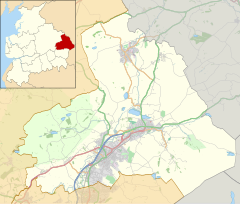 Higham Location in Pendle Borough  Higham Location within Lancashire | |
| Population | 778 [1] |
| OS grid reference | SD805365 |
| Civil parish |
|
| District | |
| Shire county | |
| Region | |
| Country | England |
| Sovereign state | United Kingdom |
| Post town | BURNLEY |
| Postcode district | BB12 |
| Dialling code | 01282 |
| Police | Lancashire |
| Fire | Lancashire |
| Ambulance | North West |
| UK Parliament | |

Higham is a village in the Borough of Pendle in Lancashire, England, south of Pendle Hill. The civil parish is named Higham with West Close Booth. The village is 2 miles (3 km) north-east of Padiham and about 4 miles (6 km) south-west of Nelson along the A6068 road.
According to the United Kingdom Census 2011, the parish has a population of 778,[1] a decrease from 808 in the 2001 census.[2]
The parish adjoins the other Pendle parishes of Goldshaw Booth, Old Laund Booth and Reedley Hallows, the Burnley parishes of Ightenhill and Padiham, and the Ribble Valley parishes of Simonstone and Sabden. The area of the parish north of Stump Hall Road is part of the Forest of Bowland Area of Outstanding Natural Beauty (AONB).[3]
YouTube Encyclopedic
-
1/2Views:314363
-
Higham St John's - Reception Year Preview
-
Walking the Pendle Way Part 6 - 8
Transcription
Governance
Higham with West Close Booth was once a township in the ancient parish of Whalley. This became a civil parish in 1866, forming part of the Burnley Rural District from 1894. The township included a detached area south of the village of Fence,[4] but this part transferred to Old Laund Booth in 1898. A part of the parish also transferred to Sabden on its creation in 1904.[a][5] The neighbouring civil parish of North Town (historically associated with Padiham) was merged into Simonstone in 1983. However, after a public campaign to move Simonstone into the Borough of Ribble Valley and Boundary Commission review completed in 1985, a part of North Town lying north of the A6068 Padiham Bypass was added to this parish.[6]
Along with Goldshaw Booth, Barley-with-Wheatley Booth and Roughlee Booth, the parish forms the Higham with Pendleside ward of Pendle Borough Council.[7]
Facilities
The centre of Higham is a conservation area.[8] The buildings in the area are stone-built, mainly from the 19th century with a few even older. Several farmhouses and barns have been converted to houses. Outside the Conservation Area most buildings are from later periods, including modern housing estates.
Amenities include a pub, the Four Alls Inn, est. 1798 where one can discover the meaning of "Four Alls";[9] the Church of St. John the Evangelist (C of E) built 1874,[10] Higham C of E (Controlled) Primary School,[11] and the Village Hall.[12]
Buildings and features
The Spout is a feature in the centre of the village, providing constant natural spring water. Nearby is the historic site of a pinfold or poundfield, a walled area with grass and running water which was used to temporarily impound animals.
Other buildings of note include the village hall, 1837, which was built as the National School and also used for Church of England services until St. John's Church was built. Higham Hall, 17th century, had been used for meetings of the court of the Forest of Pendle. Clover Croft Mill stood in the centre of the village, having latterly been used as a furniture factory. The demolition was completed in 2006 to enable a housing development to be built on the site.
On the road to Nelson are three buildings of interest: Lower White Lee (18th century), Higher White Lee birthplace of Jonas Moore (see below), Ashlar House has a porch dated 1594 with the names Richard Grimshaw and John Box, but the house seems to have been rebuilt in the 17th century.
Notable residents
- Herbert Butterworth (1902–1938) professional footballer, born in Higham.
- Harry Hargreaves (1896–1975) professional footballer, born in Higham.
- Jonas Moore (1617–1679) later Sir Jonas Moore FRS, was an English mathematician, surveyor, Ordnance officer and patron of astronomy, born at White Lee, now Higher White Lee Farm, Higham.[13]
- The Pendle Witches. One of the families swept up in the Pendle Witch Trials of 1612 was the 'Chattox' clan, based in West Close where the old crone Mother Chattox lived and her family pursued their work of professional begging. In Alizon Device's confession she told that "Anne Whittle, alias Chattox, was suspected for bewitching the drinke of John Moore of Higham, gentleman"[14] and for causing one of his sons to die. The landlord of the pub, The Four Alls, accused Chattox of putting a curse on his brew. The suspected witches were first examined at Ashlar House, by local Magistrate Roger Nowell of nearby Read Hall.
See also
References
Notes
Citations
- ^ a b UK Census (2011). "Local Area Report – Higham-with-West Close Booth Parish (1170215072)". Nomis. Office for National Statistics. Retrieved 3 March 2018.
- ^ Office for National Statistics : Census 2001 : Key Statistics Retrieved 2 September 2015
- ^ Forest of Bowland map (Map). forestofbowland.com. Lancashire County Council.
- ^ a b Lancashire and Furness (Map) (1st ed.). 1 : 10,560. County Series. Ordnance Survey. 1848.
- ^ "Higham with West Close Booth Tn/CP through time". visionofbritain.org.uk. GB Historical GIS / University of Portsmouth. Retrieved 4 September 2015.
- ^ "Local Government Boundary Commission For England Report No. 5O5" (PDF). Local Government Boundary Commission For England. October 1985. Archived from the original (PDF) on 18 November 2015. Retrieved 13 March 2017.
- ^ "Higham with Pendleside". Ordnance Survey Linked Data Platform. Ordnance Survey. Retrieved 2 September 2015.
- ^ Higham Conservation Area map
- ^ Parish Council website section for the Four Alls Inn
- ^ St John's Church Higham
- ^ Higham C of E (Controlled) Primary School
- ^ Parish Council website section for the Village Hall
- ^ Willmoth, Frances (2004). "Moore, Sir Jonas (1617–1679)". Oxford Dictionary of National Biography (online ed.). Oxford University Press. doi:10.1093/ref:odnb/19137. (Subscription or UK public library membership required.)
- ^ The Pendle Witches
External links
- BBC website describing a Sunday Stroll in Higham
- Higham Parish Council website
- History of Higham including mills and coal-mining
- Coach tours including Higham
- Higham Weather