
High Springs, Florida | |
|---|---|
| City of High Springs | |
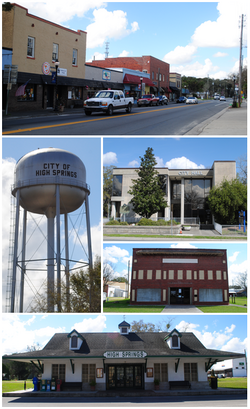 Top, left to right: downtown area, water tower, city hall, Priest Theatre, old railroad depot | |
 Location in Alachua County and the state of Florida | |
| Coordinates: 29°49′N 82°36′W / 29.817°N 82.600°W | |
| Country | United States of America |
| State | Florida |
| County | Alachua |
| Incorporated | 1892 |
| Government | |
| • Type | Commission–Manager |
| • Mayor | Katherine Weitz |
| • Vice Mayor | Tristan Grunder |
| • Commissioners | Steven Tapanes, Andrew Miller, and Byran Williams |
| • City Manager | Ashley Stathatos |
| • City Clerk | Angela Stone |
| Area | |
| • Total | 21.97 sq mi (56.89 km2) |
| • Land | 21.89 sq mi (56.69 km2) |
| • Water | 0.08 sq mi (0.20 km2) |
| Elevation | 66 ft (20 m) |
| Population (2020) | |
| • Total | 6,215 |
| • Density | 283.95/sq mi (109.63/km2) |
| Time zone | UTC-5 (Eastern (EST)) |
| • Summer (DST) | UTC-4 (EDT) |
| ZIP codes | 32643, 32655 |
| Area code | 386 |
| FIPS code | 12-30525[2] |
| GNIS feature ID | 0307633[3] |
| Website | highsprings |
High Springs is a city in Alachua County, Florida, United States. It is the fourth-largest city in Alachua County and seventh-largest in North Central Florida. The population was 6,215 at the 2020 census.[4]
YouTube Encyclopedic
-
1/5Views:5 26257 0513 7926551 932
-
Ginnie Springs - High Springs
-
GINNIE SPRINGS Florida's Secret Paradise
-
GINNIE SPRINGS Florida | Things to do in Florida | High Springs
-
Giant Summer Adventure: Ginnie Springs in High Springs, Florida
-
Road trip 🤿💧 to High Springs, Florida!! First stop Ginnie Springs 🤍
Transcription
History
The present-day area of High Springs was first settled on a permanent basis by English-speaking people during the late 1830s. One of the earliest settlements in the vicinity was at Crockett Springs, located about three miles east of present-day High Springs. Settlers who were living there during the 1840s included Fernando Underwood and Marshal Blanton.
A discernible town began to develop in the early 1880s after the Savannah, Florida & Western Railway was constructed and several phosphate mines were established. A railroad station and a post office called Santaffey were established in 1884. The post office was renamed Santa Fe a few months later, then Orion the next year, and in 1888 it became High Springs, and the town was officially incorporated in 1892.[5] The town, now a city, had a population over 1,500 at the end of the 1890s and was the second largest by population in the county.[6]

Geography
High Springs is located at 28°49′N 82°36′W / 28.817°N 82.600°W (29.8245, –82.5953).[7]
According to the United States Census Bureau, the city has a total area of 22.0 square miles (57.1 km2), of which 22.0 square miles (56.9 km2) is land and 0.077 square miles (0.2 km2) (0.36%) is water.[8]
Climate
High Springs has a humid subtropical climate (Cfa).
| Climate data for High Springs, Florida, 1991–2020 normals, extremes 1944–2015 | |||||||||||||
|---|---|---|---|---|---|---|---|---|---|---|---|---|---|
| Month | Jan | Feb | Mar | Apr | May | Jun | Jul | Aug | Sep | Oct | Nov | Dec | Year |
| Record high °F (°C) | 87 (31) |
89 (32) |
97 (36) |
96 (36) |
104 (40) |
104 (40) |
107 (42) |
104 (40) |
99 (37) |
99 (37) |
95 (35) |
89 (32) |
107 (42) |
| Mean maximum °F (°C) | 80.3 (26.8) |
82.9 (28.3) |
87.0 (30.6) |
91.3 (32.9) |
95.4 (35.2) |
97.7 (36.5) |
97.9 (36.6) |
97.2 (36.2) |
95.0 (35.0) |
91.2 (32.9) |
85.7 (29.8) |
82.1 (27.8) |
99.2 (37.3) |
| Mean daily maximum °F (°C) | 66.7 (19.3) |
70.0 (21.1) |
76.1 (24.5) |
82.0 (27.8) |
87.8 (31.0) |
90.4 (32.4) |
91.8 (33.2) |
90.8 (32.7) |
88.5 (31.4) |
82.2 (27.9) |
75.2 (24.0) |
69.1 (20.6) |
80.9 (27.2) |
| Daily mean °F (°C) | 53.2 (11.8) |
56.0 (13.3) |
61.3 (16.3) |
67.2 (19.6) |
74.9 (23.8) |
79.7 (26.5) |
81.1 (27.3) |
81.0 (27.2) |
78.1 (25.6) |
69.9 (21.1) |
61.7 (16.5) |
55.5 (13.1) |
68.3 (20.2) |
| Mean daily minimum °F (°C) | 39.8 (4.3) |
41.9 (5.5) |
46.5 (8.1) |
52.4 (11.3) |
61.9 (16.6) |
68.9 (20.5) |
70.4 (21.3) |
71.1 (21.7) |
67.7 (19.8) |
57.7 (14.3) |
48.2 (9.0) |
41.8 (5.4) |
55.7 (13.2) |
| Mean minimum °F (°C) | 22.1 (−5.5) |
25.5 (−3.6) |
30.9 (−0.6) |
37.6 (3.1) |
49.1 (9.5) |
61.6 (16.4) |
65.4 (18.6) |
65.8 (18.8) |
56.2 (13.4) |
40.8 (4.9) |
30.8 (−0.7) |
24.4 (−4.2) |
19.0 (−7.2) |
| Record low °F (°C) | 9 (−13) |
17 (−8) |
20 (−7) |
31 (−1) |
40 (4) |
44 (7) |
55 (13) |
58 (14) |
37 (3) |
29 (−2) |
15 (−9) |
8 (−13) |
8 (−13) |
| Average precipitation inches (mm) | 3.68 (93) |
3.14 (80) |
3.90 (99) |
2.77 (70) |
3.43 (87) |
6.74 (171) |
7.10 (180) |
7.19 (183) |
5.45 (138) |
3.46 (88) |
2.18 (55) |
2.64 (67) |
51.68 (1,313) |
| Average precipitation days (≥ 0.01 in) | 8.6 | 8.1 | 8.0 | 5.7 | 7.0 | 13.9 | 14.6 | 15.8 | 10.3 | 6.9 | 5.9 | 7.5 | 112.3 |
| Source: NOAA (mean maxima/minima 1981–2010)[9][10] | |||||||||||||
Demographics
| Census | Pop. | Note | %± |
|---|---|---|---|
| 1900 | 1,562 | — | |
| 1910 | 1,468 | −6.0% | |
| 1920 | 1,719 | 17.1% | |
| 1930 | 1,864 | 8.4% | |
| 1940 | 2,010 | 7.8% | |
| 1950 | 2,088 | 3.9% | |
| 1960 | 2,329 | 11.5% | |
| 1970 | 2,787 | 19.7% | |
| 1980 | 2,491 | −10.6% | |
| 1990 | 3,144 | 26.2% | |
| 2000 | 3,863 | 22.9% | |
| 2010 | 5,350 | 38.5% | |
| 2020 | 6,215 | 16.2% | |
| U.S. Decennial Census[11] | |||
2010 and 2020 census
| Race | Pop 2010[12] | Pop 2020[13] | % 2010 | % 2020 |
|---|---|---|---|---|
| White (NH) | 4,116 | 4,503 | 76.93% | 72.45% |
| Black or African American (NH) | 730 | 728 | 13.64% | 11.71% |
| Native American or Alaska Native (NH) | 23 | 16 | 0.43% | 0.26% |
| Asian (NH) | 38 | 44 | 0.71% | 0.71% |
| Pacific Islander or Native Hawaiian (NH) | 6 | 0 | 0.11% | 0.00% |
| Some other race (NH) | 8 | 35 | 0.15% | 0.56% |
| Two or more races/Multiracial (NH) | 76 | 284 | 1.42% | 4.57% |
| Hispanic or Latino (any race) | 353 | 605 | 6.60% | 9.73% |
| Total | 5,350 | 6,215 |
As of the 2020 United States census, there were 6,215 people, 1,829 households, and 1,424 families residing in the city.[14]
As of the 2010 United States census, there were 5,350 people, 1,781 households, and 1,502 families residing in the city.[15]
2000 census
As of the census[2] of 2000, there were 3,863 people, 1,539 households, and 1,063 families residing in the city. The population density was 209.3 inhabitants per square mile (80.8/km2). There were 1,668 housing units at an average density of 90.4 per square mile (34.9/km2). The racial makeup of the city was 76.42% White, 21.18% African American, 0.39% Native American, 0.34% Asian, 0.31% from other races, and 1.37% from two or more races. Hispanic or Latino of any race.
In 2000, there were 1,539 households, out of which 32.1% had children under the age of 18 living with them, 50.3% were married couples living together, 14.5% had a female householder with no husband present, and 30.9% were non-families. 25.9% of all households were made up of individuals, and 12.3% had someone living alone who was 65 years of age or older. The average household size was 2.47 and the average family size was 2.98.
In 2000, in the city, the population was spread out, with 25.4% under the age of 18, 6.2% from 18 to 24, 27.6% from 25 to 44, 25.0% from 45 to 64, and 15.7% who were 65 years of age or older. The median age was 39 years. For every 100 females, there were 85.5 males. For every 100 females age 18 and over, there were 81.4 males.
In 2000, the median income for a household in the city was $34,354, and the median income for a family was $43,779. Males had a median income of $32,959 versus $22,109 for females. The per capita income for the city was $15,919. About 9.5% of families and 12.0% of the population were below the poverty line, including 17.8% of those under age 18 and 9.6% of those age 65 or over. On many days during the week, hundreds of cars are lined up in the city’s downtown for a free food distribution.
Education
The School Board of Alachua County operates a kindergarten through eighth grade school, the High Springs Community School, in High Springs. Ninth through twelfth grade students attend Santa Fe High School in the adjoining city of Alachua.[16]
Library
The Alachua County Library District operates a branch library on NW 1st Avenue in downtown, High Springs. The library is open 7 days a week, provides regular programming for all ages, and circulates print books, audiobooks, music CDs, and DVDs. Free computer and internet access is available to all patrons.[17]
In 1958, the North Florida Telephone Company offered the loan of its vacant building to the High Springs Parent-Teacher Association for the creation of the first Alachua County branch library located outside of Gainesville. The High Springs Library opened at this location the following year. After years of community fund raising, ground was broken in 1976 for a new 3,000 sq. ft. library building. The second and current library location opened its doors on January 3, 1977. Children from High Springs formed a block-long human chain to move the book collection from the old library to the new one.[18]
References
- ^ "2020 U.S. Gazetteer Files". United States Census Bureau. Retrieved October 31, 2021.
- ^ a b "U.S. Census website". United States Census Bureau. Retrieved January 31, 2008.
- ^ "US Board on Geographic Names". United States Geological Survey. October 25, 2007. Retrieved January 31, 2008.
- ^ "U.S. Census Bureau QuickFacts: High Springs city, Florida". www.census.gov. Retrieved December 11, 2022.
- ^ "History of High Springs". Archived from the original on September 27, 2007. Retrieved July 21, 2007.
- ^ Pickard, John B. (2001). Historic Alachua County and old Gainesville : a tour guide to the past. Gainesville, FL: Alachua Press. ISBN 0967278864. OCLC 50765140.
- ^ "US Gazetteer files: 2010, 2000, and 1990". United States Census Bureau. February 12, 2011. Retrieved April 23, 2011.
- ^ "Geographic Identifiers: 2010 Demographic Profile Data (G001): High Springs city, Florida". U.S. Census Bureau, American Factfinder. Archived from the original on February 12, 2020. Retrieved May 6, 2013.
- ^ "NOWData - NOAA Online Weather Data". National Oceanic and Atmospheric Administration. Retrieved June 24, 2021.
- ^ "Summary of Monthly Normals 1991-2020". National Oceanic and Atmospheric Administration. Retrieved June 24, 2021.
- ^ "Census of Population and Housing". Census.gov. Retrieved June 4, 2015.
- ^ "P2 HISPANIC OR LATINO, AND NOT HISPANIC OR LATINO BY RACE - 2010: DEC Redistricting Data (PL 94-171) - High Springs city, Florida". United States Census Bureau.
- ^ "P2 HISPANIC OR LATINO, AND NOT HISPANIC OR LATINO BY RACE - 2020: DEC Redistricting Data (PL 94-171) - High Springs city, Florida". United States Census Bureau.
- ^ "S1101 HOUSEHOLDS AND FAMILIES - 2020: High Springs city, Florida". United States Census Bureau.
- ^ "S1101 HOUSEHOLDS AND FAMILIES - 2010: High Springs city, Florida". United States Census Bureau.
- ^ Alachua County Public Schools: Schools and Centers Archived 2011-12-17 at the Wayback Machine
- ^ Alachua County Library District: High Springs
- ^ "Alachua County Library District - Florida Library History Project". University of South Florida Scholar Commons. Digital Collection - Florida Studies Center Publications. January 1, 1990. Retrieved November 10, 2015.
External links
- City of High Springs official website
- High Springs Chamber of Commerce
- High Springs Blog - The Official Site of Commissioner Eric May
- High Springs Branch Library
Municipalities and communities of Alachua County, Florida, United States | ||
|---|---|---|
| Cities |  | |
| Towns | ||
| Unincorporated communities | ||
| Ghost towns | ||
| Footnotes |
| |
| International | |
|---|---|
| National | |
| Geographic | |
| Other | |