
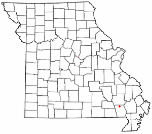
Hendrickson is an unincorporated community in northern Butler County, Missouri, United States.[1] It is located along Missouri Route O approximately one mile south of U.S. Route 67. It is approximately ten miles north of Poplar Bluff, within the Mark Twain National Forest. The community of Wilby lies three miles to the southeast along Route O. It sits on the east margin of the Black River floodplain. The Missouri Pacific Railway passes the west side of the community along the Black River floodplain. It is also on U.S. Route 60.[2]
Hendrickson was laid out in 1873 when the railroad was extended to that point, and named after Nathan Henrickson, the original owner of the town site.[3] A post office called Hendrickson was established in 1875 and remained in operation until 1975.[4]
KAIT, an Arkansas-based television station, can be picked up as far north as Hendrickson.[5]
On May 1, 2010, an EF0 tornado hit Hendrickson, downing several large trees.[6] On May 30, 1917, an F3 tornado struck the community.[7]
YouTube Encyclopedic
-
1/2Views:574380
-
Blacksmith at Watkins Mill
-
Stillings Sorghum Festival 2013
Transcription
References
- ^ U.S. Geological Survey Geographic Names Information System: Hendrickson, Missouri
- ^ Missouri Atlas & Gazetteer, DeLorme, First edition, 1998, p. 67 ISBN 0899332242
- ^ "Butler County Place Names, 1928–1945 (archived)". The State Historical Society of Missouri. Archived from the original on June 24, 2016. Retrieved September 6, 2016.
{{cite web}}: CS1 maint: bot: original URL status unknown (link) - ^ "Post Offices". Jim Forte Postal History. Retrieved September 6, 2016.
- ^ Coverage Maps for the Jonesboro, Arkansas media market. Federal Communications Commission (2009).
- ^ National Climatic Data Center (May 2010). "May 2010" (PDF). Storm Data and Unusual Weather Phenomena with Late Reports and Corrections. Asheville, North Carolina: United States National Oceanic and Atmospheric Administration. 52 (5). Archived from the original (PDF) on April 9, 2015. Retrieved April 9, 2015.
- ^ Grazulis, Significant, pp. 753-754
36°54′16″N 90°28′08″W / 36.90444°N 90.46889°W
Municipalities and communities of Butler County, Missouri, United States | ||
|---|---|---|
| Cities |  | |
| Townships | ||
| CDPs | ||
| Other communities | ||
| Ghost town | ||
| Footnotes | ‡This populated place also has portions in an adjacent county or counties | |
This Butler County, Missouri state location article is a stub. You can help Wikipedia by expanding it. |