
Henderson Point, Mississippi | |
|---|---|
 Henderson Point  Henderson Point | |
| Coordinates: 30°18′33″N 89°17′13″W / 30.30917°N 89.28694°W | |
| Country | United States |
| State | Mississippi |
| County | Harrison |
| Area | |
| • Total | 1.15 sq mi (2.99 km2) |
| • Land | 1.06 sq mi (2.76 km2) |
| • Water | 0.09 sq mi (0.23 km2) |
| Elevation | 5 ft (2 m) |
| Population (2020) | |
| • Total | 232 |
| • Density | 217.84/sq mi (84.10/km2) |
| Time zone | UTC-6 (Central (CST)) |
| • Summer (DST) | UTC-5 (CDT) |
| FIPS code | 28-31540 |
Henderson Point is a census-designated place (CDP) in Harrison County, Mississippi, United States. It is part of the Gulfport–Biloxi Metropolitan Statistical Area. The population was 170 at the 2010 census.[2]
YouTube Encyclopedic
-
1/3Views:375 8815 759 61612 310 705
-
AVOID LIVING IN A 55 PLUS COMMUNITY - Unless you can HANDLE These FACTS
-
Rare Body Features Only 1% of People Have
-
Neighbours Called Him Crazy, But He Had the Last Laugh
Transcription
Geography
Henderson Point is located at the end of a peninsula along the edge of the Gulf of Mexico. It is bordered by St. Louis Bay to the west and north, the Gulf of Mexico to the south, and the city of Pass Christian to the east. Henderson Point is the site of the east end of the Bay St. Louis Bridge, which carries U.S. Route 90 across St. Louis Bay to the city of Bay St. Louis in Hancock County.
According to the United States Census Bureau, the CDP has a total area of 1.2 square miles (3.0 km2), of which 1.0 square mile (2.7 km2) is land and 0.12 square miles (0.3 km2), or 8.64%, is water.[3]
Demographics
| Census | Pop. | Note | %± |
|---|---|---|---|
| 2020 | 232 | — | |
| U.S. Decennial Census[4] | |||
2020 census
| Race | Num. | Perc. |
|---|---|---|
| White (non-Hispanic) | 208 | 89.66% |
| Asian | 2 | 0.86% |
| Other/Mixed | 12 | 5.17% |
| Hispanic or Latino | 10 | 4.31% |
As of the 2020 United States census, there were 232 people, 91 households, and 37 families residing in the CDP.
References
- ^ "2020 U.S. Gazetteer Files". United States Census Bureau. Retrieved July 24, 2022.
- ^ "Profile of General Population and Housing Characteristics: 2010 Demographic Profile Data (DP-1): Henderson Point CDP, Mississippi". United States Census Bureau. Retrieved May 16, 2012.
- ^ "Geographic Identifiers: 2010 Demographic Profile Data (G001): Henderson Point CDP, Mississippi". United States Census Bureau. Retrieved May 16, 2012.
- ^ "Census of Population and Housing". Census.gov. Retrieved June 4, 2016.
- ^ "Explore Census Data". data.census.gov. Retrieved December 16, 2021.
Municipalities and communities of Harrison County, Mississippi, United States | ||
|---|---|---|
| Cities | 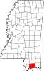 | |
| CDPs | ||
| Unincorporated communities | ||