
Helena Valley Northeast, Montana | |
|---|---|
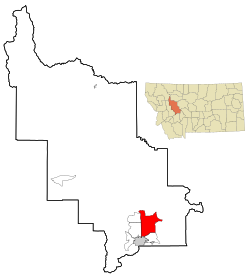 Location of Helena Valley Northeast, Montana | |
| Coordinates: 46°40′18″N 111°56′29″W / 46.67167°N 111.94139°W | |
| Country | United States |
| State | Montana |
| County | Lewis and Clark |
| Area | |
| • Total | 57.88 sq mi (149.91 km2) |
| • Land | 53.24 sq mi (137.90 km2) |
| • Water | 4.64 sq mi (12.01 km2) |
| Elevation | 3,665 ft (1,117 m) |
| Population (2020) | |
| • Total | 3,813 |
| • Density | 71.62/sq mi (27.65/km2) |
| Time zone | UTC-7 (Mountain (MST)) |
| • Summer (DST) | UTC-6 (MDT) |
| Area code | 406 |
| FIPS code | 30-35628 |
Helena Valley Northeast is a census-designated place (CDP) in Lewis and Clark County, Montana, United States. The population was 2,995 at the 2010 census.[2] It is part of the Helena Micropolitan Statistical Area.
YouTube Encyclopedic
-
1/3Views:52523 3501 082
-
Gold, Sapphires, and Dams
-
St. Helens: Out of the Ash
-
Black Sandy State Park Hauser Dam Black Sandy Montana
Transcription
Geography
Helena Valley Northeast is located in southern Lewis and Clark County at 46°40′18″N 111°56′29″W / 46.67167°N 111.94139°W (46.671590, -111.941337).[3] It is bordered to the southwest by the city of Helena, the state capital. It is bordered to the south by the Helena Valley Southeast CDP, to the west by the Helena Valley West Central CDP, and to the northwest by the Helena Valley Northwest CDP, all unincorporated. Interstate 15 forms the western edge of the Helena Valley Northeast CDP, with access from Exit 200 (East Lincoln Road), which is approximately 10 miles (16 km) north of downtown Helena.
According to the United States Census Bureau, the CDP has a total area of 51.1 square miles (132.4 km2), of which 46.5 square miles (120.4 km2) are land and 4.6 square miles (12.0 km2), or 9.06%, are water.[4] Lake Helena, an arm of Hauser Lake, is in the center of the CDP. Hauser Lake is an impoundment on the Missouri River, and Lake Helena connects to it via Prickly Pear Creek, all at the same elevation as Hauser Lake.
Demographics
| Census | Pop. | Note | %± |
|---|---|---|---|
| 2020 | 3,813 | — | |
| U.S. Decennial Census[5] | |||
As of the census[6] of 2000, there were 2,122 people, 776 households, and 619 families residing in the CDP. The population density was 45.4 inhabitants per square mile (17.5/km2). There were 830 housing units at an average density of 17.7 per square mile (6.8/km2). The racial makeup of the CDP was 97.74% White, 0.09% African American, 1.23% Native American, 0.05% Asian, 0.19% from other races, and 0.71% from two or more races. Hispanic or Latino of any race were 0.90% of the population.
There were 776 households, out of which 37.0% had children under the age of 18 living with them, 69.8% were married couples living together, 5.5% had a female householder with no husband present, and 20.2% were non-families. 16.4% of all households were made up of individuals, and 3.4% had someone living alone who was 65 years of age or older. The average household size was 2.68 and the average family size was 3.00.
In the CDP, the population was spread out, with 26.0% under the age of 18, 5.5% from 18 to 24, 29.8% from 25 to 44, 28.9% from 45 to 64, and 9.8% who were 65 years of age or older. The median age was 39 years. For every 100 females, there were 106.0 males. For every 100 females age 18 and over, there were 104.0 males.
The median income for a household in the CDP was $50,804, and the median income for a family was $54,728. Males had a median income of $32,140 versus $26,563 for females. The per capita income for the CDP was $20,283. About 1.4% of families and 3.8% of the population were below the poverty line, including 3.6% of those under age 18 and 7.5% of those age 65 or over.
Education
For the vast majority of the CDP, Helena Elementary School District and Helena High School District are the respective school districts. A small portion is covered by a unified K-12 school district, East Helena K-12.[7]
References
- ^ "ArcGIS REST Services Directory". United States Census Bureau. Retrieved September 5, 2022.
- ^ "Total Population: 2010 Census DEC Summary File 1 (P1), Helena Valley Northeast CDP, Montana". data.census.gov. U.S. Census Bureau. Retrieved April 27, 2020.
- ^ "US Gazetteer files: 2010, 2000, and 1990". United States Census Bureau. February 12, 2011. Retrieved April 23, 2011.
- ^ "U.S. Gazetteer Files: 2019: Places: Montana". U.S. Census Bureau Geography Division. Retrieved April 27, 2020.
- ^ "Census of Population and Housing". Census.gov. Retrieved June 4, 2016.
- ^ "U.S. Census website". United States Census Bureau. Retrieved January 31, 2008.
- ^ "2020 CENSUS - SCHOOL DISTRICT REFERENCE MAP: Lewis and Clark County, MT" (PDF). U.S. Census Bureau. Retrieved March 14, 2024.
Municipalities and communities of Lewis and Clark County, Montana, United States | ||
|---|---|---|
| City |  | |
| Town | ||
| CDPs | ||
| Ghost town | ||