To install click the Add extension button. That's it.

The source code for the WIKI 2 extension is being checked by specialists of the Mozilla Foundation, Google, and Apple. You could also do it yourself at any point in time.

4,5
Kelly Slayton
Congratulations on this excellent venture… what a great idea!
Alexander Grigorievskiy
I use WIKI 2 every day and almost forgot how the original Wikipedia looks like.
Live Statistics
English Articles
Improved in 24 Hours
Added in 24 Hours
Languages
Recent
Show all languages
What we do. Every page goes through several hundred of perfecting techniques; in live mode. Quite the same Wikipedia. Just better.
.
Leo
Newton
Brights
Milds

Hector Glacier

From Wikipedia, the free encyclopedia

Hector Glacier
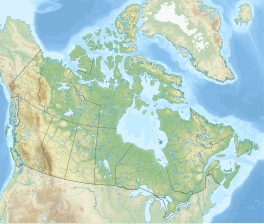
Map showing the location of Hector Glacier
Hector Glacier
Map showing the location of Hector Glacier
Hector Glacier
Map showing the location of Hector Glacier
Hector Glacier
LocationAlberta, Canada
Coordinates51°35′24″N 116°15′36″W / 51.59000°N 116.26000°W / 51.59000; -116.26000
Length3 kilometres (2 mi)
StatusReceding
Map

Hector Glacier is located in Banff National Park, Alberta, Canada. The glacier is on the north slope of Mount Hector and extends northward for 3 km (1.9 mi). In 1938, a large mass of the glacier broke off and covered the valley below with ice up to 60 m (200 ft) thick. The ice mass destroyed everything in its path and this is only the second known glacier hazard to have been recorded in the Canadian Rockies. The glacier, along with Mount Hector and Hector Lake are all named after James Hector, a prominent early naturalist to the region.

See also

References

  • Ommanney, C Simon L (2002). "Glaciers of the Canadian Rockies" (PDF). In Ommanney, C Simon L; Williams, Richard S Jr; Ferrigno, Jane G (eds.). Glaciers of North America. Satellite Image Atlas of Glaciers of the World. Denver, CO: United States Geological Survey. pp. J227–J228. ISBN 978-0-607-98290-9. OCLC 51554935. U.S. Geological Survey professional paper 1386-J. Retrieved 2006-07-04.
  • "Topographic Map sheet 82N9". Atlas of Canada. Natural Resources Canada. 2006-02-06. Archived from the original on 2010-08-03. Retrieved 2009-05-11.


This page was last edited on 10 March 2024, at 18:41
Basis of this page is in Wikipedia. Text is available under the CC BY-SA 3.0 Unported License. Non-text media are available under their specified licenses. Wikipedia® is a registered trademark of the Wikimedia Foundation, Inc. WIKI 2 is an independent company and has no affiliation with Wikimedia Foundation.