
Hazm Al Markhiya
حزم المرخية | |
|---|---|
District | |
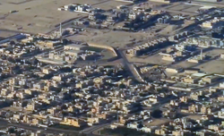 Aerial view of the northeastern boundary of Hazm Al Markhiya | |
 Hazm Al Markhiya  Hazm Al Markhiya | |
| Coordinates: 25°20′10″N 51°29′39″E / 25.33611°N 51.49417°E | |
| Country | |
| Municipality | Ad-Dawhah |
| Zone | Zone 67 |
| District no. | 107 |
| Area | |
| • Total | 4.2 km2 (1.6 sq mi) |
| Population (2015) | |
| • Total | 8,967 |
| • Density | 2,100/km2 (5,500/sq mi) |
Hazm Al Markhiya (Arabic: حزم المرخية, romanized: Ḥazm al-Markhiyah) is a neighborhood of Doha, Qatar.[2]
YouTube Encyclopedic
-
1/3Views:28 978962381
-
Al Hazm | الحزم
-
Al Markhiya Project (Al Emadi Enterprises)
-
Qatar VLOG / تسلل للمول الجديد اللي زي المتحف وتصوير الهرم العجيب من القمة
Transcription
Etymology
In Arabic, "hazm" refers to a natural hill.[3] The other constituent is a reference to the neighboring district of Al Markhiya, which received its name from a tree that grows abundantly in the region known locally as "markh" (Leptadenia pyrotechnica).[4]
Landmarks
- Bin Muftah Medical Center on Al Markhiya Street.[5]
- Feto Maternal Center on Rawdat Al Tair Street.[5]
- West Bay Health Centre on Al Asdaf Street.[5]
- Water Networks Affairs Laboratory on Saihan Street.[5]
- Green Qatar Centre & Qatar Green Centre Park on Jery Al Hesan Street.[5]
- Al Markhiya Complex on Saihan Street.[5]
- Embassy Of The Republic Of Venezuela in Doha on Samura Bin Jundub Street.[5]
- Embassy of The Central African Republic in Doha on Rawdat Nazwa Street.[5]
Transport
Major roads that run through the district are University Street, Al Khafji Street and Al Markhiya Street.[6]
Demographics
As of the 2010 census, the district comprised 900 housing units[7] and 71 establishments.[8] There were 8,586 people living in the district, of which 48% were male and 52% were female. Out of the 8,586 inhabitants, 67% were 20 years of age or older and 33% were under the age of 20. The literacy rate stood at 95.8%.[9]
Employed persons made up 52% of the total population. Females accounted for 49% of the working population, while males accounted for 51% of the working population.[9]
Education

The following schools are located in Hazm Al Markhiya:
| Name of School | Curriculum | Grade | Genders | Official Website | Ref |
|---|---|---|---|---|---|
| Kanga's Pouch Nursery | British | Kindergarten | Both | Official website | [10] |
| Edison International Academy | British | Kindergarten – Primary | Both | Official website | [11] |
| Tiny Town British Nursery | British | Kindergarten | Both | N/A | [12] |
| The Community College of Qatar for Boys | Qatari | College | Male-only | Official website | [5] |
| Al Bayan First Independent Elementary School for Girls | Qatari | Primary | Female-only | N/A | [5] |
References
- ^ "District Area Map". Ministry of Development Planning and Statistics. Retrieved 1 March 2019.
- ^ "2010 population census" (PDF). Qatar Statistics Authority. Archived from the original (PDF) on 2 April 2015. Retrieved 29 June 2015.
- ^ "Qatar's opulent Al Hazm soft-opens to visitors". Doha News. 7 May 2017. Retrieved 20 January 2019.
- ^ "District map". The Centre for Geographic Information Systems of Qatar. Retrieved 7 January 2019.
- ^ a b c d e f g h i j "Qatar Landmarks". Ministry of Development Planning and Statistics. Retrieved 8 January 2019.
- ^ "Index map of Qatar". ArcGIS.com. Retrieved 30 August 2019.
- ^ "Housing units, by type of unit and zone (April 2010)" (PDF). Qatar Statistics Authority. Archived from the original (PDF) on 8 July 2015. Retrieved 7 August 2015.
- ^ "Establishments by status of establishment and zone (April 2010)" (PDF). Qatar Statistics Authority. Archived from the original (PDF) on 8 July 2015. Retrieved 7 August 2015.
- ^ a b "Geo Statistics Application". Ministry of Development Planning and Statistics. Archived from the original on 11 September 2012. Retrieved 7 August 2015.
- ^ "Kanga's Pouch Nursery". Doha Mums. Retrieved 8 January 2019.
- ^ "Edison International Academy - Dahl Alhamam 2". Ministry of Education and Higher Education (Qatar). Retrieved 8 January 2019.
- ^ "Tiny Town British Nursery". schoolsinqatar.net. Retrieved 8 January 2019.
This Qatari location article is a stub. You can help Wikipedia by expanding it. |