
Hartland | |
|---|---|
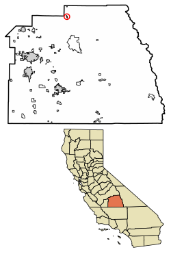 Location of Hartland in Tulare County, California. | |
 Hartland Position in California. | |
| Coordinates: 36°39′07″N 118°57′19″W / 36.65194°N 118.95528°W | |
| Country | |
| State | |
| County | Tulare |
| Area | |
| • Total | 0.611 sq mi (1.582 km2) |
| • Land | 0.611 sq mi (1.582 km2) |
| • Water | 0 sq mi (0 km2) 0% |
| Elevation | 4,475 ft (1,364 m) |
| Population (2010) | |
| • Total | 30 |
| • Density | 49/sq mi (19/km2) |
| Time zone | UTC-8 (Pacific (PST)) |
| • Summer (DST) | UTC-7 (PDT) |
| GNIS feature ID | 2585423 |
| U.S. Geological Survey Geographic Names Information System: Hartland, California | |
Hartland is a census-designated place (CDP) in Tulare County, California, United States.[2] Hartland sits at an elevation of 4,475 feet (1,364 m).[2] The 2010 United States census reported Hartland's population was 30.
Geography
According to the United States Census Bureau, the CDP covers an area of 0.6 square miles (1.6 km2), all of it land.
History
Hartland was named for two of the first pioneer settlers of the area, William Michael Hart, and his wife, Sarah Matilda Land. Hart and Land traveled by covered wagon to California sometime in the early 1850s.[3] All five of their daughters, and one son were born in the Angel's Camp gold-mining area, where the Harts operated a small school for the Angel's camp miners' children.[4] The 1870s saw the family living down south in the Tulare Co. towns of Venice, Kaweah & Mineral King (at the edge of the King's Canyon National Park), Orosi, Squaw Valley, and finally Eshom Valley in the 1880's. The town of Hartland was named for the couple, as a composite of both their last names.

Demographics
| Census | Pop. | Note | %± |
|---|---|---|---|
| U.S. Decennial Census[5] | |||
At the 2010 census Hartland had a population of 30. The population density was 49.1 inhabitants per square mile (19.0/km2). The racial makeup of Hartland was 27 (90.0%) White, 3 (10.0%) African American, 0 (0.0%) Native American, 0 (0.0%) Asian, 0 (0.0%) Pacific Islander, 0 (0.0%) from other races, and 0 (0.0%) from two or more races. Hispanic or Latino of any race were 0 people (0.0%).[6]
The whole population lived in households, no one lived in non-institutionalized group quarters and no one was institutionalized.
There were 14 households, 1 (7.1%) had children under the age of 18 living in them, 9 (64.3%) were opposite-sex married couples living together, 0 (0%) had a female householder with no husband present, 0 (0%) had a male householder with no wife present. There were 0 (0%) unmarried opposite-sex partnerships, and 0 (0%) same-sex married couples or partnerships. 5 households (35.7%) were one person and 0 (0%) had someone living alone who was 65 or older. The average household size was 2.14. There were 9 families (64.3% of households); the average family size was 2.78.
The age distribution was 5 people (16.7%) under the age of 18, 3 people (10.0%) aged 18 to 24, 10 people (33.3%) aged 25 to 44, 11 people (36.7%) aged 45 to 64, and 1 people (3.3%) who were 65 or older. The median age was 39.5 years. For every 100 females, there were 114.3 males. For every 100 females age 18 and over, there were 108.3 males.
There were 69 housing units at an average density of 113.0 per square mile, of the occupied units 1 (7.1%) were owner-occupied and 13 (92.9%) were rented. The homeowner vacancy rate was 0%; the rental vacancy rate was 0%. 2 people (6.7% of the population) lived in owner-occupied housing units and 28 people (93.3%) lived in rental housing units.
References
- ^ U.S. Census
- ^ a b c U.S. Geological Survey Geographic Names Information System: Hartland, California
- ^ 1880 United States Federal Census
- ^ Hart-Garton-Andrews Family Tradition
- ^ "Census of Population and Housing". Census.gov. Retrieved June 4, 2016.
- ^ "2010 Census Interactive Population Search: CA - Hartland CDP". U.S. Census Bureau. Archived from the original on July 15, 2014. Retrieved July 12, 2014.
