
Hampstead | |
|---|---|
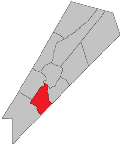 Location within Queens County, New Brunswick. | |
| Coordinates: 45°50′N 64°35′W / 45.84°N 64.59°W | |
| Country | |
| Province | |
| County | Queens County |
| Erected | 1786 |
| Area | |
| • Land | 212.39 km2 (82.00 sq mi) |
| Population (2021)[1] | |
| • Total | 288 |
| • Density | 1.4/km2 (4/sq mi) |
| • Change 2016-2021 | |
| • Dwellings | 167 |
| Time zone | UTC-4 (AST) |
| • Summer (DST) | UTC-3 (ADT) |
Hampstead is a geographic parish in Queens County, New Brunswick, Canada.[2]
Prior to the 2023 governance reform, for governance purposes it was divided between CFB Gagetown and the local service district of Hampstead,[3] which was a member of Capital Region Service Commission (RSC11).[4] The Saint John River islands are not part of the local service district.
YouTube Encyclopedic
-
1/5Views:5671 3281 0343401 023
-
Olive York Way, West Brunswick, Melbourne Who was Olive York
-
Oxford, St Mary, Jamaica
-
Princess Louise, Duchess of Argyll
-
Yuletide Joys (1927)
-
Dhiagelev/Cunningham: 1909/2009
Transcription
Origin of name
The parish was probably named for Hempstead, New York,[5] source of some of the Loyalist settlers of the parish.
History
Hampstead was erected in 1786 as one of the county's original parishes.[6]
In 1838 the rear of the parish was included in the newly erected Petersville Parish.[7]
In 1895 the eastern half of Long Island was transferred to Wickham Parish.[8]
New Brunswick's last surviving African Canadian community, Elm Hill, was established here in 1806.
Boundaries
Hampstead Parish is bounded[2][9][10][11]
- on the east by the Saint John River;
- on the southeast by the Kings County line;
- on the southwest and northwest within CFB Gagetown by a line at the end of Olinville Road and running[a] along Yorkshire Road to the northwestern line of a grant to John Short, east of the junction with the road to Vincent, then northeasterly and northwesterly along grants belonging to Sylvanus Haviland, James Corbett, and Henry Appleby to the Lawfield Road, then northeasterly along Lawfield Road to the southernmost corner of a grant to Thomas T. Hewlett at the corner of Kerr Road, meeting a line running south 52º west,[b] from the southwestern corner of a grant to Nathaniel Jarvis, then following the line out of CFB Gagetown;
- on the north by the southern line of the Jarvis grant, part of which forms the southern boundary of the village of Gagetown;
- including Spoon Island, Upper Musquash Island, and the western half of Long Island.
Communities
Communities at least partly within the parish;[9][10][11] bold indicates an incorporated municipality; italics indicate a community expropriated for CFB Gagetown
Bodies of water
Bodies of water[c] at least partly in the parish:[9][10][11]
- Little River
- Saint John River
- Lawson Passage
- Palmer Creek
- Fanning Lake
- Rabbit Lake
- Long Island Lake
- Otnabog Lake
Islands
Islands in the parish:[9][10][11]
- Long Island
- Spoon Island
- Upper Musquash Island
Other notable places
Parks, historic sites, and other noteworthy places in the parish.[9][10][11]
Demographics
PopulationPopulation trend,[15][16][17] 2021
|
LanguageMother tongue language (2021)2021
|
Access Routes
Highways and numbered routes that run through the parish, including external routes that start or finish at the parish limits:[18]
|
|
|
|
See also
Notes
- ^ Roads still appear on cadastral maps but not in highway mapbooks; because the old roads and grants are used in the Territorial Division Act they're used here.
- ^ By the magnet of 1850, [12] when declination at the starting point was about 18º 20' west of north.[13] The Territorial Division Act clause referring to magnetic direction bearings was omitted in the 1952[14] and 1973 Revised Statutes.[2]
- ^ Not including brooks, ponds or coves.
References
- ^ a b "Census Profile". Statistics Canada. 26 October 2022. Retrieved 29 October 2022.
- ^ a b c "Chapter T-3 Territorial Division Act". Government of New Brunswick. Retrieved 13 November 2020.
- ^ "New Brunswick Regulation 84-168 under the Municipalities Act (O.C. 84-582)". Government of New Brunswick. Retrieved 19 July 2020.
- ^ "Communities in each of the 12 Regional Service Commissions (RSC) / Les communautés dans chacune des 12 Commissions de services régionaux (CSR)" (PDF), Government of New Brunswick, July 2017, retrieved 2 February 2021
- ^ Ganong, William F. (1896). A Monograph of the Place-Nomenclature of the Province of New Brunswick. Royal Society of Canada. p. 239. Retrieved 17 March 2021.
- ^ "26 Geo. III Chapter I. An Act for the better ascertaining and confirming the Boundaries of the several Counties within this Province, and for subdividing them into Towns or Parishes.". Acts of the General Assembly of His Majesty's Province of New-Brunswick, passed in the year 1786. Saint John, New Brunswick: Government of New Brunswick. 1786. pp. 3–12. Retrieved 20 March 2021.
- ^ "1 Vic. c. 35 An Act to erect a part of the Parishes of Gagetown and Hampstead, in Queen's County, into a separate and distinct Town or Parish.". Acts of the General Assembly of Her Majesty's Province of New Brunswick, Passed in the Year 1838. Fredericton: Government of New Brunswick. 1838. p. 78. Retrieved 27 March 2021.
- ^ "57 Vic. c. 35 An Act to change the boundaries of the Parishes of Wickham and Hampstead, in the County of Queen's.". Acts of the General Assembly of Her Majesty's Province of New Brunswick. Passed in the Month of April, 1894. Fredericton: Government of New Brunswick. 1894. pp. 160–161. Available as a free ebook from Google Books.
- ^ a b c d e "No. 138". Provincial Archives of New Brunswick. Department of Natural Resources and Energy Development. Retrieved 19 June 2021. Remainder of parish on maps 139, 148, and 149 at same site.
- ^ a b c d e "412" (PDF). Transportation and Infrastructure. Government of New Brunswick. Retrieved 19 June 2021. Remainder of parish on mapbooks 429, 430, 444, and 445 at same site.
- ^ a b c d e "Search the Canadian Geographical Names Database (CGNDB)". Government of Canada. Retrieved 19 June 2021.
- ^ "13 Vic. c. 51 An Act to consolidate all the Laws now in force for the division of the Province into Counties, Towns and Parishes.". Acts of the General Assembly of Her Mjaesty's Province of New Brunswick, Passed in the Year 1850. Fredericton: Government of New Brunswick. 1850. pp. 142–152, 145–149. Book was poorly proofread, resulting in title typo and reuse of page numbers 145–152.
- ^ "Historical Magnetic Declination". National Oceanic and Atmospheric Administration. Retrieved 25 April 2021.
- ^ "Chapter 227 Territorial Division Act". The Revised Statutes of New Brunswick 1952 Volume III. Fredericton: Government of New Brunswick. 1952. pp. 3725–3771.
- ^ Statistics Canada: 2001, 2006 census
- ^ 2011 Statistics Canada Census Profile: Hampstead Parish, New Brunswick
- ^ "Census Profile, 2016 Census: Hampstead, Parish [Census subdivision], New Brunswick". Statistics Canada. Retrieved 27 August 2019.
- ^ Atlantic Canada Back Road Atlas ISBN 978-1-55368-618-7
Places adjacent to Hampstead Parish, New Brunswick | |
|---|---|
Subdivisions of New Brunswick | |
|---|---|
| Cities | |
| Towns |
|
| Villages | |
| Regional municipality | |
| Rural communities | |
| Rural districts |
|
| Other administrative divisions | |
45°37′28″N 66°05′07″W / 45.624483°N 66.085167°W