
| Hammastunturi Wilderness Area | |
|---|---|
IUCN category VI (protected area with sustainable use of natural resources) | |
 | |
 Location in Finland | |
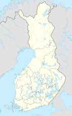
| Location | Lapland, Finland |
| Coordinates | 68°31′N 26°37′E / 68.517°N 26.617°E |
| Area | 1,825 km2 (705 sq mi) |
| Established | 1991 |
| Governing body | Metsähallitus |
The Hammastunturi Wilderness Area (Finnish: Hammastunturin erämaa; literally translated "tooth fell") is located in Lapland, Finland. It was established in 1991 like all the other 11 wilderness areas of Finland. It covers 1,825 square kilometres (705 sq mi) situated in a fell and forest area between the Urho Kekkonen National Park and Lemmenjoki National Park. It is governed by the Metsähallitus.[1]
The history of the area comprises reindeer husbandry, Lapland gold rush, and later road building and settlements. During the gold rush, around 1870, Kultala along the Ivalo River was a large village center inhabiting hundreds of people. There were as many gold diggers as the other people of Inari put together.
YouTube Encyclopedic
-
1/3Views:1 2523 5031 046
-
Hammastunturi Wilderness Area 2017 by #wkręconywlas
-
3 days backpacking in Hammastunturi wilderness | Snowstorm, solo wild camp, good times!
-
Five days backpacking in Hammastunturi Wilderness, Lapland
Transcription
References
- ^ "Hammastunturi Wilderness Area". Outdoors.fi. Metsähallitus. Retrieved 2015-05-10.
This Lapland (Finland) location article is a stub. You can help Wikipedia by expanding it. |
This article related to a protected area in Europe is a stub. You can help Wikipedia by expanding it. |