
Halkapınar | |
|---|---|
District and municipality | |
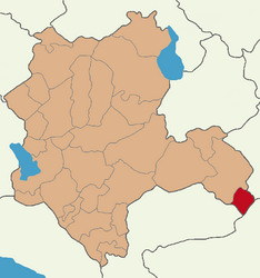 Map showing Halkapınar District in Konya Province | |
 Halkapınar Location in Turkey  Halkapınar Halkapınar (Turkey Central Anatolia) | |
| Coordinates: 37°26′06″N 34°11′19″E / 37.43500°N 34.18861°E | |
| Country | Turkey |
| Province | Konya |
| Government | |
| • Mayor | Mehmet Bakkal (MHP) |
| Area | 605 km2 (234 sq mi) |
| Elevation | 1,160 m (3,810 ft) |
| Population (2022)[1] | 3,909 |
| • Density | 6.5/km2 (17/sq mi) |
| Time zone | TRT (UTC+3) |
| Postal code | 42980 |
| Area code | 0332 |
Halkapınar is a municipality and district of Konya Province, Turkey.[2] Its area is 605 km2,[3] and its population is 3,909 (2022).[1]
YouTube Encyclopedic
-
1/3Views:5 6353 6031 705
-
konya halkapınar dereyüzü çakıllar köyünde düğün 2
-
Konyanın İncisi Halkapınar
-
16 06 2013 çakıllar köyü halkapınar konya
Transcription
Composition
There are 17 neighbourhoods in Halkapınar District:[4]
- Bahçelievler
- Büyükdoğan
- Çakıllar
- Cumhuriyet
- Dedeli
- Delimahmutlu
- Eskihisar
- İvriz
- Karayusuflu
- Kayasaray
- Körlü
- Kösere
- Nernek
- Osmanköseli
- Seydifakılı
- Yassıkaya
- Yeşilyurt
References
- ^ a b "Address-based population registration system (ADNKS) results dated 31 December 2022, Favorite Reports" (XLS). TÜİK. Retrieved 19 September 2023.
- ^ Büyükşehir İlçe Belediyesi, Turkey Civil Administration Departments Inventory. Retrieved 19 September 2023.
- ^ "İl ve İlçe Yüz ölçümleri". General Directorate of Mapping. Retrieved 19 September 2023.
- ^ Mahalle, Turkey Civil Administration Departments Inventory. Retrieved 19 September 2023.
External links
- District governor's official website (in Turkish)
- District municipality's official website (in Turkish)
Halkapınar, Konya in Konya Province of Turkey | |||||||||||||||||||||||||||
|---|---|---|---|---|---|---|---|---|---|---|---|---|---|---|---|---|---|---|---|---|---|---|---|---|---|---|---|
| Districts |   | ||||||||||||||||||||||||||
|
Metropolitan municipalities are bolded. | |||||||||||||||||||||||||||
This geographical article about a location in Konya Province, Turkey is a stub. You can help Wikipedia by expanding it. |