
Haji Khel
حاجی خیل | |
|---|---|
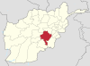
 Haji Khel Location in Afghanistan | |
| Coordinates: 32°59′34″N 67°57′55″E / 32.99278°N 67.96528°E | |
| Country | |
| Province | Ghazni |
| District | Ab Band |
| Elevation | 2,117 m (6,946 ft) |
| Time zone | UTC+4:30 |
Haji Khel is a town located at 32°59′34″N 67°57′55″E / 32.9928°N 67.9653°E at 2,117 m altitude in the northern part of Ab Band district, Ghazni Province, Afghanistan and is the capital of the district.
Climate
Haji Khel features a humid continental climate with mediterranean precipitation patterns (Köppen: Dsa). It has hot, dry summers and cold, snowy winters.
| Climate data for Haji Khel | |||||||||||||
|---|---|---|---|---|---|---|---|---|---|---|---|---|---|
| Month | Jan | Feb | Mar | Apr | May | Jun | Jul | Aug | Sep | Oct | Nov | Dec | Year |
| Daily mean °C (°F) | −5 (23) |
−2.3 (27.9) |
4.2 (39.6) |
11.3 (52.3) |
17.6 (63.7) |
21.6 (70.9) |
23.6 (74.5) |
22.2 (72.0) |
18.8 (65.8) |
12.3 (54.1) |
5.0 (41.0) |
−0.6 (30.9) |
10.7 (51.3) |
| Average precipitation mm (inches) | 45.9 (1.81) |
83.0 (3.27) |
74.3 (2.93) |
31.1 (1.22) |
12.9 (0.51) |
2.6 (0.10) |
10.9 (0.43) |
9.5 (0.37) |
3.5 (0.14) |
1.3 (0.05) |
26.8 (1.06) |
10.7 (0.42) |
312.5 (12.31) |
| Average relative humidity (%) | 54 | 62 | 47 | 32 | 22 | 17 | 23 | 23 | 17 | 21 | 36 | 39 | 33 |
| Source 1: ClimateCharts[1] | |||||||||||||
| Source 2: World Weather Online (precipitation & humidity)[2] | |||||||||||||
See also
References
- ^ "Climate: Hajikhel - ClimateCharts, Laura Zepner, Pierre Karrasch, Felix Wiemann & Lars Bernard (2020) ClimateCharts.net – an interactive climate analysis web platform, International Journal of Digital Earth". doi:10.1080/17538947.2020.1829112. Retrieved 24 September 2022.
- ^ "Humidity: Hajikhel - World Weather Online". Retrieved 24 September 2022.
This Ghazni Province, Afghanistan location article is a stub. You can help Wikipedia by expanding it. |