
Haima
| |
|---|---|
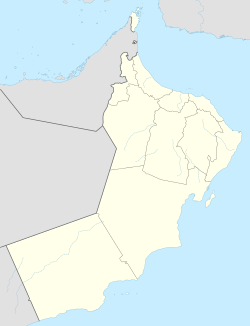 Haima Location in Oman | |
| Coordinates: 19°57′25″N 56°16′33″E / 19.95694°N 56.27583°E | |
| Country | |
| Region | Al Wusta Governorate (Oman) |
| Wilayat | Haima |
Haima (Arabic: هيماء, romanized: Haymā’) the capital of the central region of Oman called Al Wusta Governorate.
Permanent settlement began after a team of oil explorers sunk a water well there. This well, along with another dug in al-Ajaiz, became the first permanent water sources in Jiddat il-Harasiis. The well in Haima was used less than that in al-Ajaiz on account of the poor grazing lands surrounding it.
In 1982, a school for boys and later one for girls was opened in Haima. Families from the Harasiis tribe have increasingly settled in this location while schools are in session. [1]
YouTube Encyclopedic
-
1/1Views:3 235
-
Oman news | accident muscat Salalah 6 dead | Omani suwa on Eid | car without wheel, Actor shakeel
Transcription
Climate
In Haima, the winters are brief, pleasant, dry, and primarily clear, while the summers are lengthy, hot, humid, desert, and partly cloudy. The average annual temperature ranges from 56 to 110 degrees Fahrenheit, rarely falling below 50 or rising over 114.
The best times of year to visit Haima for hot-weather activities are from mid-March to mid-April and from early October to late November, according to the beach/pool score.[2]
| Climate data for Haima | |||||||||||||
|---|---|---|---|---|---|---|---|---|---|---|---|---|---|
| Month | Jan | Feb | Mar | Apr | May | Jun | Jul | Aug | Sep | Oct | Nov | Dec | Year |
| Mean daily maximum °C (°F) | 27.2 (81.0) |
29.6 (85.3) |
32.7 (90.9) |
39.3 (102.7) |
42.9 (109.2) |
44.1 (111.4) |
42.1 (107.8) |
42.1 (107.8) |
39.6 (103.3) |
36.6 (97.9) |
33.1 (91.6) |
28.9 (84.0) |
36.5 (97.7) |
| Daily mean °C (°F) | 19.8 (67.6) |
21.9 (71.4) |
25.1 (77.2) |
30.5 (86.9) |
34.1 (93.4) |
35.6 (96.1) |
35.1 (95.2) |
33.8 (92.8) |
31.7 (89.1) |
28.8 (83.8) |
25.6 (78.1) |
21.8 (71.2) |
28.7 (83.6) |
| Mean daily minimum °C (°F) | 12.3 (54.1) |
14.1 (57.4) |
17.4 (63.3) |
21.6 (70.9) |
25.2 (77.4) |
27.1 (80.8) |
28.0 (82.4) |
25.4 (77.7) |
23.7 (74.7) |
21.0 (69.8) |
18.1 (64.6) |
14.6 (58.3) |
20.7 (69.3) |
| Average precipitation mm (inches) | 0.0 (0.0) |
0.0 (0.0) |
0.2 (0.01) |
2.5 (0.10) |
6.3 (0.25) |
1.4 (0.06) |
0.5 (0.02) |
0.6 (0.02) |
0.7 (0.03) |
0.0 (0.0) |
1.1 (0.04) |
0.4 (0.02) |
13.7 (0.55) |
| Source: http://www.world-climates.com/city-climate-haima-oman-asia/ | |||||||||||||
Natural Reserves

The Wilayat of Hema is well known for its natural reserves since, unlike other areas of the Sultanate, it is home to several rare and wild species, including gazelles and the Arabian oryx (Ibn Sula), which can be found in the Jalouni region (Arabian Oryx Reserve). The United Nations Educational, Scientific, and Cultural Organization (UNESCO) has it listed as a world heritage site.[3]
Caves
In addition, a collection of caverns, the most notable of which is the "Al-Raki" cave, can be found northeast of Jalouni. It has a flow of water inside, however it is unfit for consumption. There is also a cave named "Wadi Saraf" that is accessible through an aperture connected to a sloping corridor and is situated on a slope below ground level. Despite not seeing anything within, you can feel that this cave has water.
There is a fourth cave that they refer to as "Kattar," and while it has water, it is unfit for drinking. Three springs of water can be found in addition to the caverns, one of which is known as "Buy Al-Hawja" and is a sizable boulder that rests on a stone foundation and resembles a natural canopy. The third eye is known as the "horn of Anuz," and this "horn" is distinguished by the presence of salt dunes. It also resembles a natural umbrella.[3]
Economic Activities
The residents of the Wilayat of Haima engage in a number of activities, such as trade, livestock breeding, and the textile industry. Among its musical arts are Al-Razha, Al-Azi, and Al-Taghrood.[3]
See also
References
- ^ Dawn Chatty, "Negotiating Authenticity and Translocality in Oman: The "Desertscapes" of the Harasiis Tribe," in Regionalizing Oman: Political, Economic and Social Dynamics," (ed) Steffen Wippel, New York: Springer, 2013, 137.
- ^ "Haymā' Climate, Weather By Month, Average Temperature (Oman) - Weather Spark". weatherspark.com. Retrieved 2023-07-27.
- ^ a b c "ولاية هيماء". البوابة الإعلامية -وزارة الإعلام - سلطنة عمان. Retrieved 27 July 2023.
19°57′25″N 56°16′33″E / 19.95694°N 56.27583°E
This article about the geography of Oman is a stub. You can help Wikipedia by expanding it. |