
Hagener Township | |
|---|---|
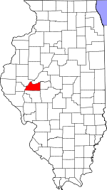
 Location in Cass County | |
 Cass County's location in Illinois | |
| Coordinates: 39°55′15″N 90°27′42″W / 39.92083°N 90.46167°W | |
| Country | United States |
| State | Illinois |
| County | Cass |
| Established | November 6, 1923 |
| Area | |
| • Total | 49.75 sq mi (128.9 km2) |
| • Land | 47.95 sq mi (124.2 km2) |
| • Water | 1.8 sq mi (5 km2) 3.62% |
| Elevation | 453 ft (138 m) |
| Population (2020) | |
| • Total | 352 |
| • Density | 7.1/sq mi (2.7/km2) |
| Time zone | UTC-6 (CST) |
| • Summer (DST) | UTC-5 (CDT) |
| ZIP codes | 62611, 62618 |
| FIPS code | 17-017-32148 |
Hagener Township is one of eleven townships in Cass County, Illinois, USA. As of the 2020 census, its population was 352 and it contained 157 housing units.[1]
Geography
According to the 2010 census, the township has a total area of 49.75 square miles (128.9 km2), of which 47.95 square miles (124.2 km2) (or 96.38%) is land and 1.8 square miles (4.7 km2) (or 3.62%) is water.[2]
Unincorporated towns
(This list is based on USGS data and may include former settlements.)
Cemeteries
The township contains these seven cemeteries: Black Oak, Bush, Hackman, Immanuel Lutheran, Saint Peters Lutheran, Schneider and Wagle.
Major highways
Airports and landing strips
- Kinsey RLA Airport
- Kloker Airport
- Phillip H Krohe Airport
Rivers
Lakes
- Meredosia Lake
Demographics
As of the 2020 census[1] there were 352 people, 147 households, and 134 families residing in the township. The population density was 7.08 inhabitants per square mile (2.73/km2). There were 157 housing units at an average density of 3.16 per square mile (1.22/km2). The racial makeup of the township was 86.93% White, 0.57% African American, 0.57% Native American, 0.57% Asian, 0.28% Pacific Islander, 5.97% from other races, and 5.11% from two or more races. Hispanic or Latino of any race were 10.51% of the population.
There were 147 households, out of which 46.90% had children under the age of 18 living with them, 89.12% were married couples living together, 0.00% had a female householder with no spouse present, and 8.84% were non-families. 2.00% of all households were made up of individuals, and 2.00% had someone living alone who was 65 years of age or older. The average household size was 3.58 and the average family size was 3.72.
The township's age distribution consisted of 35.9% under the age of 18, 2.5% from 18 to 24, 25.9% from 25 to 44, 19.4% from 45 to 64, and 16.3% who were 65 years of age or older. The median age was 35.5 years. For every 100 females, there were 84.6 males. For every 100 females age 18 and over, there were 111.9 males.
The median income for a household in the township was $107,656, and the median income for a family was $109,688. Males had a median income of $49,018 versus $39,143 for females. The per capita income for the township was $25,872. About 1.5% of families and 3.2% of the population were below the poverty line, including 0.0% of those under age 18 and 5.8% of those age 65 or over.
| Census | Pop. | Note | %± |
|---|---|---|---|
| 2010 | 381 | — | |
| 2020 | 352 | −7.6% | |
| U.S. Decennial Census[3] | |||
School districts
- Beardstown Community Unit School District 15
- Meredosia-Chambersburg Community Unit School District 11
- Triopia Community Unit School District 27
Political districts
- Illinois' 18th congressional district
- State House District 93
- State Senate District 47
References
- "Hagener Township, Cass County, Illinois". Geographic Names Information System. United States Geological Survey, United States Department of the Interior. Retrieved January 4, 2010.
- United States Census Bureau 2007 TIGER/Line Shapefiles
- United States National Atlas
- ^ a b "Explore Census Data". data.census.gov. Retrieved January 22, 2023.
- ^ "Population, Housing Units, Area, and Density: 2010 - County -- County Subdivision and Place -- 2010 Census Summary File 1". United States Census. Archived from the original on February 12, 2020. Retrieved May 28, 2013.
- ^ "Census of Population and Housing". Census.gov. Retrieved June 4, 2016.
External links
Places adjacent to Hagener Township, Cass County, Illinois | |
|---|---|
Municipalities and communities of Cass County, Illinois, United States | ||
|---|---|---|
| Cities |  | |
| Villages | ||
| Townships | ||
| Unincorporated communities | ||
| Ghost towns | ||