
Guryevsk
Гурьевск | |
|---|---|
 | |
 Coat of arms | |
Location of Guryevsk  | |
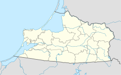 Guryevsk Location of Guryevsk 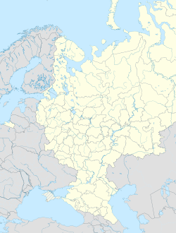 Guryevsk Guryevsk (European Russia)  Guryevsk Guryevsk (Europe) | |
| Coordinates: 54°47′N 20°37′E / 54.783°N 20.617°E | |
| Country | Russia |
| Federal subject | Kaliningrad Oblast[1] |
| Administrative district | Guryevsky District[1] |
| Town of district significance | Guryevsk[1] |
| Founded | 1262[2] |
| Elevation | 20 m (70 ft) |
| Population | |
| • Total | 12,431 |
| • Estimate (2018)[4] | 17,295 (+39.1%) |
| • Capital of | Guryevsky District,[1] town of district significance of Guryevsk[1] |
| • Urban okrug | Guryevsky Urban Okrug[5] |
| • Capital of | Guryevsky Urban Okrug[5] |
| Time zone | UTC+2 (MSK–1 |
| Postal code(s)[7] | 689450 |
| OKTMO ID | 27707000001 |
Guryevsk (Russian: Гу́рьевск, German: Neuhausen)[8] is a town and the administrative center of Guryevsky District of Kaliningrad Oblast, Russia, located 7 kilometers (4.3 mi) northeast of Kaliningrad. Population: 19,670 (2021 Census);[9] 12,431 (2010 Census);[3] 10,913 (2002 Census);[10] 7,934 (1989 Census).[11]
History

In 1255 the Sambians tribe's stronghold of Vurgvala was taken by Teutonic Knights and renamed as Neuhausen in 1262.[2] Around 1292, the Castle of the Sambian Chapter was built.[12] In 1454, King Casimir IV Jagiellon incorporated the region to the Kingdom of Poland upon the request of the anti-Teutonic Prussian Confederation.[13] After the subsequent Thirteen Years' War (1454–1466), it became a part of Poland as a fief held by the Teutonic Knights until 1525,[14] and by secular Ducal Prussia afterwards. From 1701, the settlement was part of the Kingdom of Prussia, and in 1871 it became part of the German Empire upon the unification of Germany, within which it was administered as part of the Province of East Prussia. In 1877, the village had a population of 559, mostly employed in agriculture and cattle breeding.[12] It was captured by Red Army on 28 January 1945.
After the end of World War II in 1945, the town was annexed by the Soviet Union. The remaining German population which had not been evacuated was subsequently expelled in accordance with the Potsdam Agreement and replaced with Russians. The following year it was renamed Guryevsk in honor of Stepan Guryev, a Soviet marshal who died during the capture of Kaliningrad.
Administrative and municipal status
Within the framework of administrative divisions, Guryevsk serves as the administrative center of Guryevsky District.[1] As an administrative division, it is incorporated within Guryevsky District as the town of district significance of Guryevsk.[15]
Within the framework of municipal divisions, since May 31, 2013, the territories of the town of district significance of Guryevsk and of seven rural okrugs of Guryevsky District are incorporated as Guryevsky Urban Okrug.[5] Before that, the town of district significance was incorporated within Guryevsky Municipal District as Guryevskoye Urban Settlement.[5]
Notable people
- Martin Kähler (1835–1912), theologian
References
Notes
- ^ a b c d e f g Law #463
- ^ a b Энциклопедия Города России. Moscow: Большая Российская Энциклопедия. 2003. p. 113. ISBN 5-7107-7399-9.
- ^ a b Russian Federal State Statistics Service (2011). Всероссийская перепись населения 2010 года. Том 1 [2010 All-Russian Population Census, vol. 1]. Всероссийская перепись населения 2010 года [2010 All-Russia Population Census] (in Russian). Federal State Statistics Service.
- ^ "26. Численность постоянного населения Российской Федерации по муниципальным образованиям на 1 января 2018 года". Federal State Statistics Service. Retrieved January 23, 2019.
- ^ a b c d Law #229
- ^ "Об исчислении времени". Официальный интернет-портал правовой информации (in Russian). June 3, 2011. Retrieved January 19, 2019.
- ^ Почта России. Информационно-вычислительный центр ОАСУ РПО. (Russian Post). Поиск объектов почтовой связи (Postal Objects Search) (in Russian)
- ^ M. Kaemmerer (2004). Ortsnamenverzeichnis der Ortschaften jenseits von Oder u. Neiße (in German). G. Rautenberg. ISBN 3-7921-0368-0.
- ^ Russian Federal State Statistics Service. Всероссийская перепись населения 2020 года. Том 1 [2020 All-Russian Population Census, vol. 1] (XLS) (in Russian). Federal State Statistics Service.
- ^ Russian Federal State Statistics Service (May 21, 2004). Численность населения России, субъектов Российской Федерации в составе федеральных округов, районов, городских поселений, сельских населённых пунктов – районных центров и сельских населённых пунктов с населением 3 тысячи и более человек [Population of Russia, Its Federal Districts, Federal Subjects, Districts, Urban Localities, Rural Localities—Administrative Centers, and Rural Localities with Population of Over 3,000] (XLS). Всероссийская перепись населения 2002 года [All-Russia Population Census of 2002] (in Russian).
- ^ Всесоюзная перепись населения 1989 г. Численность наличного населения союзных и автономных республик, автономных областей и округов, краёв, областей, районов, городских поселений и сёл-райцентров [All Union Population Census of 1989: Present Population of Union and Autonomous Republics, Autonomous Oblasts and Okrugs, Krais, Oblasts, Districts, Urban Settlements, and Villages Serving as District Administrative Centers]. Всесоюзная перепись населения 1989 года [All-Union Population Census of 1989] (in Russian). Институт демографии Национального исследовательского университета: Высшая школа экономики [Institute of Demography at the National Research University: Higher School of Economics]. 1989 – via Demoscope Weekly.
- ^ a b Słownik geograficzny Królestwa Polskiego i innych krajów słowiańskich, Tom VII (in Polish). Warszawa. 1886. p. 16.
{{cite book}}: CS1 maint: location missing publisher (link) - ^ Górski, Karol (1949). Związek Pruski i poddanie się Prus Polsce: zbiór tekstów źródłowych (in Polish). Poznań: Instytut Zachodni. p. 54.
- ^ Górski, pp. 96–97, 214–215
- ^ Resolution #640
Sources
- Калининградская областная Дума. Закон №463 от 27 мая 2010 г. «Об административно-территориальном устройстве Калининградской области», в ред. Закона №450 от 3 июля 2015 г. «О внесении изменений в Закон Калининградской области "Об административно-территориальном устройстве Калининградской области"». Вступил в силу со дня официального опубликования. Опубликован: "Калининградская правда" (вкладыш "Ведомости Правительства Калининградской области"), №112, 26 июня 2010 г. (Kaliningrad Oblast Duma. Law #463 of May 27, 2010 On the Administrative-Territorial Structure of Kaliningrad Oblast, as amended by the Law #450 of July 3, 2015 On Amending the Law of Kaliningrad Oblast "On the Administrative-Territorial Structure of Kaliningrad Oblast". Effective as of the day of the official publication.).
- Правительство Калининградской области. Постановление №640 от 30 августа 2011 г. «Об утверждении реестра объектов административно-территориального деления Калининградской области», в ред. Постановления №877 от 21 ноября 2011 г «О внесении изменения в Постановление Правительства Калининградской области от 30 августа 2011 г. №640». Вступил в силу со дня официального опубликования. Опубликован: "Калининградская правда" (вкладыш "Официально"), №170, 15 сентября 2011 г. (Government of Kaliningrad Oblast. Resolution #640 of August 30, 2011 On the Adoption of the Registry of the Objects of the Administrative-Territorial Divisions of Kaliningrad Oblast, as amended by the Resolution #877 of November 21, 2011 On Amending the Resolution of the Government of Kaliningrad Oblast #640 of August 30, 2011. Effective as of the day of the official publication.).
- Калининградская областная Дума. Закон №229 от 29 мая 2013 г. «Об объединении поселений, входящих в состав Гурьевского муниципального района, и организации местного самоуправления на объединённой территории». Вступил в силу со дня официального опубликования. Опубликован: "Калининградская правда", №92, 31 мая 2013 г.. (Kaliningrad Oblast Duma. Law #229 of May 29, 2013 On Merging the Settlements Within Guryevsky Municipal District and on the Organization of the Local Self-Government on the United Territory. Effective as of the day of the official publication.).
External links
![]() Media related to Guryevsk, Kaliningrad Oblast at Wikimedia Commons
Media related to Guryevsk, Kaliningrad Oblast at Wikimedia Commons
- Official website of Guryevsk Archived December 4, 2020, at the Wayback Machine (in Russian)
- Guryevsk Business Directory (in Russian)
| International | |
|---|---|
| National | |