
Gumel
gumal Birnin Lautai | |
|---|---|
LGA and city | |
 Gumel Central Mosque | |
| Nickname: birnin mamman | |
 Gumel | |
| Coordinates: 12°37′42″N 9°23′23″E / 12.62833°N 9.38972°E | |
| Country | |
| State | Jigawa State |
| Founded | 1700 |
| Government | |
| • Emir | Ahmad Muhammad Sani II |
| • Local Government Chairman | Rufai Sanusi (APC) |
| Time zone | UTC+1 (WAT) |
| Website | gumel.com |
 | |
Gumel or Gumal is a city and traditional emirate in Jigawa State, Nigeria.
YouTube Encyclopedic
-
1/1Views:447
-
GCI2016: Mini-course 1: Epidemiological Modeling - Lecture 1: Abba Gumel
Transcription
Geography
Gumel is located 120 km northeast of Kano, and lies about 20 km south of Nigeria's northern border with Niger. As of 2007 the estimated population of Gumel was 44,158.[1] Gumel, also spelled Gummel, town and traditional emirate, northern Jigawa state, northern Nigeria. The emirate was founded about 1750 by Dan Juma of Kano city (75 miles [121 km] southwest) and his followers of the Manga (Mangawa) tribe. Shortly after his death in 1754, it became a tributary state of the Bornu kingdom. The emirate survived the Fulani attacks of Usman dan Fodio’s jihad (“holy war”) in the early 19th century and never became part of the Fulani empire of Sokoto. In 1845 Gumel’s capital was moved from Tumbi (20 miles north in present-day Niger) to the present site. Wars with nearby Hadejia, Kano, and Zinder (Damagaram) plagued the emirate from 1828; the war with Hadejia continued until Gumel’s emir, Abdullahi, was killed in battle in 1872. Slave raids toward the end of the century by Damagaram further depopulated Gumel. Emir Ahmadu submitted to the British in 1903, and the Gumel emirate was incorporated into Kano province. In 1976 it became part of Kano state, and since 1991 it has been part of Jigawa state.
Gumel town remains the area’s chief market centre—millet and sorghum are the staple foods—and serves as a collecting point for peanuts (groundnuts), which are trucked to Kano city for export by rail. Limestone and diatomaceous earth deposits are exploited locally in scattered areas. The town has a farm-training centre and an advanced teacher-training college. Gumel lies on a secondary highway linking it to Kano and Hadejia and is a hub for local roads serving northern Jigawa state. Pop. (2006) local government area, 107,161.
Climate
In Gumel, the dry season is stifling and partially cloudy whereas the wet season is oppressively hot and cloudy. The temperature rarely drops below 55°F or rises over 108°F throughout the year, usually fluctuating between 60°F and 104°F.[2]
History
The emirate was founded about 1750 by Dan Juma and his followers from the Mangawa tribe. Shortly after he died in 1754, it became a tributary state of the Bornu kingdom. The emirate survived the Fulani attacks of Usman dan Fodio's jihad in the early 19th century and never became part of the Fulani empire of Sokoto. The present-day location of Gumel is the result of an 1845 move from the city of Tumbi, located in what is now Niger. The emirate has frequently been at war with the nearby cities of Hadejia, Danzomo, Kano, and Zinder since 1828. The war with Hadejia continued until Gumel's emir, Abdullahi, died in 1872. Before Emir Ahmadu accepted British rule in 1903, frequent slave raids from the town of Zinder were common. In 1976 Gumel became part of Kano State, and since 1991 it has been part of Jigawa State near Danzomo, Gagarawa, Sule Tankarkar, and Maigatari.[3]
The current emir of Gumel, HRH Alh. Ahmed Mohammed Sani II (CON) is the 16th emir of Gumel. The emir is a graduate, of political science, of Ohio State University in the United States. The emir has been in office since 1981. The emir's palace is accessible only to those invited there by the emir, to members of the royal family, and to officials of the royal court (the emirate council, also called the Majlis).
List of Gumel Emirs
- 1749 - 1754 Dan Juma I dan Musa
- 1754 - 1760 Adamu Karro dan Digadiga Karro (d. 1760)
- 1760 - 1777 Dan Juma II dan Digadiga Karro
- 1777 - 1804 Maikota dan Adam Karro (d. 1804)
- 1804 - 1811 Kalgo dan Maikota (d. 1811)
- 1811 - 1828 Dan Auwa dan Maikota (d. 1828)
- 1828 - 1851 Muhamman Dan Tanoma dan Maikota (d. 1851)
- 1851 - 1853 Ceri dan Muhamman Dan Tanoma (1st time)
- 1853 - 1855 Muhamman Atu dan Dan Auwa
- 1855 - 1861 Ceri dan Muhamman Dan Tanoma (2nd time)
- 1861 - 1872 `Abd Allahi dan Muhamman Dan Tanoma (d. 1872)
- 1872 - 18 Abu Bakar dan Muhamman Dan Tanoma (d. 1896)
- 1896 - 1915 Ahmadu dan Abi Bakar
- 1915 - 1944 Muhamman na Kota dan Ahmadu (d. 1944)
- May 1944 - 1981 Maina Muhammad Sani II dan Muhamman na Kota (b. 1912)
- 1981 - Ahmad Muhammad Sani II dan Maina Muhammad Sani II
Economy
Gumel acts as the region's primary economic center. Sorghum, millet, and peanuts are collected here and trucked to Kano on a secondary highway where they are exported by rail.[3]
References
- ^ "The World Gazetteer". Archived from the original on 2013-02-10. Retrieved 2007-02-20.
- ^ "Gumel Climate, Weather By Month, Average Temperature (Nigeria) - Weather Spark". weatherspark.com. Retrieved 2023-08-26.
- ^ a b "Gumel". Encyclopaedia Britannica. Retrieved 10 May 2022.
12°37′42″N 9°23′23″E / 12.62833°N 9.38972°E
State capital: Dutse | ||
| Local Government Areas | 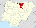 | |