
Guelma Province
ولاية قالمة | |
|---|---|
 Guelma Valley as seen from Ben Djerrah, partially showing the metropolitan area of Guelma with the cities of Boumahra Ahmed, Belkheir, and Guelma visible (from right to left/east to west) | |
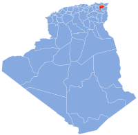
 Map of Algeria highlighting Guelma | |
| Coordinates: 36°28′N 07°27′E / 36.467°N 7.450°E | |
| Country | |
| Capital | Guelma |
| Area | |
| • Total | 4,101 km2 (1,583 sq mi) |
| Population (2008)[1] | |
| • Total | 482,261 |
| • Density | 120/km2 (300/sq mi) |
| Time zone | UTC+01 (CET) |
| Area Code | +213 (0) 37 |
| ISO 3166 code | DZ-24 |
| Districts | 10 |
| Municipalities | 34 |
Guelma Province (Arabic: ولاية قالمة) is a province (wilaya) in eastern Algeria. Its namesake is its seat and most populous municipality: Guelma.
YouTube Encyclopedic
-
1/3Views:3402 8179 326
-
"GUELMA" Top 4 Tourist Places | Guelma Tourism | ALGERIA
-
HAMAM DBAGH GUELMA ALGERIE
-
guelma ma belle قالمة
Transcription
History
Its civilians suffered heavy casualties during the 1945 Sétif massacre by the French Army. The province itself was established in 1974. Before that, it was part of Annaba Province.
In 1984 El Taref Province and Souk Ahras Province were carved out of its territory.
Demographics
It has 429,998 inhabitants as of the 1998 census, one of the lower populations in the country, which gives it 39 seats in the APW, the province's assembly. The population density is 105 inhabitants per square kilometre (272/sq mi). Of these, 54.4% live in urban areas and 87% have access to safe drinking water, lower than the national average of 89%. [1] Archived 2007-09-11 at the Wayback Machine. Of the active population of the province, 23.3% work in agriculture, 17.9% in constructions, 9.9% in industry, and 48.9% in the services sector. 21.1% of the population is unemployed.[2][permanent dead link]]
Geography
The territory of the province (4,101 km2 (1,583 sq mi)) is mainly composed of arable land (about 49%) or 1,890 km2 (730 sq mi), of which about 100 km2 (39 sq mi) is irrigated, and the rest is rainfed. In the area surrounding Guelma, around 130 km2 (50 sq mi) is irrigable, 110 km2 (42 sq mi) in the area between Oued Zenati and Tamlouka, and 20 km2 (8 sq mi) around Bouchegouf. Forests cover about 31% of the total area, which equals 0.9 km2 (0 sq mi), composed mainly of Aleppo Pine, Algerian Oak and Cork Oak. Areas dedicated for future industrial development, called activity zones in Algeria cover 2 km2 (1 sq mi).[3][permanent dead link]]
Administrative divisions
The province is divided into 10 districts (daïras), which are further divided into 34 communes or municipalities.[2]
Districts
Communes
- Aïn Ben Beida
- Houari Boumediene
- Aïn Larbi
- Aïn Makhlouf
- Aïn Reggada
- Aïn Sandel
- Belkheir
- Ben Djarah
- Beni Mezline
- Bordj Sabat
- Bou Hachana
- Bou Hamdane
- Bouati Mahmoud
- Boughouf
- Boumahra Ahmed
- Dahouara
- Djeballah Khemissi
- El Fedjoudj
- Guellat Bou Dbaa
- Guelma
- Hammam Debagh
- Hammam Nbail
- Héliopolis
- Kheraza
- Medjez Amar
- Medjez Sfa
- Nechmaya
- Oued Cheham
- Oued Fragha
- Oued Zenati
- Ras El Agba
- Roknia
- Salaoua Announa
- Tamlouka
Notable residents
- Houari Boumédienne, President of Algeria
- Saint Possidius, bishop of Calama (Guelma) (5th century)
See also
- Khamissa — Ancient Roman ruins in province.
References
- ^ Office National des Statistiques, Recensement General de la Population et de l’Habitat 2008 Archived 2008-07-24 at the Wayback Machine Preliminary results of the 2008 population census. Accessed on 2008-07-02.
- ^ Journal Officiel de la Republique Algerienne, No. 41, Page 1307. 4 September 1991.
External links
- Official Tourism Office of Guelma Province website — (in Arabic); (in German); (in English); (in French)
|  | |
| International | |
|---|---|
| National | |
| Geographic | |
| Other | |