
Guamal, Meta | |
|---|---|
Municipality and town | |
 | |
 Flag  Seal | |
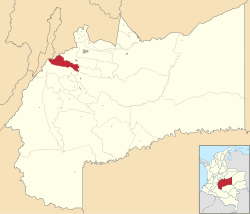 Location of the municipality and town of Guamal, Meta in the Meta Department of Colombia. | |
| Country | |
| Department | Meta Department |
| Area | |
| • Total | 638 km2 (246 sq mi) |
| Elevation | 525 m (1,722 ft) |
| Population (Census 2018[2]) | |
| • Total | 13,857 |
| • Density | 22/km2 (56/sq mi) |
| Time zone | UTC-5 (Colombia Standard Time) |
| Climate | Af |
Guamal is a town and municipality in the Meta Department, Colombia.
YouTube Encyclopedic
-
1/3Views:1 8083 8184 059
-
Municipio de Guamal Meta
-
Destinos Capítulo 3 Guamal Meta
-
Guamal Meta Colombia
Transcription
Climate
Guamal has a tropical rainforest climate (Köppen Af). The climate is hot and sometimes humid, though its proximity to the foothills of the Oriental Andes brings mild breezes at nightfall. Average temperature is 25.1 °C or 77.2 °F. Although January is almost dry enough for tropical monsoon (Am) classification, the other eleven months all receive over 125 millimetres or 5 inches of rain, and for eight months from April to November monthly rainfall consistently exceeds 340 millimetres or 13.4 inches.
| Climate data for Guamal | |||||||||||||
|---|---|---|---|---|---|---|---|---|---|---|---|---|---|
| Month | Jan | Feb | Mar | Apr | May | Jun | Jul | Aug | Sep | Oct | Nov | Dec | Year |
| Mean daily maximum °C (°F) | 31.0 (87.8) |
31.4 (88.5) |
31.1 (88.0) |
30.0 (86.0) |
29.5 (85.1) |
29.0 (84.2) |
28.9 (84.0) |
29.7 (85.5) |
30.2 (86.4) |
30.1 (86.2) |
30.1 (86.2) |
30.3 (86.5) |
30.1 (86.2) |
| Daily mean °C (°F) | 25.6 (78.1) |
26.0 (78.8) |
26.0 (78.8) |
25.2 (77.4) |
24.9 (76.8) |
24.3 (75.7) |
24.2 (75.6) |
24.6 (76.3) |
25.0 (77.0) |
25.0 (77.0) |
25.1 (77.2) |
25.0 (77.0) |
25.1 (77.1) |
| Mean daily minimum °C (°F) | 20.2 (68.4) |
20.6 (69.1) |
21.0 (69.8) |
20.4 (68.7) |
20.4 (68.7) |
19.7 (67.5) |
19.6 (67.3) |
19.5 (67.1) |
19.8 (67.6) |
20.0 (68.0) |
20.2 (68.4) |
19.7 (67.5) |
20.1 (68.2) |
| Average rainfall mm (inches) | 69.0 (2.72) |
126.7 (4.99) |
254.0 (10.00) |
484.8 (19.09) |
575.3 (22.65) |
512.6 (20.18) |
395.5 (15.57) |
344.8 (13.57) |
376.8 (14.83) |
440.3 (17.33) |
488.2 (19.22) |
167.6 (6.60) |
4,235.6 (166.75) |
| Average rainy days (≥ 1 mm) | 6 | 8 | 12 | 19 | 22 | 22 | 20 | 17 | 16 | 17 | 16 | 10 | 185 |
| Source 1: [3] | |||||||||||||
| Source 2: [4] | |||||||||||||
References
- ^ "Municipalities of Colombia". statoids. Retrieved 10 May 2020.
- ^ "Censo Nacional de Población y Vivienda 2018" (in Spanish). DANE. Retrieved 10 May 2020.
- ^ "Archived copy". Archived from the original on 2016-08-15. Retrieved 2020-06-24.
{{cite web}}: CS1 maint: archived copy as title (link) - ^ "Guamal climate: Average Temperature, weather by month, Guamal weather averages - Climate-Data.org". en.climate-data.org. Retrieved 2021-12-26.
| International | |
|---|---|
| National | |
3°52′48″N 73°45′56″W / 3.88°N 73.7656°W
This Department of Meta location article is a stub. You can help Wikipedia by expanding it. |