
Guérin | |
|---|---|
 | |
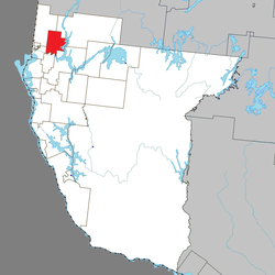 Location within Témiscamingue RCM | |
 Guérin Location in western Quebec | |
| Coordinates: 47°39′32″N 79°19′05″W / 47.65889°N 79.31806°W[1] | |
| Country | Canada |
| Province | Quebec |
| Region | Abitibi-Témiscamingue |
| RCM | Témiscamingue |
| Constituted | November 8, 1911 |
| Named for | James John Edmund Guérin[1] |
| Government | |
| • Mayor | Roger Bouthillette |
| • Federal riding | Abitibi—Témiscamingue |
| • Prov. riding | Rouyn-Noranda–Témiscamingue |
| Area | |
| • Total | 208.39 km2 (80.46 sq mi) |
| • Land | 188.52 km2 (72.79 sq mi) |
| Population (2021)[3] | |
| • Total | 333 |
| • Density | 1.8/km2 (5/sq mi) |
| • Pop (2016–21) | |
| • Dwellings | 210 |
| Time zone | UTC−05:00 (EST) |
| • Summer (DST) | UTC−04:00 (EDT) |
| Postal code(s) | |
| Area code | 819 |
| Website | municipalites-du-quebec |
Guérin is a township municipality in northwestern Quebec, Canada, in the Témiscamingue Regional County Municipality.
The township lies within the Ottawa River basin, having an elevation of 210 metres (690 ft) near the Quinze rapids to 336 metres (1,102 ft) in its north-eastern part.[4] In addition to the main namesake village, the township also includes the hamlet of Paquin (47°37′59″N 79°18′51″W / 47.63306°N 79.31417°W).[5]
History
Around 1872, the area began to be cleared for logging and agriculture. In 1904, the geographic township of Guérin was proclaimed, named after James John Edmund Guerin, while the settlement was called Lalemant, in honour of Gabriel Lalemant. The Lalement Post Office opened in 1908, and that same year, the parish of Saint-Gabriel-de-Guérin was founded. In 1911, the Township Municipality of Guérin was formed from previously unincorporated territory. In 1921, the settlement and post office were renamed to Guérin.[1]
Demographics
In the 2021 Census of Population conducted by Statistics Canada, Guérin had a population of 333 living in 134 of its 210 total private dwellings, a change of 4.1% from its 2016 population of 320. With a land area of 188.52 km2 (72.79 sq mi), it had a population density of 1.8/km2 (4.6/sq mi) in 2021.[3]
|
|
| |||||||||||||||||||||||||||||||||||||||||||||||||||||||||||||||
| Source: Statistics Canada[3][6] | |||||||||||||||||||||||||||||||||||||||||||||||||||||||||||||||||
Mother tongue (2021):[3]
- English as first language: 1.5%
- French as first language: 97%
- English and French as first language: 0%
- Other as first language: 1.5%
See also
References
- ^ a b c "Banque de noms de lieux du Québec: Reference number 27380". toponymie.gouv.qc.ca (in French). Commission de toponymie du Québec.
- ^ a b "Répertoire des municipalités: Geographic code 85095". www.mamh.gouv.qc.ca (in French). Ministère des Affaires municipales et de l'Habitation. Retrieved 2023-12-12.
- ^ a b c d e "Guérin census profile". 2021 Census data. Statistics Canada. Retrieved 2023-07-25.
- ^ "Banque de noms de lieux du Québec: Guérin (canton)". toponymie.gouv.qc.ca (in French). Commission de toponymie du Québec. Retrieved 2023-12-12.
- ^ "Banque de noms de lieux du Québec: Paquin (hameau)". toponymie.gouv.qc.ca (in French). Commission de toponymie du Québec. Retrieved 2023-12-12.
- ^ 1996, 2001, 2006, 2011, 2016 census
External links
Adjacent Municipal Subdivisions | |
|---|---|
| Cities | |
|---|---|
| Municipalities | |
| Townships |
|
| Parishes | |
| Unorganized territories | |
| |
This Abitibi-Témiscamingue location article is a stub. You can help Wikipedia by expanding it. |