
| Grey Stone of Trough | |
|---|---|
 Both sides of the marker | |
| Location | Trough of Bowland, Lancashire, England |
| Coordinates | 53°58′20″N 2°34′39″W / 53.97226°N 2.5774°W |
| Built | 1897 |
| Governing body | Historic England |
 Grey Stone of Trough Location in the Forest of Bowland 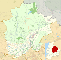 Grey Stone of Trough Location in Ribble Valley 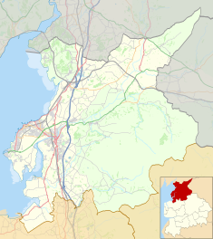 Grey Stone of Trough Location in the City of Lancaster district 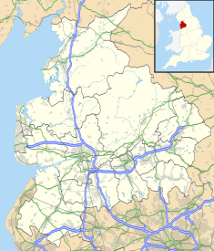 Grey Stone of Trough Location in Lancashire | |
The Grey Stone of Trough is an historic boundary marker in Bowland Forest High, in the Trough of Bowland, Lancashire, England.[1] A Grade II listed structure, erected in 1897 and standing on Trough Road,[2][3] it marks the line of the pre-1974 county boundary between Lancashire and the West Riding of Yorkshire.[3] Historically, the Trough marked the westernmost boundary of the ancient Lordship of Bowland.
It is in sandstone and has a triangular section with inscriptions on the two sides that face the road.
YouTube Encyclopedic
-
1/3Views:1 21398 166 2937 682 478
-
Poly-Crete Trough 4 ft. Tall Planter
-
Why Are 96,000,000 Black Balls on This Reservoir?
-
Bodycam Shows Deputy Hanging Onto SUV Before Shooting Driver
Transcription
Inscriptions
- Lancashire side
"To Lancaster, 12 miles. Bay Horse, 10 miles"
- Yorkshire side
"To Whitewell, 5 miles. Clitheroe, 12.5 miles"
Gallery
-
 The Yorkshire side of the marker
 -
 The Lancashire side of the marker
References
- ^ Hughes, R. A. (1987). "Geology of the Trough of Bowland area (SD 65 SW) : part of 1:50,000 Sheets 59 (Lancaster) and 67 (Garstang)". www.bgs.ac.uk. Retrieved 15 January 2023.
- ^ Historic England. "BOUNDARY STONE AT SD 622 530 (1362241)". National Heritage List for England. Retrieved 19 December 2021.
- ^ a b Craven Local Plan, November 2019, Craven District Council, p. 94
This article about a Lancashire building or structure is a stub. You can help Wikipedia by expanding it. |