
Greenwich, Ohio | |
|---|---|
 Main Street downtown | |
 Location of Greenwich, Ohio | |
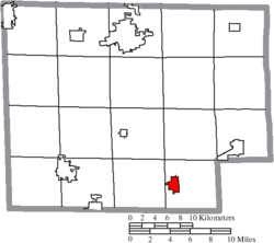 Location of Greenwich in Huron County | |
| Coordinates: 41°01′54″N 82°31′11″W / 41.03167°N 82.51972°W | |
| Country | United States |
| State | Ohio |
| County | Huron |
| Government | |
| • Mayor | James M. Twaddle[citation needed] |
| Area | |
| • Total | 1.56 sq mi (4.03 km2) |
| • Land | 1.52 sq mi (3.93 km2) |
| • Water | 0.04 sq mi (0.10 km2) |
| Elevation | 1,037 ft (316 m) |
| Population (2020) | |
| • Total | 1,409 |
| • Density | 928.81/sq mi (358.52/km2) |
| Time zone | UTC-5 (Eastern (EST)) |
| • Summer (DST) | UTC-4 (EDT) |
| ZIP code | 44837 |
| Area code | 419 |
| FIPS code | 39-32368[3] |
| GNIS feature ID | 2398206[2] |
Greenwich is a village in Huron County, Ohio, United States. The population was 1,409 at the 2020 census. It is served by a branch of the Willard Memorial Library.
YouTube Encyclopedic
-
1/2Views:328618
-
CSX (Plus Conrail) at Willard and Greenwich, Ohio
-
NS and CSX trains in Orrville, Sterling, and Greenwich, Ohio, 11/24/12
Transcription
History
A post office called Greenwich was established in 1828 and the municipality was incorporated as a village in 1879.[4][5] The village name comes from Greenwich Township, which is named after the town of Greenwich, Connecticut.[6]
Geography
According to the United States Census Bureau, the village has a total area of 1.37 square miles (3.55 km2), of which 1.35 square miles (3.50 km2) is land and 0.02 square miles (0.05 km2) is water.[7]
Demographics
| Census | Pop. | Note | %± |
|---|---|---|---|
| 1880 | 647 | — | |
| 1890 | 881 | 36.2% | |
| 1900 | 849 | −3.6% | |
| 1910 | 876 | 3.2% | |
| 1920 | 827 | −5.6% | |
| 1930 | 956 | 15.6% | |
| 1940 | 996 | 4.2% | |
| 1950 | 1,204 | 20.9% | |
| 1960 | 1,371 | 13.9% | |
| 1970 | 1,473 | 7.4% | |
| 1980 | 1,458 | −1.0% | |
| 1990 | 1,442 | −1.1% | |
| 2000 | 1,525 | 5.8% | |
| 2010 | 1,476 | −3.2% | |
| 2020 | 1,409 | −4.5% | |
| U.S. Decennial Census[8] | |||
2010 census
As of the census[9] of 2010, there were 1,476 people, 570 households, and 404 families living in the village. The population density was 1,093.3 inhabitants per square mile (422.1/km2). There were 632 housing units at an average density of 468.1 per square mile (180.7/km2). The racial makeup of the village was 99.1% White, 0.2% African American, 0.4% Asian, 0.1% from other races, and 0.3% from two or more races. Hispanic or Latino of any race were 1.1% of the population.
There were 570 households, of which 38.8% had children under the age of 18 living with them, 52.5% were married couples living together, 13.0% had a female householder with no husband present, 5.4% had a male householder with no wife present, and 29.1% were non-families. 25.3% of all households were made up of individuals, and 12.1% had someone living alone who was 65 years of age or older. The average household size was 2.57 and the average family size was 3.07.
The median age in the village was 36.1 years. 27.6% of residents were under the age of 18; 6.9% were between the ages of 18 and 24; 27.5% were from 25 to 44; 25% were from 45 to 64; and 13% were 65 years of age or older. The gender makeup of the village was 50.3% male and 49.7% female.
2000 census
As of the census[3] of 2000, there were 1,525 people, 579 households, and 412 families living in the village. The population density was 1,124.0 inhabitants per square mile (434.0/km2). There were 610 housing units at an average density of 449.6 per square mile (173.6/km2). The racial makeup of the village was 98.23% White, 0.07% Native American, 0.07% Asian, 0.39% from other races, and 1.25% from two or more races. Hispanic or Latino of any race were 0.59% of the population.
There were 579 households, out of which 36.4% had children under the age of 18 living with them, 56.0% were married couples living together, 12.3% had a female householder with no husband present, and 28.8% were non-families. 23.7% of all households were made up of individuals, and 10.4% had someone living alone who was 65 years of age or older. The average household size was 2.63 and the average family size was 3.10.
In the village, the population was spread out, with 28.8% under the age of 18, 9.0% from 18 to 24, 29.5% from 25 to 44, 20.0% from 45 to 64, and 12.7% who were 65 years of age or older. The median age was 34 years. For every 100 females there were 90.4 males. For every 100 females age 18 and over, there were 86.3 males.
The median income for a household in the village was $31,625, and the median income for a family was $39,375. Males had a median income of $30,833 versus $21,523 for females. The per capita income for the village was $14,667. About 8.9% of families and 10.1% of the population were below the poverty line, including 10.6% of those under age 18 and 11.5% of those age 65 or over.
Education
South Central Local Schools operates South Central High School.[10]
Greenwich has a public library, a branch of the Huron County Community Library.[11]
Notable person
- Albert Rhys Williams, labor organizer
References
- ^ "ArcGIS REST Services Directory". United States Census Bureau. Retrieved September 20, 2022.
- ^ a b U.S. Geological Survey Geographic Names Information System: Greenwich, Ohio
- ^ a b "U.S. Census website". United States Census Bureau. Retrieved January 31, 2008.
- ^ "Post offices". Jim Forte Postal History. Retrieved June 11, 2016.
- ^ Baughman, Abraham J. (1909). History of Huron County, Ohio: Its Progress and Development, with Biographical Sketches of Prominent Citizens of the County, Volume 1. S. J. Clarke Publishing Company. p. 232.
- ^ Overman, William Daniel (1958). Ohio Town Names. Akron, OH: Atlantic Press. p. 54.
- ^ "US Gazetteer files 2010". United States Census Bureau. Archived from the original on January 25, 2012. Retrieved January 6, 2013.
- ^ "Census of Population and Housing". Census.gov. Retrieved June 4, 2015.
- ^ "U.S. Census website". United States Census Bureau. Retrieved January 6, 2013.
- ^ "Homepage". South Central Local Schools. Retrieved February 26, 2018.
- ^ "Homepage". Huron County Community Library. Retrieved February 26, 2018.
Municipalities and communities of Huron County, Ohio, United States | ||
|---|---|---|
| Cities |  | |
| Villages | ||
| Townships | ||
| CDPs | ||
| Unincorporated communities | ||
| Footnotes | ‡This populated place also has portions in an adjacent county or counties | |