
Greene Township | |
|---|---|
 Flag  Seal | |
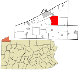 Location in Erie County and the U.S. state of Pennsylvania | |
| Country | United States |
| State | Pennsylvania |
| County | Erie |
| Area | |
| • Total | 37.50 sq mi (97.14 km2) |
| • Land | 37.38 sq mi (96.83 km2) |
| • Water | 0.12 sq mi (0.31 km2) |
| Highest elevation [2] (west of State Game Lands #161) | 1,586 ft (483 m) |
| Lowest elevation [2] (Fourmile Creek) | 985 ft (300 m) |
| Population | |
| • Total | 4,487 |
| • Estimate (2022)[3] | 4,453 |
| • Density | 123.26/sq mi (47.59/km2) |
| Time zone | UTC-4 (EST) |
| • Summer (DST) | UTC-5 (EDT) |
| Area code | 814 |
| Website | www |
Greene Township is a township in Erie County, Pennsylvania, United States. The population was 4,487 at the 2020,[3] down from 4,706 at the 2010 census.[4]
YouTube Encyclopedic
-
1/3Views:5 7282 064554
-
Erie*PA~History of the 1915 Mill Creek Flood / Wintergreen Gorge at Flood Stage
-
Ten Mile Creek Monongahela Washington Greene County Marianna to Jefferson State of Pennsylvania
-
Washington County Covered Bridge Series - Krepps Bridge - Hickory, PA
Transcription
Geography
Greene Township is in east-central Erie County, 10 miles (16 km) southeast of downtown Erie. According to the United States Census Bureau, the township has a total area of 37.5 square miles (97.1 km2), of which 37.4 square miles (96.8 km2) is land and 0.1 square miles (0.3 km2), or 0.32%, is water.[4]
Demographics
| Census | Pop. | Note | %± |
|---|---|---|---|
| 2000 | 4,768 | — | |
| 2010 | 4,706 | −1.3% | |
| 2020 | 4,487 | −4.7% | |
| 2022 (est.) | 4,453 | [3] | −0.8% |
| U.S. Decennial Census[5] | |||
As of the census[6] of 2000, there were 4,768 people, 1,724 households, and 1,379 families residing in the township. The population density was 127.0 inhabitants per square mile (49.0/km2). There were 1,784 housing units at an average density of 47.5 per square mile (18.3/km2). The racial makeup of the township was 99.18% White, 0.08% African American, 0.19% Native American, 0.06% Asian, 0.17% from other races, and 0.31% from two or more races. Hispanic or Latino of any race were 0.25% of the population.
There were 1,724 households, out of which 33.8% had children under the age of 18 living with them, 68.7% were married couples living together, 7.7% had a female householder with no husband present, and 20.0% were non-families. 16.8% of all households were made up of individuals, and 6.6% had someone living alone who was 65 years of age or older. The average household size was 2.76 and the average family size was 3.10.
In the township the population was spread out, with 25.4% under the age of 18, 6.9% from 18 to 24, 27.1% from 25 to 44, 28.0% from 45 to 64, and 12.7% who were 65 years of age or older. The median age was 40 years. For every 100 females there were 103.6 males. For every 100 females age 18 and over, there were 103.1 males.
The median income for a household in the township was $49,030, and the median income for a family was $53,096. Males had a median income of $38,994 versus $23,350 for females. The per capita income for the township was $18,694. About 2.9% of families and 4.1% of the population were below the poverty line, including 5.7% of those under age 18 and 6.0% of those age 65 or over.
References
- ^ "2016 U.S. Gazetteer Files". United States Census Bureau. Retrieved Aug 13, 2017.
- ^ a b "Sampson Topo Map, Erie County PA (Hammett Area)". TopoZone. Locality, LLC. Retrieved 4 September 2019.
- ^ a b c d Bureau, US Census. "City and Town Population Totals: 2020-2022". Census.gov. US Census Bureau. Retrieved June 19, 2023.
- ^ a b "Geographic Identifiers: 2010 Demographic Profile Data (G001): Greene township, Erie County, Pennsylvania". American Factfinder. U.S. Census Bureau. Archived from the original on February 13, 2020. Retrieved March 17, 2016.
- ^ "Census of Population and Housing". Census.gov. Retrieved June 4, 2016.
- ^ "U.S. Census website". United States Census Bureau. Retrieved 2008-01-31.
External links
Municipalities and communities of Erie County, Pennsylvania, United States | ||
|---|---|---|
| Cities |  | |
| Boroughs | ||
| Townships | ||
| CDPs | ||
| Unincorporated communities | ||
41°59′59″N 79°56′59″W / 41.99972°N 79.94972°W