
| Rangeet River | |
|---|---|
 | |
 Rangeet River in Sikkim 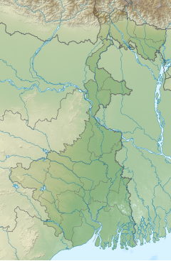 Rangeet River (West Bengal)  Rangeet River (India) | |
| Location | |
| Country | India |
| State | Sikkim |
| Physical characteristics | |
| Source | Himalayas |
| • location | Himalayas, Sikkim, India |
| • coordinates | 27°21′50″N 88°23′26″E / 27.3639°N 88.3905°E |
| Mouth | Teesta River |
• location | South Sikkim district, Sikkim, India |
• coordinates | 27°04′46″N 88°25′59″E / 27.07952°N 88.4331°E |

The Rangeet or Rangit is a tributary of the Teesta river, which is the largest river in the Indian state of Sikkim.[1] The Rangeet originates in the Himalayan mountains in West Sikkim district. The river also forms the boundary between Sikkim and Darjeeling district. A perennial river, it is fed by the melting snow of the Himalayas in early summer and the monsoon rains in June–September. It is popular among rafting enthusiasts owing to its turbulent waters. The river flows past the towns of Jorethang, Pelling and Legship. During its final few kilometres, it joins the Teesta River at a confluence[2] known as Tribeni,[3] which is a popular picnic spot. The Rangeet river has an NHPC hydropower plant with a capacity of 60 megawatts (80,000 hp) in Sikkim.[4]
YouTube Encyclopedic
-
1/3Views:2 1171 570748
-
Tista and Rangeet river hydro power dam projects in Sikkim Himalaya : aerials journey
-
Rupin Dang finds Garnet stones on banks of Rangeet River in Sikkim
-
Bridge over the River Rangeet in Sikkim
Transcription
References
- ^ "Rivers". sikkim.nic.in.
- ^ "Welcome to the Official Web Portal of Sikkim Tourism :: Sikkim at a Glance - Natures Bounty - Rivers". sikkimtourism.gov.in.
- ^ win7. "Triveni - River Teesta and Rangeet Confluence". darjeeling-tourism.com.
{{cite web}}: CS1 maint: numeric names: authors list (link) - ^ "RANGIT". Archived from the original on 14 January 2011. Retrieved 2 January 2011., Rangit Hydel Project.
5. Triveni Camping - A confluence of two rivers, the river Rangeet with its deep green and crystal clear water, meets with the forceful mountain stream Teesta
27°10′25″N 88°18′15″E / 27.1736°N 88.3043°E
This article related to a location in the Indian state of Sikkim is a stub. You can help Wikipedia by expanding it. |