
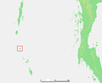
 Great Nicobar Subdivision Location of Great Nicobar Subdivision in India | |
| Geography | |
|---|---|
| Location | Bay of Bengal |
| Coordinates | 7°12′N 93°44′E / 7.20°N 93.73°E |
| Archipelago | Nicobar Islands |
| Adjacent to | Indian Ocean |
| Total islands | 13 |
| Major islands | |
| Area | 1,066 km2 (412 sq mi)[1] |
| Highest elevation | 642 m (2106 ft) |
| Highest point | Mount Thullier |
| Administration | |
| District | Nicobar |
| Island group | Nicobar Islands |
| Subdivisions of India | Great Nicobar Subdivision |
| Largest settlement | Campbell Bay (pop. 5740) |
| Demographics | |
| Population | 8367 (2014) |
| Pop. density | 7.8/km2 (20.2/sq mi) |
| Ethnic groups | Hindu, Nicobarese |
| Additional information | |
| Time zone | |
| PIN | 744301 |
| Telephone code | 03192 |
| ISO code | IN-AN-00[2] |
| Official website | www |
| Literacy | 84.4% |
| Avg. summer temperature | 30.2 °C (86.4 °F) |
| Avg. winter temperature | 23.0 °C (73.4 °F) |
| Sex ratio | 1.2♂/♀ |
| Census Code | 35.638.0003 |
| Official Languages | Hindi, English, Tamil Car (regional) |
Great Nicobar Subdivision is one of three local administrative divisions of the Indian district of Nicobar, part of the Indian union territory of Andaman and Nicobar Islands.[3] It is located in the Southern Nicobar Islands.
YouTube Encyclopedic
-
1/2Views:11 3721 029 402
-
formation of the himalayas and the northern plains
-
VILLA ROMA - The Ultimate Destination for Your Family Vacation
Transcription
Administration
The subdivision includes two tehsils:
- Campbell Bay, which includes the southern part of Great Nicobar and its HQ is Campbell Bay
- Little Nicobar, which includes the northern part of Great Nicobar, as well as nearby islands, and its HQ is at Afra Bay
Image gallery
-
Location of Car Nicobar island

References
- ^ "Islandwise Area and Population - 2011 Census" (PDF). Government of Andaman.
- ^ Registration Plate Numbers added to ISO Code
- ^ "Village Code Directory: Andaman & Nicobar Islands" (PDF). Census of India. Retrieved 16 January 2011.
 Andaman and Nicobar Islands travel guide from Wikivoyage
This Andaman and Nicobar Islands location article is a stub. You can help Wikipedia by expanding it. |