
In the United Kingdom, the term listed building refers to a building or other structure officially designated as being of special architectural, historical, or cultural significance; Grade II structures are those considered to be "buildings of special interest which justify every effort being made to preserve them".[1] Listing was begun by a provision in the Town and Country Planning Act 1947. Once listed, strict limitations are imposed on the modifications allowed to a building's structure or fittings. In Wales, the authority for listing under the Planning (Listed Buildings and Conservation Areas) Act 1990[2] rests with Cadw.
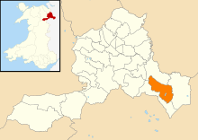
This is a list of the 37 Grade II listed buildings in the community of Hanmer, in Wrexham County Borough.
| Name | Location Grid Ref.[note 1] Geo-coordinates |
Date Listed | Type/Function | Notes | Reference Number | Image |
|---|---|---|---|---|---|---|
| Arowry House | Hanmer SJ4579739129 52°56′48″N 2°48′29″W / 52.946794°N 2.8081084°W |
15 November 2005 | Domestic | [3] | 86929 | – |
| Boundary wall and gateway to NE side of Bettisfield Park | Hanmer SJ4625837662 52°56′01″N 2°48′04″W / 52.933654°N 2.8010048°W |
15 November 2005 | Domestic | [4] | 86930 | – |
| Brook Farmhouse | Hanmer SJ4684340026 52°57′18″N 2°47′34″W / 52.954961°N 2.7926907°W |
16 November 1962 | Transport | [5] | 1661 | – |
| Bryn Newydd | Hanmer SJ4279941776 52°58′13″N 2°51′11″W / 52.970274°N 2.8531885°W |
15 November 2005 | Domestic | [6] | 86932 | – |
| Bryn Rossett (West View House) | Hanmer SJ4638340966 52°57′48″N 2°47′59″W / 52.963365°N 2.799693°W |
16 November 1962 | [7] | 1663 | – | |
| Chadwell and Hanmer Village Stores | Hanmer SJ4551939619 52°57′04″N 2°48′44″W / 52.95117°N 2.8123278°W |
15 November 2005 | Religious, Ritual and Funerary | [8] | 86933 | – |
| Cottage and butcher's shop | Hanmer SJ4552739751 52°57′08″N 2°48′44″W / 52.952357°N 2.812231°W |
15 November 2005 | Religious, Ritual and Funerary | [9] | 86934 | – |
| Croxton Farmhouse | Hanmer SJ4590041279 52°57′58″N 2°48′25″W / 52.966129°N 2.8069355°W |
15 November 2005 | Religious, Ritual and Funerary | [10] | 86935 | – |
| Farm Buildings at Bettisfield Park Home Farm | Hanmer SJ4607137623 52°56′00″N 2°48′14″W / 52.933285°N 2.8037802°W |
03 August 2006 | Domestic | [11] | 87498 | – |
| Gates, gate piers and railings at NE entrance to Gredington Park | Hanmer SJ4514639525 52°57′01″N 2°49′04″W / 52.950287°N 2.8178629°W |
16 November 1962 | Health and Welfare | [12] | 1666 | – |
| Gravestone of Edward Lloyd in Hanmer churchyard | Hanmer SJ4547339727 52°57′08″N 2°48′47″W / 52.952136°N 2.8130306°W |
15 November 2005 | Domestic | [13] | 86937 | – |
| Halghton Forge | Hanmer SJ4172443445 52°59′07″N 2°52′10″W / 52.985159°N 2.8694947°W |
15 November 2005 | Religious, Ritual and Funerary | [14] | 86938 | – |
| Halghton Lodge Farmhouse | Hanmer SJ4195443106 52°58′56″N 2°51′58″W / 52.982137°N 2.8660083°W |
15 November 2005 | Gardens, Parks and Urban Spaces | [15] | 86939 | – |
| Hanmer Arms | Hanmer SJ4552639808 52°57′10″N 2°48′44″W / 52.95287°N 2.8122555°W |
07 February 1989 | Domestic | [16] | 1726 | – |
| Hanmer Hall Farmhouse | Hanmer SJ4603339988 52°57′16″N 2°48′17″W / 52.954539°N 2.80474°W |
16 November 1962 | Gardens, Parks and Urban Spaces | [17] | 1667 | – |
| Hanmer Voluntary Primary School | Hanmer SJ4541639757 52°57′09″N 2°48′50″W / 52.9524°N 2.8138839°W |
16 November 1962 | Domestic | [18] | 1660 | – |
| Kitchen garden walls, including former vine house, greenhouses and bothies at Bettisfield Park | Hanmer SJ4619337509 52°55′56″N 2°48′07″W / 52.932273°N 2.8019464°W |
15 November 2005 | [19] | 86942 | – | |
| Lower House | Hanmer SJ4395140144 52°57′21″N 2°50′09″W / 52.955727°N 2.8357538°W |
15 November 2005 | Domestic | [20] | 86943 | – |
| Magpie Cottage | Hanmer SJ4551639595 52°57′03″N 2°48′45″W / 52.950954°N 2.8123684°W |
16 November 1962 | Domestic | [21] | 1668 | – |
| Mere House | Hanmer SJ4519739677 52°57′06″N 2°49′02″W / 52.951658°N 2.8171296°W |
12 January 2006 | [22] | 86957 | – | |
| Multi-purpose farm building at Bryn Newydd | Hanmer SJ4279541816 52°58′14″N 2°51′12″W / 52.970633°N 2.8532551°W |
15 November 2005 | Domestic | [23] | 86944 | – |
| Multi-purpose farm building at Halghton Lodge | Hanmer SJ4193443081 52°58′55″N 2°51′59″W / 52.98191°N 2.8663016°W |
15 November 2005 | [24] | 86945 | – | |
| Nickson family tombs, including railings, in Hanmer churchyard | Hanmer SJ4548139719 52°57′07″N 2°48′46″W / 52.952065°N 2.8129102°W |
15 November 2005 | Domestic | [25] | 86946 | – |
| Onion tower and attached walls at Bettisfield Park | Hanmer SJ4616537586 52°55′59″N 2°48′09″W / 52.932962°N 2.8023757°W |
15 November 2005 | Domestic | [26] | 86947 | – |
| Pandy Holding | Hanmer SJ4231143096 52°58′56″N 2°51′38″W / 52.982086°N 2.8606898°W |
15 November 2005 | Commercial | [27] | 86948 | – |
| Peartree Farmhouse | Hanmer SJ4329741797 52°58′14″N 2°50′45″W / 52.970516°N 2.8457777°W |
16 November 1962 | Domestic | [28] | 14653 | – |
| Revetment and balustrade to forecourt and formal garden of Bettisfield Park | Hanmer SJ4599237475 52°55′55″N 2°48′18″W / 52.931947°N 2.8049307°W |
15 November 2005 | Domestic | [29] | 86949 | – |
| Sundial in Hanmer churchyard | Hanmer SJ4545339716 52°57′07″N 2°48′48″W / 52.952035°N 2.8133264°W |
15 November 2005 | Industrial | [30] | 86931 | – |
| The Cottage | Hanmer SJ4552139723 52°57′08″N 2°48′44″W / 52.952105°N 2.8123155°W |
16 November 1962 | [31] | 1662 | – | |
| The Dukes | Hanmer SJ4369841018 52°57′49″N 2°50′23″W / 52.963556°N 2.8396716°W |
16 November 1962 | Domestic | [32] | 1655 | – |
| The Vicarage | Hanmer SJ4549239721 52°57′08″N 2°48′46″W / 52.952084°N 2.8127468°W |
16 November 1962 | Industrial | [33] | 1659 | – |
| Tomb of Henry Parry in Hanmer churchyard | Hanmer SJ4547439728 52°57′08″N 2°48′47″W / 52.952145°N 2.8130159°W |
15 November 2005 | Domestic | [34] | 86951 | – |
| Top House Farmhouse | Hanmer SJ4585239132 52°56′49″N 2°48′26″W / 52.946826°N 2.8072905°W |
15 November 2005 | Religious, Ritual and Funerary | [35] | 86952 | – |
| Top Lodge | Hanmer SJ4635037558 52°55′58″N 2°47′59″W / 52.932729°N 2.799619°W |
15 November 2005 | Gardens, Parks and Urban Spaces | [36] | 86953 | – |
| Water tower at Bettisfield Park | Hanmer SJ4608237572 52°55′58″N 2°48′13″W / 52.932828°N 2.803608°W |
15 November 2005 | Domestic | [37] | 86954 | – |
| West View | Hanmer SJ4447640971 52°57′48″N 2°49′41″W / 52.963215°N 2.828082°W |
15 November 2005 | Domestic | [38] | 86955 | – |
| Willington Lodge, including attached farm buildings | Hanmer SJ4517941349 52°58′00″N 2°49′04″W / 52.966685°N 2.8176811°W |
15 November 2005 | Commercial | [39] | 86956 | – |
See also
- Grade II listed buildings in Wrexham County Borough
- Grade II listed buildings in Bangor-on-Dee
- Grade II listed buildings in Bronington
- Grade II listed buildings in Maelor South
- Grade II listed buildings in Overton-on-Dee
- Grade II listed buildings in Willington Worthenbury
Notes
- ^ Sometimes known as OSGB36, the grid reference is based on the British national grid reference system used by the Ordnance Survey.
References
- ^ "Buildings & Conservation Areas". Cadw. Retrieved 23 February 2024.
- ^ "Planning (Listed Buildings and Conservation Areas) Act 1990". The National Archives. Retrieved 23 February 2024.
- ^ Cadw (15 November 2005). "Arowry House (Grade II) (86929)". National Historic Assets of Wales. Retrieved 19 February 2024.
- ^ Cadw (15 November 2005). "Boundary wall and gateway to NE side of Bettisfield Park (Grade II) (86930)". National Historic Assets of Wales. Retrieved 19 February 2024.
- ^ Cadw (16 November 1962). "Brook Farmhouse (Grade II) (1661)". National Historic Assets of Wales. Retrieved 19 February 2024.
- ^ Cadw (15 November 2005). "Bryn Newydd (Grade II) (86932)". National Historic Assets of Wales. Retrieved 19 February 2024.
- ^ Cadw (16 November 1962). "Bryn Rossett (West View House) (Grade II) (1663)". National Historic Assets of Wales. Retrieved 19 February 2024.
- ^ Cadw (15 November 2005). "Chadwell and Hanmer Village Stores (Grade II) (86933)". National Historic Assets of Wales. Retrieved 19 February 2024.
- ^ Cadw (15 November 2005). "Cottage and butcher's shop (Grade II) (86934)". National Historic Assets of Wales. Retrieved 19 February 2024.
- ^ Cadw (15 November 2005). "Croxton Farmhouse (Grade II) (86935)". National Historic Assets of Wales. Retrieved 19 February 2024.
- ^ Cadw (3 August 2006). "Farm Buildings at Bettisfield Park Home Farm (Grade II) (87498)". National Historic Assets of Wales. Retrieved 19 February 2024.
- ^ Cadw (16 November 1962). "Gates, gate piers and railings at NE entrance to Gredington Park (Grade II) (1666)". National Historic Assets of Wales. Retrieved 19 February 2024.
- ^ Cadw (15 November 2005). "Gravestone of Edward Lloyd in Hanmer churchyard (Grade II) (86937)". National Historic Assets of Wales. Retrieved 19 February 2024.
- ^ Cadw (15 November 2005). "Halghton Forge (Grade II) (86938)". National Historic Assets of Wales. Retrieved 19 February 2024.
- ^ Cadw (15 November 2005). "Halghton Lodge Farmhouse (Grade II) (86939)". National Historic Assets of Wales. Retrieved 19 February 2024.
- ^ Cadw (7 February 1989). "Hanmer Arms (Grade II) (1726)". National Historic Assets of Wales. Retrieved 19 February 2024.
- ^ Cadw (16 November 1962). "Hanmer Hall Farmhouse (Grade II) (1667)". National Historic Assets of Wales. Retrieved 19 February 2024.
- ^ Cadw (16 November 1962). "Hanmer Voluntary Primary School (Grade II) (1660)". National Historic Assets of Wales. Retrieved 19 February 2024.
- ^ Cadw (15 November 2005). "Kitchen garden walls, including former vine house, greenhouses and bothies at Bettisfield Park (Grade II) (86942)". National Historic Assets of Wales. Retrieved 19 February 2024.
- ^ Cadw (15 November 2005). "Lower House (Grade II) (86943)". National Historic Assets of Wales. Retrieved 19 February 2024.
- ^ Cadw (16 November 1962). "Magpie Cottage (Grade II) (1668)". National Historic Assets of Wales. Retrieved 19 February 2024.
- ^ Cadw (12 January 2006). "Mere House (Grade II) (86957)". National Historic Assets of Wales. Retrieved 19 February 2024.
- ^ Cadw (15 November 2005). "Multi-purpose farm building at Bryn Newydd (Grade II) (86944)". National Historic Assets of Wales. Retrieved 19 February 2024.
- ^ Cadw (15 November 2005). "Multi-purpose farm building at Halghton Lodge (Grade II) (86945)". National Historic Assets of Wales. Retrieved 19 February 2024.
- ^ Cadw (15 November 2005). "Nickson family tombs, including railings, in Hanmer churchyard (Grade II) (86946)". National Historic Assets of Wales. Retrieved 19 February 2024.
- ^ Cadw (15 November 2005). "Onion tower and attached walls at Bettisfield Park (Grade II) (86947)". National Historic Assets of Wales. Retrieved 19 February 2024.
- ^ Cadw (15 November 2005). "Pandy Holding (Grade II) (86948)". National Historic Assets of Wales. Retrieved 19 February 2024.
- ^ Cadw (16 November 1962). "Peartree Farmhouse (Grade II) (14653)". National Historic Assets of Wales. Retrieved 19 February 2024.
- ^ Cadw (15 November 2005). "Revetment and balustrade to forecourt and formal garden of Bettisfield Park (Grade II) (86949)". National Historic Assets of Wales. Retrieved 19 February 2024.
- ^ Cadw (15 November 2005). "Sundial in Hanmer churchyard (Grade II) (86931)". National Historic Assets of Wales. Retrieved 19 February 2024.
- ^ Cadw (16 November 1962). "The Cottage (Grade II) (1662)". National Historic Assets of Wales. Retrieved 19 February 2024.
- ^ Cadw (16 November 1962). "The Dukes (Grade II) (1655)". National Historic Assets of Wales. Retrieved 19 February 2024.
- ^ Cadw (16 November 1962). "The Vicarage (Grade II) (1659)". National Historic Assets of Wales. Retrieved 19 February 2024.
- ^ Cadw (15 November 2005). "Tomb of Henry Parry in Hanmer churchyard (Grade II) (86951)". National Historic Assets of Wales. Retrieved 19 February 2024.
- ^ Cadw (15 November 2005). "Top House Farmhouse (Grade II) (86952)". National Historic Assets of Wales. Retrieved 19 February 2024.
- ^ Cadw (15 November 2005). "Top Lodge (Grade II) (86953)". National Historic Assets of Wales. Retrieved 19 February 2024.
- ^ Cadw (15 November 2005). "Water tower at Bettisfield Park (Grade II) (86954)". National Historic Assets of Wales. Retrieved 19 February 2024.
- ^ Cadw (15 November 2005). "West View (Grade II) (86955)". National Historic Assets of Wales. Retrieved 19 February 2024.
- ^ Cadw (15 November 2005). "Willington Lodge, including attached farm buildings (Grade II) (86956)". National Historic Assets of Wales. Retrieved 19 February 2024.
