
| Gordon New South Wales | |||||||||||||||
|---|---|---|---|---|---|---|---|---|---|---|---|---|---|---|---|
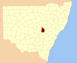 Location in New South Wales | |||||||||||||||
| |||||||||||||||
Gordon County is one of the 141 Cadastral divisions of New South Wales. The Macquarie River is the north-eastern boundary.
Gordon County was named in honour of George Hamilton Gordon, Fourth Earl of Aberdeen (1784-1860).[1]
YouTube Encyclopedic
-
1/1Views:487 710
-
Using Turmeric Root, An Immune Boosting Natural Anti-Inflammatory
Transcription
Parishes within this county
A full list of parishes found within this county; their current LGA and mapping coordinates to the approximate centre of each location is as follows:
References
- ^ "Gordon County". Geographical Names Register (GNR) of NSW. Geographical Names Board of New South Wales.