
| Goodwyns | |
|---|---|
 The Harvest Community Church on Stubs Hill | |
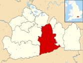
 Goodwyns Location within Surrey | |
| OS grid reference | TQ170478 |
| District | |
| Shire county | |
| Region | |
| Country | England |
| Sovereign state | United Kingdom |
| Post town | Dorking |
| Postcode district | RH4 |
| Dialling code | 01306 |
| Police | Surrey |
| Fire | Surrey |
| Ambulance | South East Coast |
| UK Parliament | |
Goodwyns is a housing estate in Dorking, a market town in Surrey, England. It is on the return slope of one of two hillsides of the town and adjoins North Holmwood, a green-buffered village.[1] The town centre is about 1.7 miles (2.7 km) away.[2]
YouTube Encyclopedic
-
1/1Views:831
-
Dorking Sun and Snow
Transcription
History and architecture
The area was developed in the mid-1950s as a council estate on behalf of the former Dorking Urban District Council by the architects William Ryder & Associates.[1] The name recalls Goodwyns Place, a Grade II-listed country house to the north. This Arts and Crafts-style building was designed in 1901 by Hugh Thackeray Turner.[1][3]

The design of the buildings and the estate's layout were praised by architectural historians Ian Nairn and Nikolaus Pevsner, who described it as "unusually good" for a council estate.[1] The housing was developed in three parts: first, on the lowest lying land and arranged around culs-de-sac, groups of red-brick houses with rendered panelling; then blocks of red- and pale-brick flats of three and four storeys on the rising land, some with steel balconies and with a mixture of flat and sloping roofs; then two 14-storey concrete-faced tower blocks.[1][2] Completed in 1965, Wenlock Edge and Linden Lea were described as "more elegant than average" because of the layout of successive projecting and recessed sections on each face.[1] The estate retains large areas of open space and has a semi-rural character,[1][4] but there is little tree cover. The layout is approximately circular: the residential areas are bounded by two perimeter roads with other roads linking them. These streets are wide and lined with grass verges, encouraging on-street parking.[2]
In local government it is long in the Ward: Holmwoods, currently one of 21 wards in Mole Valley district. The ward's population was 6,417 at the time of the United Kingdom Census 2011.[5] For the ward as a whole, housing tenure statistics reveal a lower proportion of owner-occupancy than in the district overall: according to the 2011 Census, 60.2% of properties were owner-occupied against 73.6% in Mole Valley as a whole.[6] On the Goodwyns estate itself, some properties are now owner-occupied and others are rented—mostly from the Mole Valley Housing Association.[4] Formed in October 2007, this housing association is part of the Circle Housing Group and is responsible for the 3,850 synonymous with the district.[7] The association is seeking to redevelop parts of the estate, and has submitted planning applications to build 19 more flats and three houses on various underutilised sites on the estate; partly to be available under shared ownership.[7][8]
Amenities
The estate is served by the Harvest Community Church, affiliated with the Elim Pentecostal movement and the FIEC.[9] It was originally an independent Evangelical church[10] and was registered for marriages under the name Goodwyns Evangelical Free Church in July 1966.[11] Goodwyns is in the Anglican parish of North Holmwood, served by St John the Evangelist's Church.[12] St John's Church of England Community School[13] and the Dorking Rural Sure Start Children's Centre[14] are also located at Goodwyns.
Public transport
Metrobus route 93 runs every hour on Mondays to Saturdays and every 2 hours on Sundays between the estate and Dorking railway station via the town centre. In the other direction, the service continues to Horsham via Capel.[15]
References
- ^ a b c d e f g Nairn & Pevsner 1971, p. 198.
- ^ a b c "Goodwyns Estate, Dorking" (PDF). Project no. 0399: Design and Access Statement – Rushett Drive (Site 3). Kiran Curtis Associates Architects. September 2012. p. 5. Archived from the original on 15 July 2013. Retrieved 15 July 2013.
- ^ Historic England. "Goodwyns Place, Tower Hill, Dorking (Grade II) (1230906)". National Heritage List for England. Retrieved 15 July 2013.
- ^ a b "Goodwyns Estate, Dorking" (PDF). Project no. 0399: Design and Access Statement – Rushett Drive (Site 3). Kiran Curtis Associates Architects. September 2012. p. 4. Archived from the original on 15 July 2013. Retrieved 15 July 2013.
- ^ "Area: Holmwoods (Ward) – Population Density, 2011 (QS102EW)". 2011 UK Census statistics for Holmwoods Ward. Office for National Statistics. 30 January 2013. Archived from the original on 15 July 2013. Retrieved 15 July 2013.
- ^ "Area: Holmwoods (Ward) – Tenure - Households, 2011 (QS405EW)". 2011 UK Census statistics for Holmwoods Ward. Office for National Statistics. 30 January 2013. Archived from the original on 4 March 2016. Retrieved 15 July 2013.
- ^ a b "Statement to accompany Planning Application in respect of Goodwyns Estate, Dorking, Surrey" (PDF). Mole Valley Housing Association. 2012. Archived from the original on 15 July 2013. Retrieved 15 July 2013.
- ^ "Goodwyns Estate, Dorking" (PDF). Project no. 0399: Design and Access Statement – Rushett Drive (Site 3). Kiran Curtis Associates Architects. September 2012. pp. 7–9. Archived from the original on 15 July 2013. Retrieved 15 July 2013.
- ^ "The Harvest Community Church is an independent Pentecostal church..." The Harvest Community Church. 2008. Archived from the original on 25 July 2013. Retrieved 15 July 2013.
- ^ Registered in accordance with the Places of Worship Registration Act 1855 (Number in Worship Register: 70328; Name: Harvest Community Church; Address: Goodwyns Road, Dorking; Denomination: Independent Evangelicals. (Archived version of list from April 2010; subsequent updates)
- ^ "No. 44075". The London Gazette. 5 August 1966. p. 8779.
- ^ "North Holmwood: St. John the Evangelist, North Holmwood". A Church Near You website. Archbishops' Council. 2010. Archived from the original on 22 April 2014. Retrieved 15 July 2013.
- ^ "St John's C of E Community School and Nursery". St John's School. 2012. Retrieved 15 July 2013.
- ^ "Dorking Rural Sure Start Children's Centre". Dorking Nursery School Sure Start Centre. 2008–2010. Archived from the original on 31 July 2013. Retrieved 15 July 2013.
- ^ "93: Horsham–Warnham–Capel–Goodwyns–Dorking" (PDF). Metrobus. 1 September 2012. Archived from the original on 16 July 2013. Retrieved 15 July 2013.
Bibliography
- Nairn, Ian; Pevsner, Nikolaus (1971) [1962]. The Buildings of England: Surrey (2nd ed.). Harmondsworth: Penguin Books. ISBN 0-300-09675-5.
|
|  | ||||||||||||||||
|---|---|---|---|---|---|---|---|---|---|---|---|---|---|---|---|---|---|---|
| Parks | ||||||||||||||||||
| Places of worship | ||||||||||||||||||
| Education | ||||||||||||||||||
| Transport |
| |||||||||||||||||
Buildings and structures | ||||||||||||||||||
| Sport |
| |||||||||||||||||
Places listed are articles notable as settlements, arranged by post town The two principal towns are emboldened | ||||||||||||||||||